46.175.104.2 - IP Lookup: Free IP Address Lookup, Postal Code Lookup, IP Location Lookup, IP ASN, Public IP
Country:
Region:
City:
Location:
Time Zone:
Postal Code:
IP information under different IP Channel
ip-api
Country
Region
City
ASN
Time Zone
ISP
Blacklist
Proxy
Latitude
Longitude
Postal
Route
Luminati
Country
Region
24
City
wegierskagorka
ASN
Time Zone
Europe/Warsaw
ISP
ARKOM Mucharski Adam
Latitude
Longitude
Postal
IPinfo
Country
Region
City
ASN
Time Zone
ISP
Blacklist
Proxy
Latitude
Longitude
Postal
Route
IP2Location
46.175.104.2Country
Region
slaskie
City
wegierska gorka
Time Zone
Europe/Warsaw
ISP
Language
User-Agent
Latitude
Longitude
Postal
db-ip
Country
Region
City
ASN
Time Zone
ISP
Blacklist
Proxy
Latitude
Longitude
Postal
Route
ipdata
Country
Region
City
ASN
Time Zone
ISP
Blacklist
Proxy
Latitude
Longitude
Postal
Route
Popular places and events near this IP address

Battle of Węgierska Górka
Distance: Approx. 1499 meters
Latitude and longitude: 49.6,19.13333333
The Battle of Węgierska Górka was a two-day-long defence of a Polish fortified area in south of Żywiec Region (Lesser Poland) during the opening stages of the Invasion of Poland of 1939. Although the Polish position was not completed and only five bunkers were manned, the line was defended for two days and nights against superior German forces of the German 7th Infantry Division. One of the bunkers was successfully evacuated by the Polish 1st Mountain Brigade, but the others lacked radio receivers and did not receive the order to retreat.

Radziechowy
Village in Silesian Voivodeship, Poland
Distance: Approx. 4380 meters
Latitude and longitude: 49.64666667,19.12583333
Radziechowy [rad͡ʑɛˈxɔvɨ] is a village in the administrative district of Gmina Radziechowy-Wieprz, within Żywiec County, Silesian Voivodeship, in southern Poland. It lies approximately 8 kilometres (5 mi) south-west of Żywiec and 68 km (42 mi) south of the regional capital Katowice. It is one of the oldest villages in Żywiec Basin.

Golgotha of the Beskids
Distance: Approx. 4383 meters
Latitude and longitude: 49.6467,19.1258
The Golgotha of the Beskids (Polish: Golgota Beskidów) is a Way of the Cross on the Matyska hill in the Radziechowy village, near Żywiec, in the Silesian Beskids of south Poland.

Gmina Radziechowy-Wieprz
Gmina in Silesian Voivodeship, Poland
Distance: Approx. 4603 meters
Latitude and longitude: 49.633,19.167
Gmina Radziechowy-Wieprz is a rural gmina (administrative district) in Żywiec County, Silesian Voivodeship, in southern Poland. Its seat is the village of Wieprz, which lies approximately 7 kilometres (4 mi) south of Żywiec and 70 km (43 mi) south of the regional capital Katowice. The gmina covers an area of 65.94 square kilometres (25.5 sq mi), and as of 2019 its total population is 13,105.

Gmina Węgierska Górka
Gmina in Silesian Voivodeship, Poland
Distance: Approx. 1499 meters
Latitude and longitude: 49.6,19.13333333
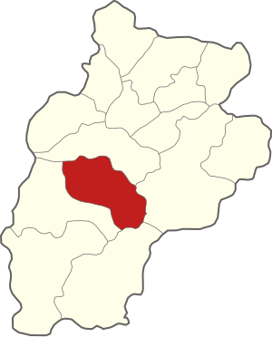
Gmina Węgierska Górka is a rural gmina (administrative district) in Żywiec County, Silesian Voivodeship, in southern Poland. Its seat is the village of Węgierska Górka, which lies approximately 12 kilometres (7 mi) south-west of Żywiec and 73 km (45 mi) south of the regional capital Katowice. The gmina covers an area of 77.06 square kilometres (29.8 sq mi), and as of 2019 its total population is 15,073.

Twardorzeczka
Village in Silesian Voivodeship, Poland
Distance: Approx. 5268 meters
Latitude and longitude: 49.65,19.08333333
Twardorzeczka [tfardɔˈʐɛt͡ʂka] is a village in the administrative district of Gmina Lipowa, within Żywiec County, Silesian Voivodeship, in southern Poland. It lies approximately 10 kilometres (6 mi) south-west of Żywiec and 67 km (42 mi) south of the regional capital Katowice. It lies in Żywiec Basin alongside a Twardorzeczka stream flowing out from Silesian Beskids.

Bystra, Żywiec County
Village in Silesian Voivodeship, Poland
Distance: Approx. 5290 meters
Latitude and longitude: 49.61944444,19.1875
Bystra [ˈbɨstra] is a village in the administrative district of Gmina Radziechowy-Wieprz, within Żywiec County, Silesian Voivodeship, in southern Poland. It lies approximately 3 kilometres (2 mi) south-east of Wieprz, 8 km (5 mi) south of Żywiec, and 72 km (45 mi) south of the regional capital Katowice.
Przybędza
Village in Silesian Voivodeship, Poland
Distance: Approx. 987 meters
Latitude and longitude: 49.61666667,19.11666667
Przybędza [pʂɨˈbɛnd͡za] is a village in the administrative district of Gmina Radziechowy-Wieprz, within Żywiec County, Silesian Voivodeship, in southern Poland. It lies approximately 11 kilometres (7 mi) south-west of Żywiec and 71 km (44 mi) south of the regional capital Katowice.

Cięcina
Village in Silesian Voivodeship, Poland
Distance: Approx. 1499 meters
Latitude and longitude: 49.6,19.13333333
Cięcina [t͡ɕɛnˈt͡ɕina] is a village in the administrative district of Gmina Węgierska Górka, within Żywiec County, Silesian Voivodeship, in southern Poland. It lies approximately 12 km (7 mi) south-west of Żywiec and 73 km (45 mi) south of the regional capital Katowice. It is one of the oldest villages in Żywiec Basin.

Cisiec
Village in Silesian Voivodeship, Poland
Distance: Approx. 2970 meters
Latitude and longitude: 49.58333333,19.1
Cisiec [ˈt͡ɕiɕɛt͡s] is a village in the administrative district of Gmina Węgierska Górka, within Żywiec County, Silesian Voivodeship, in southern Poland. It lies approximately 4 kilometres (2 mi) south-west of Węgierska Górka, 15 km (9 mi) south-west of Żywiec, and 75 km (47 mi) south of the regional capital Katowice.
Węgierska Górka
Village in Silesian Voivodeship, Poland
Distance: Approx. 19 meters
Latitude and longitude: 49.60777778,19.11666667
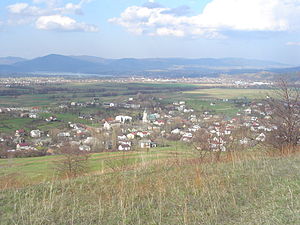
Węgierska Górka [vɛnˈɡʲɛrska ˈɡurka] (Literally Polish for "Hungarian Hill") is a village in Żywiec County, Silesian Voivodeship, in the historic province of Lesser Poland. It is the seat of the gmina (administrative district) called Gmina Węgierska Górka. It lies approximately 12 kilometres (7 mi) south-west of Żywiec and 72 km (45 mi) south of the regional capital Katowice.

Żabnica, Silesian Voivodeship
Village in Silesian Voivodeship, Poland
Distance: Approx. 4186 meters
Latitude and longitude: 49.58055556,19.15638889
Żabnica [ʐabˈnit͡sa] is a village in the administrative district of Gmina Węgierska Górka, within Żywiec County, Silesian Voivodeship, in southern Poland. It lies approximately 3 kilometres (2 mi) south-east of Węgierska Górka, 13 km (8 mi) south of Żywiec, and 76 km (47 mi) south of the regional capital Katowice.
Weather in this IP's area
overcast clouds
6 Celsius
4 Celsius
5 Celsius
6 Celsius
1002 hPa
92 %
1002 hPa
953 hPa
8892 meters
2.33 m/s
4.31 m/s
157 degree
91 %

