46.174.69.175 - IP Lookup: Free IP Address Lookup, Postal Code Lookup, IP Location Lookup, IP ASN, Public IP
Country:
Region:
City:
Location:
Time Zone:
Postal Code:
ISP:
ASN:
language:
User-Agent:
Proxy IP:
Blacklist:
IP information under different IP Channel
ip-api
Country
Region
City
ASN
Time Zone
ISP
Blacklist
Proxy
Latitude
Longitude
Postal
Route
db-ip
Country
Region
City
ASN
Time Zone
ISP
Blacklist
Proxy
Latitude
Longitude
Postal
Route
IPinfo
Country
Region
City
ASN
Time Zone
ISP
Blacklist
Proxy
Latitude
Longitude
Postal
Route
IP2Location
46.174.69.175Country
Region
donetska oblast
City
dobropol'ye
Time Zone
Europe/Kiev
ISP
Language
User-Agent
Latitude
Longitude
Postal
ipdata
Country
Region
City
ASN
Time Zone
ISP
Blacklist
Proxy
Latitude
Longitude
Postal
Route
Popular places and events near this IP address

Dobropillia Raion
Former subdivision of Donetsk Oblast, Ukraine
Distance: Approx. 5939 meters
Latitude and longitude: 48.483296,37.01174683
Dobropillia Raion (Ukrainian: Добропільський район, romanized: Dobropil's'kyi raion; Russian: Добропо́льский район, romanized: Dobropol'skiy raion) was a raion (district) within the southwestern part of Donetsk Oblast in eastern Ukraine. Its administrative center was Dobropillia, which was incorporated separately as the town of oblast significance and did not belong to the raion. Its area was 949 km2 (366 sq mi).

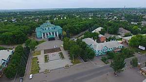
Dobropillia
City in Donetsk Oblast, Ukraine
Distance: Approx. 842 meters
Latitude and longitude: 48.46888889,37.08277778
Dobropillia (Ukrainian: Добропілля, IPA: [dobroˈp⁽ʲ⁾ilʲːɐ] ; Russian: Доброполье, romanized: Dobropolye) is a city in Pokrovsk Raion, Donetsk Oblast, Ukraine. Prior to 2020, it was a city of oblast significance and served as the administrative center of the former Dobropillia Raion, though it did not belong to the raion. It is located 94 kilometres (58 mi) from Donetsk, the administrative center of the oblast.
Almazna coal mine
Mine in Dobropillia, Donetsk Oblast, Ukraine
Distance: Approx. 842 meters
Latitude and longitude: 48.468889,37.082778
The Almazna coal mine is a large coal mine located in the south-east of Ukraine in Donetsk Oblast. Almazna represents one of the largest coal reserve in Ukraine having estimated reserves of 73.1 million tonnes of coal. The annual coal production is around 712,000 tonnes.

Bilytske
City in Donetsk Oblast, Ukraine
Distance: Approx. 9970 meters
Latitude and longitude: 48.4,37.18333333
Bilytske (Ukrainian: Білицьке, pronounced [ˈb⁽ʲ⁾iɫɪt͡sʲke] ; Russian: Белицкое) is a city in Dobropillia urban hromada, Donetsk Oblast (province) of Ukraine. Population: 7,764 (2022 estimate).
Sviatohorivka
Urban locality in Donetsk Oblast, Ukraine
Distance: Approx. 4608 meters
Latitude and longitude: 48.48083333,37.03
Sviatohorivka (Ukrainian: Святогорівка) is an rural settlement in Pokrovsk Raion, Donetsk Oblast, eastern Ukraine. Population: 1,799 (2022 estimate).
Vodianske
Urban locality in Donetsk Oblast, Ukraine
Distance: Approx. 5962 meters
Latitude and longitude: 48.40944444,37.10416667
Vodianske (Ukrainian: Водянське) is an rural settlement in Pokrovsk Raion, Donetsk Oblast, eastern Ukraine. The population is 1,373 (2022 estimate).
Weather in this IP's area
broken clouds
-2 Celsius
-6 Celsius
-2 Celsius
-2 Celsius
1025 hPa
58 %
1025 hPa
1004 hPa
10000 meters
3.31 m/s
7.79 m/s
262 degree
60 %

