Country:
Region:
City:
Latitude and Longitude:
Time Zone:
Postal Code:
IP information under different IP Channel
ip-api
Country
Region
City
ASN
Time Zone
ISP
Blacklist
Proxy
Latitude
Longitude
Postal
Route
Luminati
Country
ASN
Time Zone
Europe/Kyiv
ISP
WEB3 Leaders INC
Latitude
Longitude
Postal
IPinfo
Country
Region
City
ASN
Time Zone
ISP
Blacklist
Proxy
Latitude
Longitude
Postal
Route
db-ip
Country
Region
City
ASN
Time Zone
ISP
Blacklist
Proxy
Latitude
Longitude
Postal
Route
ipdata
Country
Region
City
ASN
Time Zone
ISP
Blacklist
Proxy
Latitude
Longitude
Postal
Route
Popular places and events near this IP address

Battle of Prague (1757)
Part of the Third Silesian War
Distance: Approx. 1202 meters
Latitude and longitude: 50.08333333,14.55
In the Battle of Prague or Battle of Štěrboholy, fought on 6 May 1757 during the Third Silesian War (Seven Years' War), Frederick the Great's 64,000 Prussians forced 60,000 Austrians to retreat, but having lost 14,300 men, decided he was not strong enough to attack Prague. The battle is mentioned in the famous German ballad Lenore written in 1773 by Gottfried August Bürger.

Skalka (Prague Metro)
Prague metro station
Distance: Approx. 2410 meters
Latitude and longitude: 50.06805556,14.5075
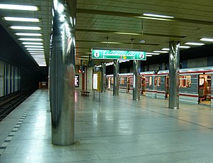
Skalka is a Prague Metro station of Line A, located in Strašnice, Prague 10. It was opened on 4 July 1990 as the southern terminus of the extension of the line from Strašnická. On 27 May 2006 the line was extended to Depo Hostivař.
Hloubětín (Prague Metro)
Prague metro station
Distance: Approx. 2705 meters
Latitude and longitude: 50.10611111,14.53805556
Hloubětín (Czech pronunciation: [ˈɦloubjɛciːn]) is a Prague Metro station on Line B, located in the eponymous district.

Depo Hostivař (Prague Metro)
Prague metro station
Distance: Approx. 1442 meters
Latitude and longitude: 50.07583333,14.51555556
Depo Hostivař (Czech pronunciation: [ˈɦoscɪvar̝̊]) is a Prague Metro station and terminus of Line A. It is located on Černokostelecká street, which forms the border between Strašnice and Malešice in Prague 10. The station was constructed in the building of an existing metro depot and was opened on 27 May 2006 as the eastern terminus of the extension from Skalka.

Hloubětín
District of Prague in the Czech Republic
Distance: Approx. 2689 meters
Latitude and longitude: 50.10611111,14.53555556
Hloubětín (Czech pronunciation: [ˈɦloubjɛciːn], German: Tiefenbach) is a district of Prague located 9 kilometres (5.6 mi) from the centre, belonging mostly to Prague 9, with parts of it also belonging to Prague 14 and Prague 10. There were 10,704 people living in this area in 2001. The area, first recorded in the 13th century due to presence of the Teutonic Knights, became part of Prague in 1922.

Czech Statistical Office
Czech governmental institution
Distance: Approx. 2260 meters
Latitude and longitude: 50.07,14.50777778
The Czech Statistical Office (abbreviated CSO or CZSO; Czech: Český statistický úřad, abbreviated ČSÚ) is a central state administration authority of the Czech Republic. It is an office independent of the country's government, whose main tasks are the collection, processing and dissemination of statistical data and the organization of elections in the Czech Republic and the population census.

Prague 14
Municipal District of Prague in Czech Republic
Distance: Approx. 2679 meters
Latitude and longitude: 50.10277778,14.55222222
Prague 14 is a municipal district in Prague since 1994. It is located in the north-eastern part of the city, east of district Prague 9. It consists of four cadastres: Hloubětín (part), Kyje, Černý Most and Hostavice.

Strašnice
Cadastral district of Prague in Czech Republic
Distance: Approx. 2616 meters
Latitude and longitude: 50.07222222,14.5
Strašnice is a cadastral district in Prague. It became part of Prague on 1 January 1922. It lies mostly in the municipal and administrative district of Prague 10 while a small part is in Prague 3.
Štěrboholy
Distance: Approx. 1728 meters
Latitude and longitude: 50.073,14.553
The Czech village of Štěrboholy was founded in 1371, and became part of Prague in 1968. Now it is its own cadastral area, part of the administrative district Prague 10. Its area is 2.97 km2, its population is 2,464 and its population density is 829 inhabitants/km2.

Malešice
Cadastral Area of Prague in Czech Republic
Distance: Approx. 1138 meters
Latitude and longitude: 50.08333333,14.5175
Malešice is a cadastral district in Prague. The earliest reference about the village is from 1309. It became a part of Prague on 1 January 1922.

Hrdlořezy (Prague)
Cadastral district of Prague in Prague 9, Czech Republic
Distance: Approx. 1960 meters
Latitude and longitude: 50.09444444,14.51388889
Hrdlořezy is a cadastral district in Prague. It has population of 1,666. It became part of Prague on 1 January 1922.

Kyje
Cadastral district of Prague in Czech Republic
Distance: Approx. 2032 meters
Latitude and longitude: 50.0975,14.54833333
Kyje (German: Keeg) is a cadastral district of Prague, Czech Republic. In 2015 it had 9,036 inhabitants.
Weather in this IP's area
moderate rain
5 Celsius
0 Celsius
4 Celsius
5 Celsius
1010 hPa
81 %
1010 hPa
980 hPa
10000 meters
6.17 m/s
220 degree
07:20:18
16:14:11

