46.151.22.221 - IP Lookup: Free IP Address Lookup, Postal Code Lookup, IP Location Lookup, IP ASN, Public IP
Country:
 Poland
Region:
City:
Location:
Time Zone:
Postal Code:
ISP:
ASN:
language:
User-Agent:
Proxy IP:
Blacklist:
IP information under different IP Channel
ip-api
Country
Region
City
ASN
Time Zone
ISP
Blacklist
Proxy
Latitude
Longitude
Postal
Route
db-ip
Country
Region
City
ASN
Time Zone
ISP
Blacklist
Proxy
Latitude
Longitude
Postal
Route
IPinfo
Country
Region
City
ASN
Time Zone
ISP
Blacklist
Proxy
Latitude
Longitude
Postal
Route
IP2Location
46.151.22.221Country
plRegion
malopolskie
City
kety
Time Zone
Europe/Warsaw
ISP
Language
User-Agent
Latitude
Longitude
Postal
ipdata
Country
Region
City
ASN
Time Zone
ISP
Blacklist
Proxy
Latitude
Longitude
Postal
Route
Popular places and events near this IP address

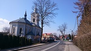
Kęty
Place in Lesser Poland Voivodeship, Poland
Distance: Approx. 2049 meters
Latitude and longitude: 49.9,19.21666667
Kęty [ˈkɛntɨ] is a town in Oświęcim County, Lesser Poland Voivodeship, Poland with 18,955 inhabitants (2012). The town located in Silesian Foothills dates its earliest document from 1277 when Polish prince of Opole Władysław confirmed sale of the settlement and adoption of Lviv city rights. The town's name comes from the word kąt (Polish for corner).

Wilamowice
Place in Silesian Voivodeship, Poland
Distance: Approx. 6383 meters
Latitude and longitude: 49.91638889,19.15194444
Wilamowice (Polish: [vilamɔˈvit͡sɛ]; earlier Willamowice; German: Wilmesau; Wymysorys: Wymysoü [ˈvɨmɨsɔy̯], Silesian: Wilamowicy) is a rural town in southern Poland, situated in the Bielsko County, Silesian Voivodeship. The town is inhabited by a Germanic ethnic group of Vilamovians, who speak the highly endangered Wymysorys language.

Gmina Kęty
Gmina in Lesser Poland Voivodeship, Poland
Distance: Approx. 2049 meters
Latitude and longitude: 49.9,19.21666667
Gmina Kęty is an urban-rural gmina (administrative district) in Oświęcim County, Lesser Poland Voivodeship, in southern Poland. Its seat is the town of Kęty, which lies approximately 17 kilometres (11 mi) south of Oświęcim and 55 km (34 mi) west of the regional capital Kraków. The gmina covers an area of 75.79 square kilometres (29.3 sq mi), and as of 2006 its total population is 33,598 (out of which the population of Kęty amounts to 19,252, and the population of the rural part of the gmina is 14,346).

Bulowice
Village in Lesser Poland Voivodeship, Poland
Distance: Approx. 5757 meters
Latitude and longitude: 49.83333333,19.25
Bulowice [bulɔˈvit͡sɛ] is a village in the administrative district of Gmina Kęty, within Oświęcim County, Lesser Poland Voivodeship, in southern Poland. It lies approximately 8 kilometres (5 mi) south of Kęty, 25 km (16 mi) south of Oświęcim, and 56 km (35 mi) south-west of the regional capital Kraków.
Malec, Lesser Poland Voivodeship
Village in Lesser Poland Voivodeship, Poland
Distance: Approx. 6016 meters
Latitude and longitude: 49.93333333,19.25
Malec [ˈmalɛt͡s] is a village in the administrative district of Gmina Kęty, within Oświęcim County, Lesser Poland Voivodeship, in southern Poland. It lies approximately 5 kilometres (3 mi) north-east of Kęty, 13 km (8 mi) south of Oświęcim, and 52 km (32 mi) west of the regional capital Kraków.

Nowa Wieś, Oświęcim County
Village in Lesser Poland Voivodeship, Poland
Distance: Approx. 2766 meters
Latitude and longitude: 49.90666667,19.2175
Nowa Wieś [ˈnɔva ˈvjɛɕ] is a village in the administrative district of Gmina Kęty, within Oświęcim County, Lesser Poland Voivodeship, in southern Poland. It lies approximately 1 kilometre (1 mi) north of Kęty, 16 km (10 mi) south of Oświęcim, and 55 km (34 mi) west of the regional capital Kraków.
Witkowice, Lesser Poland Voivodeship
Village in Lesser Poland Voivodeship, Poland
Distance: Approx. 5345 meters
Latitude and longitude: 49.91388889,19.27916667
Witkowice [vitkɔˈvit͡sɛ] is a village in the administrative district of Gmina Kęty, within Oświęcim County, Lesser Poland Voivodeship, in southern Poland. It lies approximately 5 kilometres (3 mi) east of Kęty, 16 km (10 mi) south of Oświęcim, and 50 km (31 mi) west of the regional capital Kraków.

Bujaków, Bielsko County
Village in Silesian Voivodeship, Poland
Distance: Approx. 4582 meters
Latitude and longitude: 49.85,19.18333333
Bujaków [buˈjakuf] is a village in the administrative district of Gmina Porąbka, within Bielsko County, Silesian Voivodeship, in southern Poland. It lies approximately 5 kilometres (3 mi) north-west of Porąbka, 9 km (6 mi) east of Bielsko-Biała, and 47 km (29 mi) south of the regional capital Katowice.

Czaniec
Village in Silesian Voivodeship, Poland
Distance: Approx. 4126 meters
Latitude and longitude: 49.85027778,19.25277778
Czaniec [ˈt͡ʂaɲɛt͡s] is a village in the administrative district of Gmina Porąbka, within Bielsko County, Silesian Voivodeship, in southern Poland. It lies approximately 5 kilometres (3 mi) north-east of Porąbka, 14 km (9 mi) east of Bielsko-Biała, and 48 km (30 mi) south of the regional capital Katowice. John Paul II's genealogy hails from here.

Kobiernice
Village in Silesian Voivodeship, Poland
Distance: Approx. 3605 meters
Latitude and longitude: 49.85,19.21666667
Kobiernice [kɔbjɛrˈnit͡sɛ] is a village in the administrative district of Gmina Porąbka, within Bielsko County, Silesian Voivodeship, in southern Poland. It lies approximately 4 kilometres (2 mi) north of Porąbka, 11 km (7 mi) east of Bielsko-Biała, and 48 km (30 mi) south of the regional capital Katowice.
Hecznarowice
Village in Silesian Voivodeship, Poland
Distance: Approx. 4524 meters
Latitude and longitude: 49.9,19.16666667
Hecznarowice [xɛt͡ʂnarɔˈvit͡sɛ] is a village in the administrative district of Gmina Wilamowice, within Bielsko County, Silesian Voivodeship, in southern Poland. It lies approximately 3 kilometres (2 mi) south-east of Wilamowice, 11 km (7 mi) north-east of Bielsko-Biała, and 41 km (25 mi) south of the regional capital Katowice.
Zasole Bielańskie
Village in Silesian Voivodeship, Poland
Distance: Approx. 5594 meters
Latitude and longitude: 49.91666667,19.16666667
Zasole Bielańskie [zaˈsɔlɛ bjɛˈlaɲskʲɛ] is a village in the administrative district of Gmina Wilamowice, within Bielsko County, Silesian Voivodeship, in southern Poland. It lies approximately 2 kilometres (1 mi) east of Wilamowice, 12 km (7 mi) north-east of Bielsko-Biała, and 39 km (24 mi) south of Katowice, the capital city of the Silesian Voivodeship.
Weather in this IP's area
overcast clouds
-1 Celsius
-4 Celsius
-1 Celsius
1 Celsius
1032 hPa
99 %
1032 hPa
990 hPa
10000 meters
2.47 m/s
4.17 m/s
234 degree
98 %