46.149.183.160 - IP Lookup: Free IP Address Lookup, Postal Code Lookup, IP Location Lookup, IP ASN, Public IP
Country:
Region:
City:
Location:
Time Zone:
Postal Code:
IP information under different IP Channel
ip-api
Country
Region
City
ASN
Time Zone
ISP
Blacklist
Proxy
Latitude
Longitude
Postal
Route
Luminati
Country
Region
26
City
kalush
ASN
Time Zone
Europe/Kyiv
ISP
Kaluska informatsiyna merezha LLC
Latitude
Longitude
Postal
IPinfo
Country
Region
City
ASN
Time Zone
ISP
Blacklist
Proxy
Latitude
Longitude
Postal
Route
IP2Location
46.149.183.160Country
Region
ivano-frankivska oblast
City
broshniv-osada
Time Zone
Europe/Kiev
ISP
Language
User-Agent
Latitude
Longitude
Postal
db-ip
Country
Region
City
ASN
Time Zone
ISP
Blacklist
Proxy
Latitude
Longitude
Postal
Route
ipdata
Country
Region
City
ASN
Time Zone
ISP
Blacklist
Proxy
Latitude
Longitude
Postal
Route
Popular places and events near this IP address
Ugartsthal
Distance: Approx. 8012 meters
Latitude and longitude: 49.03222222,24.2925
Ugartsthal, a former German colony in the Kingdom of Galicia and Lodomeria which is today part of the village Sivka-Kaluska in Kalush Raion (Ivano-Frankivsk Oblast, Ukraine), is located 7 km (4 mi) west of Kalush.
Rozhniativ
Rural locality in Ivano-Frankivsk Oblast, Ukraine
Distance: Approx. 7356 meters
Latitude and longitude: 48.93638889,24.15472222
Rozhniativ (Ukrainian: Рожня́тів; Polish: Rożniatów), formerly Rozhnitiv (Ukrainian: Рожні́тів), is a rural settlement in Kalush Raion, Ivano-Frankivsk Oblast, Ukraine. It hosts the administration of Rozhniativ settlement hromada, one of the hromadas of Ukraine. The population is 3,873 (2022 estimate).

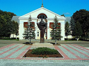
Broshniv-Osada
Rural locality in Ivano-Frankivsk Oblast, Ukraine
Distance: Approx. 1231 meters
Latitude and longitude: 48.99944444,24.18138889
Broshniv-Osada (Ukrainian: Бро́шнів-Оса́да) is a rural settlement in Kalush Raion, Ivano-Frankivsk Oblast, western Ukraine. It hosts the administration of Broshniv-Osada settlement hromada, one of the hromadas of Ukraine. Population: 5,419 (2022 estimate).
Svarychiv
Rural locality in Ivano-Frankivsk Oblast, Ukraine
Distance: Approx. 3293 meters
Latitude and longitude: 48.96666667,24.2
Svarychiv (Ukrainian: Сва́ричів, Polish: Swaryczów) is a village in Kalush Raion in Ivano-Frankivsk Oblast (province) of western Ukraine. It belongs to Rozhniativ settlement hromada, one of the hromadas of Ukraine. The population on the all-Ukrainian population census 2001 was 5,039 people.
Berlohy
Rural locality in Ivano-Frankivsk Oblast, Ukraine
Distance: Approx. 5105 meters
Latitude and longitude: 48.96416667,24.2475
Berlohy (Ukrainian: Берлоги) is a village (selo) in Kalush Raion, of Ivano-Frankivsk Oblast, approximately 46 km from the regional center, Ivano-Frankivsk. The village is situated on the left bank of the river Limnytsya (Ukrainian: Лі́мниця). Local government — Berlohivska village council.
Weather in this IP's area
overcast clouds
-0 Celsius
-3 Celsius
-0 Celsius
-0 Celsius
1029 hPa
98 %
1029 hPa
985 hPa
1329 meters
2.28 m/s
4.04 m/s
304 degree
100 %

