46.132.187.225 - IP Lookup: Free IP Address Lookup, Postal Code Lookup, IP Location Lookup, IP ASN, Public IP
Country:
Region:
City:
Location:
Time Zone:
Postal Code:
ISP:
ASN:
language:
User-Agent:
Proxy IP:
Blacklist:
IP information under different IP Channel
ip-api
Country
Region
City
ASN
Time Zone
ISP
Blacklist
Proxy
Latitude
Longitude
Postal
Route
db-ip
Country
Region
City
ASN
Time Zone
ISP
Blacklist
Proxy
Latitude
Longitude
Postal
Route
IPinfo
Country
Region
City
ASN
Time Zone
ISP
Blacklist
Proxy
Latitude
Longitude
Postal
Route
IP2Location
46.132.187.225Country
Region
kanta-hame
City
hameenlinna
Time Zone
Europe/Helsinki
ISP
Language
User-Agent
Latitude
Longitude
Postal
ipdata
Country
Region
City
ASN
Time Zone
ISP
Blacklist
Proxy
Latitude
Longitude
Postal
Route
Popular places and events near this IP address

Hämeenlinna
City in Tavastia Proper, Finland
Distance: Approx. 215 meters
Latitude and longitude: 60.99444444,24.46666667
Hämeenlinna (Finnish: [ˈhæmeːnˌlinːɑ]; Swedish: Tavastehus; Karelian: Hämienlinna; Latin: Tavastum or Croneburgum) is a city in Finland and the regional capital of Kanta-Häme. It is located in the southern interior of the country and on the shores of Lake Vanajavesi. The population of Hämeenlinna is approximately 68,000, while the sub-region has a population of approximately 94,000.

Häme Castle
Castle in Tavastia Proper, Finland
Distance: Approx. 941 meters
Latitude and longitude: 61.00388889,24.45805556
Häme Castle or Tavastia Castle (Finnish: Hämeen linna, Swedish: Tavastehus slott) is a medieval castle in Tavastia Proper, Finland. It is located in Hämeenlinna, the city between Helsinki and Tampere. Originally located on an island, the castle now sits on the coast of lake Vanajavesi.

Hämeenlinna Ice Hall
Arena in Hämeenlinna, Finland
Distance: Approx. 1750 meters
Latitude and longitude: 60.995,24.43194444
Hämeenlinna Ice Hall (also known as Patria-areena, Rinkelinmäen jäähalli or Hämeenlinnan jäähalli or Ritari-areena) is an arena in Rinkelinmäki, Hämeenlinna, Finland. It is primarily used for ice hockey and is the home arena of the Liiga team HPK and the Naisten Liiga team HPK Kiekkonaiset.

Vanaja (Finland)
Former municipality
Distance: Approx. 892 meters
Latitude and longitude: 61.00361111,24.46944444
Vanaja is a former municipality of Finland. It was located in Häme Province about 100 kilometres (60 mi) north of Helsinki. It is also speculated that it might have been the name for an Iron Age and early Middle Ages settlement found opposite to the Häme Castle.

Hämeenlinna railway station
Railway station in Hämeenlinna, Finland
Distance: Approx. 1026 meters
Latitude and longitude: 61.00222222,24.47833333
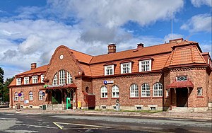
Hämeenlinna railway station (Finnish: Hämeenlinnan rautatieasema, Swedish: Tavastehus järnvägsstation) is located in the town of Hämeenlinna, Finland. Hämeenlinna belongs to the oldest railway stations in Finland, because the first railway line in Finland was opened between Helsinki and Hämeenlinna in 1862. The original station building, designed by the architect Carl Albert Edelfelt, was destroyed during the Finnish Civil War in 1918.

Ahvenisto Race Circuit
Motor racing track in Hämeenlinna, Finland
Distance: Approx. 2424 meters
Latitude and longitude: 61.00205,24.42115
Ahvenisto Race Circuit (Finnish: Ahveniston moottorirata) is a motor racing circuit located in Hämeenlinna, Finland. The circuit is 2.840 km (1.765 mi) long. It features a total elevation change of 32 metres (105 ft), its main straight is 0.280 km (0.174 mi) in length and its width varies between 9 and 17 metres (30 and 56 ft).

Kaurialan kenttä
Stadium in Hämeenlinna, Finland
Distance: Approx. 1236 meters
Latitude and longitude: 60.99361111,24.44194444
Kaurialan kenttä is a multi-use stadium in Hämeenlinna, Finland. It is currently used mostly for football matches and is the home stadium of FC Hämeenlinna. The stadium holds 4,000 people.
Häme Province
Former province of Finland
Distance: Approx. 1314 meters
Latitude and longitude: 61,24.4414
The Province of Häme (Finnish: Hämeen lääni, Swedish: Tavastehus län) was a province of Finland from 1831 to 1997. In 1997 the southern parts with Kanta-Häme, Päijät-Häme was merged with the province of Uusimaa and Kymi into the new province of Southern Finland. The northern part with Pirkanmaa was merged with the provinces of Vaasa, Central Finland, Turku and Pori into the new province of Western Finland.

The Artillery Museum of Finland
Military museum in Hämeenlinna, Finland
Distance: Approx. 1129 meters
Latitude and longitude: 61.00527778,24.45583333
The Artillery Museum of Finland (Suomen Tykistömuseo in Finnish) is a special military museum dedicated to the history of the artillery from the 15th century to the present day. It was located in Niinisalo from 1977 to 1997. In 1997 it was relocated to Hämeenlinna.
Engineers Museum
Scientific military history museum in Finland
Distance: Approx. 1075 meters
Latitude and longitude: 61.00502778,24.45722222
The Engineers Museum (also known as the Engineer Museum, the Pioneer Museum or the Sapper Museum; Finnish: Valtakunnallinen Pioneerimuseo, lit. 'National Pioneer Museum') was a military engineering museum in Finland. It was the oldest corps museum in Finland. It was opened on 13 May 1945 in the garrison of Koria, which was the part of Elimäki municipality, now Kouvola town.

Goodman (shopping centre)
Shopping mall in Hämeenlinna, Finland
Distance: Approx. 532 meters
Latitude and longitude: 60.99333333,24.45611111
Goodman is a shopping center located in the Hämeensaari district of the Hämeenlinna city center in Tavastia Proper, Finland, and it was opened on October 30, 2014. It is located on a deck built above Highway 3 (Helsinki–Tampere Highway), which runs through the city as a motorway. There are about 70 stores in the shopping center, many of which are new in Hämeenlinna.

Hämeenlinna Market Square
Square in Hämeenlinna, Finland
Distance: Approx. 79 meters
Latitude and longitude: 60.99659359,24.46511567
The Hämeenlinna Market Square (Finnish: Hämeenlinnan kauppatori) is the most significant town square in the city center of Hämeenlinna in Tavastia Proper, Finland, where most of the city's market square trade takes place. The market square is located in the Saaristenmäki district on the same site where it was already located in the 1775 town plan. In the new plan drawn up by C. L. Engel in 1832 after the Great Fire of Hämeenlinna, the market and the streets surrounding it remained in their old places.
Weather in this IP's area
light snow
-4 Celsius
-11 Celsius
-4 Celsius
-4 Celsius
1018 hPa
92 %
1018 hPa
1003 hPa
377 meters
5.54 m/s
13.04 m/s
121 degree
100 %