46.122.97.10 - IP Lookup: Free IP Address Lookup, Postal Code Lookup, IP Location Lookup, IP ASN, Public IP
Country:
 Slovenia
Region:
City:
Location:
Time Zone:
Postal Code:
ISP:
ASN:
language:
User-Agent:
Proxy IP:
Blacklist:
IP information under different IP Channel
ip-api
Country
Region
City
ASN
Time Zone
ISP
Blacklist
Proxy
Latitude
Longitude
Postal
Route
db-ip
Country
Region
City
ASN
Time Zone
ISP
Blacklist
Proxy
Latitude
Longitude
Postal
Route
IPinfo
Country
Region
City
ASN
Time Zone
ISP
Blacklist
Proxy
Latitude
Longitude
Postal
Route
IP2Location
46.122.97.10Country
siRegion
dobrova-polhov gradec
City
podsmreka
Time Zone
Europe/Ljubljana
ISP
Language
User-Agent
Latitude
Longitude
Postal
ipdata
Country
Region
City
ASN
Time Zone
ISP
Blacklist
Proxy
Latitude
Longitude
Postal
Route
Popular places and events near this IP address

Bokalce Castle
Building in Ljubljana, Ljubljana
Distance: Approx. 1403 meters
Latitude and longitude: 46.04811111,14.44461944
Bokalce Castle (Slovene: Grad Bokalce,Slovene pronunciation: [bɔˈkaːu̯tsɛ] German: Strobelhof) is a castle or mansion in Ljubljana, the capital of Slovenia. It stands at 312m above sea level.
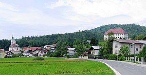
Dobrova, Dobrova–Polhov Gradec
Place in Upper Carniola, Slovenia
Distance: Approx. 1987 meters
Latitude and longitude: 46.05330278,14.41444722
Dobrova (pronounced [ˈdoːbɾɔʋa]; German: Dobrawa) is a clustered settlement northwest of Ljubljana in the Upper Carniola region of Slovenia. It is the administrative centre of the Municipality of Dobrova–Polhov Gradec. It lies on the road from Ljubljana to Polhov Gradec at the point where roads split off to Horjul to the southwest and to Šentvid, Ljubljana to the northeast.

Draževnik
Place in Upper Carniola, Slovenia
Distance: Approx. 890 meters
Latitude and longitude: 46.04724722,14.42730278
Draževnik (pronounced [ˈdɾaːʒɛwnik]) is a small settlement southeast of Dobrova in the Municipality of Dobrova–Polhov Gradec in the Upper Carniola region of Slovenia.

Komanija
Place in Upper Carniola, Slovenia
Distance: Approx. 586 meters
Latitude and longitude: 46.04473611,14.42888056
Komanija (pronounced [kɔmaˈniːja], German: Komania) is a small settlement south of Dobrova in the Municipality of Dobrova–Polhov Gradec in the Upper Carniola region of Slovenia.

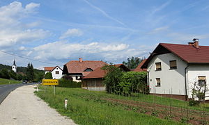
Podsmreka, Dobrova–Polhov Gradec
Place in Upper Carniola, Slovenia
Distance: Approx. 228 meters
Latitude and longitude: 46.03978611,14.42815556
Podsmreka (pronounced [pɔtˈsmɾeːka]; in older sources also Podsmreko, German: Podsmerek) is a village south of Dobrova in the Municipality of Dobrova–Polhov Gradec in the Upper Carniola region of Slovenia.

Razori
Place in Upper Carniola, Slovenia
Distance: Approx. 1333 meters
Latitude and longitude: 46.05074444,14.424425
Razori (pronounced [ɾaˈzoːɾi]; in older sources also Rozore) is a small clustered village on the right bank of Horjulščica Creek (a.k.a. Horjulka Creek) near Dobrova in the Municipality of Dobrova–Polhov Gradec in the Upper Carniola region of Slovenia. There are springs in the area and a water reservoir for Dobrova lies above the village.

Brezovica railway station
Railway station in Slovenia
Distance: Approx. 2071 meters
Latitude and longitude: 46.02138889,14.42638889
Brezovica railway station (Slovene: Železniška postaja Brezovica) is the principal railway station in Brezovica, Slovenia.
Brezovica pri Ljubljani
Place in Inner Carniola, Slovenia
Distance: Approx. 2357 meters
Latitude and longitude: 46.02065833,14.41776111
Brezovica pri Ljubljani (pronounced [ˈbɾéːzɔʋitsa pɾi ljuˈbljàːni]; German: Bresowitz) is a settlement in the Municipality of Brezovica in central Slovenia. It is the administrative center of the municipality. The municipality is part of the traditional region of Inner Carniola and is now included in the Central Slovenia Statistical Region.

Kozarje
Place in Upper Carniola, Slovenia
Distance: Approx. 934 meters
Latitude and longitude: 46.04185833,14.44278611
Kozarje (pronounced [kɔˈzaːɾjɛ]; in older sources also Kozarji) is a formerly independent settlement in the western part of the capital Ljubljana in central Slovenia. It is part of the traditional region of Upper Carniola and is now included with the rest of the municipality in the Central Slovenia Statistical Region. It includes the hamlet of Žeje.

Vrhovci (Ljubljana)
Place in Upper Carniola, Slovenia
Distance: Approx. 2191 meters
Latitude and longitude: 46.0429,14.45908333
Vrhovci (pronounced [ʋəɾˈxoːu̯tsi]) is a formerly independent settlement in the southwest part of the capital Ljubljana in central Slovenia. It is part of the traditional region of Upper Carniola and is now included with the rest of the municipality in the Central Slovenia Statistical Region. It includes the territory of Bokalce Castle (German: Strobelhof).

QSI International School of Ljubljana
School
Distance: Approx. 2126 meters
Latitude and longitude: 46.03755556,14.45844444
QSI International School of Ljubljana (QSIL) is a school in Slovenia that caters to students from 15 different nationalities ranging from 3 to 18 years of age. It was established in 1995 and instruction of its core classes are carried out in English by native English speakers. QSIL also offers Slovene (language and culture), German, French, and Spanish to all students from 5 to 18 years old.

Bokalce
Place in Upper Carniola, Slovenia
Distance: Approx. 1405 meters
Latitude and longitude: 46.04805556,14.44472222
Bokalce (pronounced [bɔˈkaːu̯tsɛ], in older sources also Bokalci, German: Strobelhof) is a formerly independent settlement in the southwest part of the capital Ljubljana in central Slovenia. It is part of the traditional region of Upper Carniola and is now included with the rest of the municipality in the Central Slovenia Statistical Region.
Weather in this IP's area
clear sky
5 Celsius
5 Celsius
5 Celsius
6 Celsius
1031 hPa
66 %
1031 hPa
975 hPa
10000 meters
0.45 m/s
0.89 m/s
325 degree
5 %