46.102.212.185 - IP Lookup: Free IP Address Lookup, Postal Code Lookup, IP Location Lookup, IP ASN, Public IP
Country:
Region:
City:
Location:
Time Zone:
Postal Code:
IP information under different IP Channel
ip-api
Country
Region
City
ASN
Time Zone
ISP
Blacklist
Proxy
Latitude
Longitude
Postal
Route
Luminati
Country
Region
eng
City
feltham
ASN
Time Zone
Europe/London
ISP
ICUK Computing Services Limited
Latitude
Longitude
Postal
IPinfo
Country
Region
City
ASN
Time Zone
ISP
Blacklist
Proxy
Latitude
Longitude
Postal
Route
IP2Location
46.102.212.185Country
Region
england
City
banks
Time Zone
Europe/London
ISP
Language
User-Agent
Latitude
Longitude
Postal
db-ip
Country
Region
City
ASN
Time Zone
ISP
Blacklist
Proxy
Latitude
Longitude
Postal
Route
ipdata
Country
Region
City
ASN
Time Zone
ISP
Blacklist
Proxy
Latitude
Longitude
Postal
Route
Popular places and events near this IP address

Crossens
Human settlement in England
Distance: Approx. 2597 meters
Latitude and longitude: 53.6697,-2.9487
Crossens is the northernmost district of the town of Southport, Merseyside, England. Historically part of the ancient parish of North Meols and entirely in Lancashire, most of Crossens was transferred to Merseyside on 1 April 1974, when local government boundaries were reorganised nationally. Part of northern Crossens, known as Fiddlers Ferry, is in West Lancashire.

North Meols
Civil parish in West Lancashire, England
Distance: Approx. 566 meters
Latitude and longitude: 53.682,-2.925
North Meols () is a civil parish and electoral ward in the West Lancashire district of Lancashire, England. The parish covers the village of Banks and the hamlet of Hundred End. The population of the parish/ward at the 2011 census was 4,146.

Banks, Lancashire
Human settlement in England
Distance: Approx. 39 meters
Latitude and longitude: 53.683,-2.917
Banks is a large coastal village in the civil parish of North Meols, in the West Lancashire district, in Lancashire, England, south of the Ribble estuary four miles (6 km) north-east of Southport town centre. In 2021 it had a population of 4430. It is in the Southport parliamentary constituency.
Crossens railway station
Former railway station in England
Distance: Approx. 2952 meters
Latitude and longitude: 53.666434,-2.951245
Crossens railway station was a railway station serving Crossens, a suburb of Southport, Sefton, Merseyside, England.
Hundred End railway station
Former railway station in England
Distance: Approx. 2475 meters
Latitude and longitude: 53.6922,-2.8823
Hundred End railway station was on the West Lancashire Railway in England. It served the small community of Hundred End, so called because this was where the Leyland Hundred and West Derby Hundred met. It opened in 1878 and closed on 30 April 1962.

Banks railway station
Disused railway station in Banks, Lancashire
Distance: Approx. 778 meters
Latitude and longitude: 53.677401,-2.92304
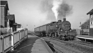
Banks railway station was on the West Lancashire Railway in England. It served the village of Banks near Southport. The station and line opened on 19 February 1878.
Hesketh Golf Links
Distance: Approx. 3451 meters
Latitude and longitude: 53.682,-2.969
Hesketh Golf Links is a 14.6-hectare (36-acre) Site of special scientific interest situated 2km north-east of Southport town centre in Merseyside. The site was notified in 1989 due to its biological features, in particular focusing on the presence of the nationally rare sand lizard (Lacerta agilis).
Mere Brow
Human settlement in England
Distance: Approx. 3376 meters
Latitude and longitude: 53.661,-2.882
Mere Brow is a small village in Lancashire, England, situated between Tarleton and Banks, just off the A565 road. It is 6 miles (9 km) east of Southport and 10 miles (15 km) south west of Preston. It is administered by the West Lancashire Borough Council and the Tarleton parish council.
Greaves Hall
Hospital in England
Distance: Approx. 859 meters
Latitude and longitude: 53.6756,-2.9159
Greaves Hall was a country house on the outskirts of Banks in Lancashire, England, built in a Tudorbethan style for Thomas Talbot Leyland Scarisbrick in 1900.

Hundred End
Human settlement in England
Distance: Approx. 2521 meters
Latitude and longitude: 53.694,-2.883
Hundred End is a coastal hamlet in West Lancashire, England. It is 2 miles east of the larger village of Banks and 2 miles west of the larger village of Hesketh Bank. It is administered by the West Lancashire District Council and North Meols parish council.
Southport Botanic Gardens
Distance: Approx. 3673 meters
Latitude and longitude: 53.66194444,-2.95916667
Southport Botanic Gardens is a botanical garden situated in the suburban village of Churchtown, Southport, in Merseyside, England. It is often called "The Jewel in the Crown" as it is nationally known for its floral displays, which have been featured in the BBC TV program Gardener's World.
Meols (ward)
Electoral ward in Sefton, England
Distance: Approx. 3247 meters
Latitude and longitude: 53.66601,-2.95635
Meols is a Metropolitan Borough of Sefton ward in the Southport Parliamentary constituency that covers the localities of Churchtown and Crossens in the north end of the town of Southport. The population of this ward taken at the 2011 census was 12,425.
Weather in this IP's area
scattered clouds
7 Celsius
4 Celsius
7 Celsius
9 Celsius
1014 hPa
84 %
1014 hPa
1012 hPa
10000 meters
6.93 m/s
11.97 m/s
275 degree
28 %


