Country:
Region:
City:
Latitude and Longitude:
Time Zone:
Postal Code:
IP information under different IP Channel
ip-api
Country
Region
City
ASN
Time Zone
ISP
Blacklist
Proxy
Latitude
Longitude
Postal
Route
Luminati
Country
Region
eng
City
kirkland
ASN
Time Zone
Europe/London
ISP
UK Dedicated Servers Limited
Latitude
Longitude
Postal
IPinfo
Country
Region
City
ASN
Time Zone
ISP
Blacklist
Proxy
Latitude
Longitude
Postal
Route
db-ip
Country
Region
City
ASN
Time Zone
ISP
Blacklist
Proxy
Latitude
Longitude
Postal
Route
ipdata
Country
Region
City
ASN
Time Zone
ISP
Blacklist
Proxy
Latitude
Longitude
Postal
Route
Popular places and events near this IP address
Askham, Cumbria
Human settlement in England
Distance: Approx. 1252 meters
Latitude and longitude: 54.6,-2.76
Askham is a village and civil parish in the Eden district of Cumbria, England. It is in the historic county of Westmorland. According to the 2001 census the parish had a population of 360, decreasing slightly to 356 at the 2011 Census.

Sockbridge and Tirril
Human settlement in England
Distance: Approx. 2421 meters
Latitude and longitude: 54.627,-2.768
Sockbridge and Tirril is a small civil parish in Eden District, Cumbria. It had a population of 397 in 2001, increasing to 415 at the 2011 Census. It comprises the adjoining settlements of Tirril, Sockbridge and Thorpe.

Lowther, Cumbria
Human settlement in England
Distance: Approx. 1682 meters
Latitude and longitude: 54.5969,-2.7314
Lowther is a civil parish in Westmorland and Furness, Cumbria. Within the parish are the settlements of Lowther Village, Newtown or Lowther Newtown, Hackthorpe, Whale, and Melkinthorpe. At the 2001 census the parish had a population of 402, increasing to 465 at the 2011 Census.

Lowther Castle
Country house in Cumbria, England
Distance: Approx. 575 meters
Latitude and longitude: 54.60583333,-2.74027778
Lowther Castle is a crenellated country house in the historic county of Westmorland, which now under the current unitary authority of Westmorland and Furness, in the ceremonial county of Cumbria, England . The estate has belonged to the Lowther family, latterly the Earls of Lonsdale, since the Middle Ages. It is a fully managed ruin, open to visits by the public to the shell of the castle and some of the gardens since 2011.

River Lowther
River in Cumbria, England
Distance: Approx. 2894 meters
Latitude and longitude: 54.63333333,-2.73333333
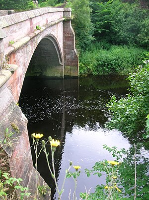
The River Lowther is a small river which flows through limestone rock in Cumbria, England. It is a tributary of the River Eamont which in turn is a tributary of the River Eden which flows into the Solway Firth near Carlisle. The Lowther begins with the confluence of the Keld Gill and the Keld Dub near the village of Keld.

Clifton Moor Skirmish
Distance: Approx. 2795 meters
Latitude and longitude: 54.627,-2.718
The Clifton Moor Skirmish took place on the evening of Wednesday 18 December during the Jacobite rising of 1745. Following the decision to retreat from Derby on 6 December, the fast-moving Jacobite army split into three smaller columns; on the morning of 18th, a small force of dragoons led by Cumberland and Sir Philip Honywood made contact with the Jacobite rearguard, at that point commanded by Lord George Murray. Murray ordered his baggage train to continue its retreat towards Penrith while he delayed Cumberland's force.

Hackthorpe
Hamlet in Cumbria, England
Distance: Approx. 2858 meters
Latitude and longitude: 54.6,-2.706
Hackthorpe is a hamlet in the Eden district, in the county of Cumbria, England. Circa 1870, it had a population of 110 as recorded in the Imperial Gazetteer of England and Wales.

Whale, Cumbria
Hamlet in England
Distance: Approx. 2564 meters
Latitude and longitude: 54.586,-2.741
Whale is a hamlet in the Westmorland and Furness unitary authority area, Cumbria, England. Historically in Westmorland, it is about a mile south of the village of Askham. In the Imperial Gazetteer of England and Wales of 1870-72 it had a population of 53.

Helton, Cumbria
Human settlement in England
Distance: Approx. 1997 meters
Latitude and longitude: 54.592,-2.759
Helton is a village in the Eden district, in the English county of Cumbria. It is about a mile south of the village of Askham. Circa 1870, it had a population of 180 as recorded in the Imperial Gazetteer of England and Wales.

Clifton and Lowther railway station
Former railway station in Westmorland, England
Distance: Approx. 2471 meters
Latitude and longitude: 54.618276,-2.713119
Clifton & Lowther railway station was a station on the Lancaster and Carlisle Railway (L&CR) south of Penrith, near the village of Clifton. Although it was the original terminus to cross Pennines rail traffic on the Eden Valley Railway, it was rapidly bypassed by a new line and junction. The station, which was on the West Coast Main Line, was treated as a private stop by the Earls of Lonsdale.

Askham Hall
Country house in Askham, England
Distance: Approx. 169 meters
Latitude and longitude: 54.608295,-2.750221
Askham Hall is a country house near Askham in Cumbria. It is a Grade I listed building.
Lowther Castle Stead
Medieval site in Cumbria
Distance: Approx. 158 meters
Latitude and longitude: 54.6099,-2.7464
Lowther Castle Stead is a medieval site in Cumbria, possibly a ringwork castle. It lies just east of the River Lowther. The castle was probably established in the 11th or 12th century as part of the Norman conquest of the region, and it was out of use by the mid-14th century.
Weather in this IP's area
light rain
6 Celsius
4 Celsius
5 Celsius
7 Celsius
1025 hPa
89 %
1025 hPa
1000 hPa
10000 meters
3.03 m/s
4.82 m/s
172 degree
100 %
07:32:07
16:17:53
