46.102.108.76 - IP Lookup: Free IP Address Lookup, Postal Code Lookup, IP Location Lookup, IP ASN, Public IP
Country:
Region:
City:
Location:
Time Zone:
Postal Code:
ISP:
ASN:
language:
User-Agent:
Proxy IP:
Blacklist:
IP information under different IP Channel
ip-api
Country
Region
City
ASN
Time Zone
ISP
Blacklist
Proxy
Latitude
Longitude
Postal
Route
db-ip
Country
Region
City
ASN
Time Zone
ISP
Blacklist
Proxy
Latitude
Longitude
Postal
Route
IPinfo
Country
Region
City
ASN
Time Zone
ISP
Blacklist
Proxy
Latitude
Longitude
Postal
Route
IP2Location
46.102.108.76Country
Region
vaslui
City
vaslui
Time Zone
Europe/Bucharest
ISP
Language
User-Agent
Latitude
Longitude
Postal
ipdata
Country
Region
City
ASN
Time Zone
ISP
Blacklist
Proxy
Latitude
Longitude
Postal
Route
Popular places and events near this IP address

Vaslui County
County of Romania
Distance: Approx. 5578 meters
Latitude and longitude: 46.59,27.77
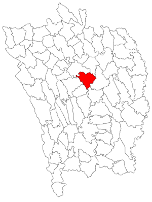
Vaslui County (Romanian pronunciation: [vasˈluj]) is a county (județ) of Romania, in the historical region Western Moldavia, with the seat at Vaslui.
Vaslui
Municipality in Romania
Distance: Approx. 643 meters
Latitude and longitude: 46.63833333,27.72916667
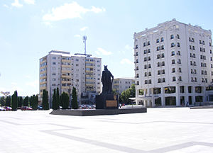
Vaslui (Romanian pronunciation: [vasˈluj]), a city in eastern Romania, is the seat of Vaslui County, in the historical region of Western Moldavia. The city administers five villages: Bahnari, Brodoc, Moara Grecilor, Rediu, and Viișoara.

Battle of Vaslui
1475 battle of the Moldavian-Ottoman Wars
Distance: Approx. 3275 meters
Latitude and longitude: 46.605,27.745
The Battle of Vaslui (also referred to as the Battle of Podul Înalt or the Battle of Racova) was fought on 10 January 1475, between Stephen III of Moldavia and the Ottoman governor of Rumelia, Hadım Suleiman Pasha. The battle took place at Podul Înalt ("the High Bridge"), near the town of Vaslui, in Moldavia (now part of eastern Romania). The Ottoman troops numbered up to 30,000 or 120,000, facing about 40,000 Moldavian troops, plus smaller numbers of allied and mercenary troops.

Vaslui Municipal Stadium
Romanian stadium
Distance: Approx. 22 meters
Latitude and longitude: 46.6335,27.73331944
The Vaslui Municipal Stadium is a multi-purpose stadium in Vaslui, Romania. It is used mostly for football matches and is the home ground of CSM Vaslui and Sporting Vaslui. The stadium has 9,240 seats, and it is covered by natural grass.
Racova (Bârlad)
Tributary of the river Bârlad in Romania
Distance: Approx. 1448 meters
Latitude and longitude: 46.6251,27.7186
The Racova is a right tributary of the river Bârlad in Romania. It discharges into the Bârlad near the city of Vaslui. Its length is 49 km (30 mi) and its basin size is 329 km2 (127 sq mi).
Stemnic
River in Vaslui County, Romania
Distance: Approx. 6520 meters
Latitude and longitude: 46.6693,27.666
The Stemnic is a right tributary of the river Bârlad in Romania. It discharges into the Bârlad near Bălteni. Its length is 32 km (20 mi) and its basin size is 150 km2 (58 sq mi).

Muntenii de Jos
Commune in Vaslui, Romania
Distance: Approx. 3152 meters
Latitude and longitude: 46.61666667,27.76666667
Muntenii de Jos is a commune in Vaslui County, Western Moldavia, Romania. It is composed of four villages: Băcăoani, Mânjești, Muntenii de Jos and Secuia.

Muntenii de Sus
Commune in Vaslui, Romania
Distance: Approx. 7850 meters
Latitude and longitude: 46.7,27.76666667
Muntenii de Sus is a commune in Vaslui County, Western Moldavia, Romania. It is composed of two villages, Muntenii de Sus and Satu Nou. These were part of Tanacu Commune from 1968 until 2004, when they were split off.

Tanacu
Commune in Vaslui, Romania
Distance: Approx. 8461 meters
Latitude and longitude: 46.68333333,27.81666667
Tanacu is a commune in Vaslui County, Western Moldavia, Romania. It is composed of two villages, Benești and Tanacu. It included Muntenii de Sus and Satu Nou villages from 1968 to 2004, when these were split off to form Muntenii de Sus Commune.

Lipovăț
Commune in Vaslui, Romania
Distance: Approx. 7843 meters
Latitude and longitude: 46.56666667,27.7
Lipovăț is a commune in Vaslui County, Western Moldavia, Romania. It is composed of five villages: Căpușneni, Chițoc, Corbu, Fundu Văii, and Lipovăț.

Pușcași
Commune in Vaslui, Romania
Distance: Approx. 7864 meters
Latitude and longitude: 46.61666667,27.63333333
Pușcași is a commune in Vaslui County, Western Moldavia, Romania. It is composed of four villages: Poiana lui Alexa, Pușcași, Teișoru and Valea Târgului. These were part of Laza Commune until 2004, when they were split off.

Beheading of St. John the Baptist Church, Vaslui
Heritage site in Vaslui County, Romania
Distance: Approx. 152 meters
Latitude and longitude: 46.63358,27.73136
The Beheading of St. John the Baptist Church (Romanian: Biserica Tăierea Capului Sfântului Ioan Botezătorul) is a Romanian Orthodox church located at 58 Ștefan cel Mare Street, Vaslui, Romania. It is dedicated to the Beheading of John the Baptist.
Weather in this IP's area
clear sky
4 Celsius
0 Celsius
4 Celsius
4 Celsius
1036 hPa
60 %
1036 hPa
1010 hPa
10000 meters
4.56 m/s
6.59 m/s
316 degree
7 %
