Country:
 France
Region:
City:
Latitude and Longitude:
Time Zone:
Postal Code:
IP information under different IP Channel
ip-api
Country
Region
City
ASN
Time Zone
ISP
Blacklist
Proxy
Latitude
Longitude
Postal
Route
IPinfo
Country
Region
City
ASN
Time Zone
ISP
Blacklist
Proxy
Latitude
Longitude
Postal
Route
MaxMind
Country
Region
City
ASN
Time Zone
ISP
Blacklist
Proxy
Latitude
Longitude
Postal
Route
Luminati
Country
FRRegion
idf
City
poissy
ASN
Time Zone
Europe/Paris
ISP
Ielo-liazo Services SAS
Latitude
Longitude
Postal
db-ip
Country
Region
City
ASN
Time Zone
ISP
Blacklist
Proxy
Latitude
Longitude
Postal
Route
ipdata
Country
Region
City
ASN
Time Zone
ISP
Blacklist
Proxy
Latitude
Longitude
Postal
Route
Popular places and events near this IP address

Nantes
Prefecture and commune in Pays de la Loire, France
Distance: Approx. 99 meters
Latitude and longitude: 47.2181,-1.5528
Nantes (, US also ; French: [nɑ̃t] ; Gallo: Naunnt or Nantt [nɑ̃(ː)t]; Breton: Naoned [ˈnãunət]) is a city in the Loire-Atlantique department of France on the Loire, 50 km (31 mi) from the Atlantic coast. The city is the sixth largest in France, with a population of 320,732 in Nantes proper and a metropolitan area of nearly 1 million inhabitants (2020). With Saint-Nazaire, a seaport on the Loire estuary, Nantes forms one of the main north-western French metropolitan agglomerations.
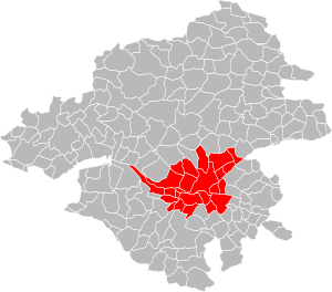
Nantes Metropolis
Métropole in Pays de la Loire, France
Distance: Approx. 42 meters
Latitude and longitude: 47.2172,-1.5539
The Nantes Metropolis (French: Nantes Métropole) is the métropole, an intercommunal structure, centred on the city of Nantes. It is located in the Loire-Atlantique department, in the Pays de la Loire region, western France. It was created in January 2015, replacing the previous Communauté urbaine de Nantes.

Nantes Cathedral
Cathedral located in Loire-Atlantique, in France
Distance: Approx. 209 meters
Latitude and longitude: 47.218,-1.5508
Nantes Cathedral, or the Cathedral of St. Peter and St. Paul of Nantes (French: Cathédrale Saint-Pierre-et-Saint-Paul de Nantes), is a Roman Catholic Gothic cathedral located in Nantes, Pays de la Loire, France.

Château des ducs de Bretagne
Distance: Approx. 302 meters
Latitude and longitude: 47.21583333,-1.55
The Château des ducs de Bretagne (English: Castle of the Dukes of Brittany) is a large castle located in the city of Nantes in the Loire-Atlantique département of France; it served as the centre of the historical province of Brittany until its separation in 1956. It is located on the right bank of the Loire, which formerly fed its ditches. It was the residence of the Dukes of Brittany between the 13th and 16th centuries, subsequently becoming the Breton residence of the French Monarchy.
Roman Catholic Diocese of Nantes
Diocese of the Roman Catholic Church in Nantes, France
Distance: Approx. 394 meters
Latitude and longitude: 47.22,-1.55
The Diocese of Nantes (Latin: Dioecesis Nannetensis; French: Diocèse de Nantes; Breton: Eskopti Naoned) is a Latin Church diocese of the Catholic Church in Nantes, France. The diocese consists of the department of Loire-Atlantique. It has existed since the 4th century.

Battle of Nantes
Distance: Approx. 99 meters
Latitude and longitude: 47.2181,-1.5528
The Battle of Nantes took place between Royalist and Republican French forces at Nantes on 29 June 1793 during the War in the Vendée. It consisted of the siege of that town, and was a Republican victory. Louis Marie Turreau wrote of it: The siege of Nantes is perhaps the most important military event of our revolution.

Musée d'Arts de Nantes
Arts museum in Nantes, France
Distance: Approx. 525 meters
Latitude and longitude: 47.219415,-1.547152
The Fine Arts Museum of Nantes, along with 14 other provincial museums, was created, by consular decree on 14 Fructidor in year IX (31 August 1801) . Today the museum is one of the largest museums in the region. The facades, roof and stairs in the building that houses the art collections have been registered as historical monuments since 29 October 1975.

Tour Bretagne
Skyscraper in Nantes
Distance: Approx. 399 meters
Latitude and longitude: 47.21694444,-1.55861111
Tour Bretagne (Brittany Tower in English) opened on November 18, 1976, at 17:00, is a 37-story skyscraper situated in downtown Nantes between a main thoroughfare, Cours des 50 Otages, and Place Bretagne (Brittany square). With a total height of 144 meters (472 feet), it dominates the skyline of the city of Nantes and is the third tallest building in France outside of Paris, after Tour Part-Dieu in Lyon and CMA CGM Tower in Marseilles. Built on the water tank, the antennas reach 25 metres (82 ft) above the top floor.

Palais de la Bourse (Nantes)
Distance: Approx. 628 meters
Latitude and longitude: 47.21277778,-1.55833333
The Palais de la Bourse is a building on place du Commerce in Nantes, France, begun at the end of the 18th century and completed in the 19th century. It was rebuilt at the end of the 20th century to house a branch of Fnac.

Tomb of Francis II, Duke of Brittany
Monument located in Nantes, in the Cathedral of St. Peter
Distance: Approx. 266 meters
Latitude and longitude: 47.218225,-1.55011667
The tomb of Francis II, Duke of Brittany is a monument located in Nantes, in the Cathedral of St. Peter. The project was commissioned by Anne of Brittany, Queen of France, who was the daughter of Francis and his second wife Margaret of Foix, who is also depicted beside Francis.
Cantons of Nantes
Distance: Approx. 394 meters
Latitude and longitude: 47.22,-1.55
The cantons of Nantes are administrative divisions of the Loire-Atlantique department, in western France. Since the French canton reorganisation which came into effect in March 2015, the city of Nantes is subdivided into 7 cantons. Their seat is in Nantes.

Basilica of Saint Nicholas, Nantes
Basilica church in France
Distance: Approx. 386 meters
Latitude and longitude: 47.21555556,-1.55777778
The Basilica of Saint Nicholas (French: Basilique Saint-Nicolas de Nantes) is a minor basilica in Nantes, Loire-Atlantique, historically in Brittany. The present church is a Gothic Revival structure built during the years 1844 to 1869 on the site of a mediaeval parish church largely rebuilt in the late 18th century. Because of the constrained site in the centre of the old city, the church is oriented north-south rather than the traditional east-west.
Weather in this IP's area
clear sky
16 Celsius
16 Celsius
16 Celsius
17 Celsius
1025 hPa
81 %
1025 hPa
1024 hPa
10000 meters
2.06 m/s
30 degree
07:45:28
20:16:41