Country:
 Netherlands
Region:
City:
Latitude and Longitude:
Time Zone:
Postal Code:
IP information under different IP Channel
ip-api
Country
Region
City
ASN
Time Zone
ISP
Blacklist
Proxy
Latitude
Longitude
Postal
Route
IPinfo
Country
Region
City
ASN
Time Zone
ISP
Blacklist
Proxy
Latitude
Longitude
Postal
Route
MaxMind
Country
Region
City
ASN
Time Zone
ISP
Blacklist
Proxy
Latitude
Longitude
Postal
Route
Luminati
Country
NLRegion
nb
City
oss
ASN
Time Zone
Europe/Amsterdam
ISP
Qonnected B.V.
Latitude
Longitude
Postal
db-ip
Country
Region
City
ASN
Time Zone
ISP
Blacklist
Proxy
Latitude
Longitude
Postal
Route
ipdata
Country
Region
City
ASN
Time Zone
ISP
Blacklist
Proxy
Latitude
Longitude
Postal
Route
Popular places and events near this IP address

Oss
Municipality in North Brabant, Netherlands
Distance: Approx. 1735 meters
Latitude and longitude: 51.76666667,5.51666667
Oss (Dutch: [ɔs] ) is a municipality and a city in the southern Netherlands, in the province of North Brabant, situated between Nijmegen and 's-Hertogenbosch.

Berghem
Town in North Brabant, Netherlands
Distance: Approx. 4765 meters
Latitude and longitude: 51.77,5.57472222
Berghem (older spelling: Berchem) is a town in the Dutch municipality of Oss. It is located about 4 km northeast of Oss itself.
Frans Heesen Stadion
Distance: Approx. 3229 meters
Latitude and longitude: 51.755113,5.528175
Frans Heesen Stadion is a multi-use stadium in the city of Oss, Netherlands. It is currently used mostly for association football matches and is the home stadium of TOP Oss. The stadium is able to hold 4,561 spectators.

Macharen
Village in North Brabant, Netherlands
Distance: Approx. 3628 meters
Latitude and longitude: 51.805,5.54416667
Macharen is a village in the southern part of the Netherlands, in the province North Brabant. It is part of the Oss municipality. The village was first mentioned in 1107 as Machera, and means "suitable sandy ridge".

Maasbommel
Small city in Gelderland, Netherlands
Distance: Approx. 4815 meters
Latitude and longitude: 51.82083333,5.53638889
Maasbommel is a city in the Dutch province of Gelderland. It is a part of the municipality of West Maas en Waal, and lies about 7 km north of Oss. It received city rights in 1312.
Haren en Macharen
Distance: Approx. 4430 meters
Latitude and longitude: 51.803095,5.561829
Haren en Macharen is a former municipality in the Dutch province of North Brabant, located north of the city of Oss. It covered the villages of Haren and Macharen. Haren en Macharen was a separate municipality until 1821, when it became a part of Megen, Haren en Macharen (since 1994 part of Oss).

Lithoijen
Village in North Brabant, Netherlands
Distance: Approx. 3877 meters
Latitude and longitude: 51.8025,5.46333333
Lithoijen is a village in the Dutch province of North Brabant. It is located in the municipality of Oss, about 5 km northwest of the city of Oss.

Oijen en Teeffelen
Distance: Approx. 3487 meters
Latitude and longitude: 51.811586,5.495052
Oijen en Teeffelen was a municipality in the Dutch province of North Brabant. It included the villages of Oijen and Teeffelen. The municipality existed until 1939, when it became part of Lith.

Oss railway station
Railway station in the Netherlands
Distance: Approx. 2416 meters
Latitude and longitude: 51.76527778,5.53166667
Oss is a railway station located in Oss, Netherlands. The station was opened on 4 June 1881 and is located on the Tilburg–Nijmegen railway. The train services are operated by Nederlandse Spoorwegen.
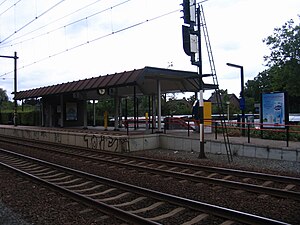
Oss West railway station
Railway station in the Netherlands
Distance: Approx. 2591 meters
Latitude and longitude: 51.75805556,5.50611111
Oss West is a railway station located in Oss, Netherlands.
Cordial (restaurant)
Restaurant in Oss, Netherlands
Distance: Approx. 2052 meters
Latitude and longitude: 51.76798333,5.52860278
Cordial is a restaurant in Oss, Netherlands. It is a fine dining restaurant that was awarded one Michelin star for the period 2002–2018. GaultMillau awarded the restaurant 17 out of 20 points.

Oss rail accident
2018 train collision incident in the Netherlands
Distance: Approx. 2528 meters
Latitude and longitude: 51.75859,5.50757
The Oss railway accident happened on 20 September 2018 when a passenger train collided with a Stint cart on a level crossing at Oss, North Brabant, Netherlands. Four children on the cart were killed, and two were seriously injured. Stint carts were subsequently banned from use on public roads in the Netherlands.
Weather in this IP's area
overcast clouds
16 Celsius
16 Celsius
15 Celsius
17 Celsius
1015 hPa
81 %
1015 hPa
1014 hPa
10000 meters
6.17 m/s
200 degree
100 %
08:09:34
18:35:51