Country:
 Netherlands
Region:
City:
Latitude and Longitude:
Time Zone:
Postal Code:
IP information under different IP Channel
ip-api
Country
Region
City
ASN
Time Zone
ISP
Blacklist
Proxy
Latitude
Longitude
Postal
Route
IPinfo
Country
Region
City
ASN
Time Zone
ISP
Blacklist
Proxy
Latitude
Longitude
Postal
Route
MaxMind
Country
Region
City
ASN
Time Zone
ISP
Blacklist
Proxy
Latitude
Longitude
Postal
Route
Luminati
Country
NLRegion
gr
City
bedum
ASN
Time Zone
Europe/Amsterdam
ISP
Qonnected B.V.
Latitude
Longitude
Postal
db-ip
Country
Region
City
ASN
Time Zone
ISP
Blacklist
Proxy
Latitude
Longitude
Postal
Route
ipdata
Country
Region
City
ASN
Time Zone
ISP
Blacklist
Proxy
Latitude
Longitude
Postal
Route
Popular places and events near this IP address

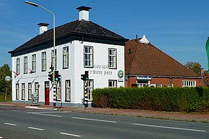
Bedum
Former municipality in Groningen, Netherlands
Distance: Approx. 763 meters
Latitude and longitude: 53.3,6.6
Bedum (Dutch: [ˈbeːdʏm] ; Gronings: Beem [beɪ̯m]) is a former municipality and a town in the northeastern Netherlands. Populated by data missing inhabitants in 2021, Bedum is one of the larger of Groningen's several satellite towns. On 1 January 2019 it merged with the municipalities of De Marne, Eemsmond and Winsum to form the new municipality Het Hogeland.

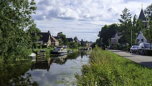
Sauwerd
Village in Groningen, Netherlands
Distance: Approx. 3980 meters
Latitude and longitude: 53.29333333,6.53472222
Sauwerd is a village in the municipality of Het Hogeland, Groningen, Netherlands. Until the local government reorganization of 1990 the village was the head of the former municipality of Adorp. The village of Sauwerd is 7 to 10 kilometers away from the nearest city, Groningen.
Adorp
Village in Groningen, Netherlands
Distance: Approx. 5047 meters
Latitude and longitude: 53.27472222,6.53444444
Adorp (Dutch: [ˈaːdɔr(ə)p]; Gronings: Oadörp [ˈʊːdœːp]) is a village in the municipality of Het Hogeland, Netherlands. It is located about 6 km north of Groningen. Until 1990, Adorp was a separate municipality, however the seat was in Sauwerd.

St. Walfriduskerk
Church in Groningen, Netherlands
Distance: Approx. 876 meters
Latitude and longitude: 53.30027778,6.6025
St. Walfridus kerk is a church in Bedum, Netherlands, dedicated to Saint Walfridus. The church was founded in 1050.

Bedum railway station
Railway station in the Netherlands
Distance: Approx. 235 meters
Latitude and longitude: 53.30666667,6.59222222
Bedum is a railway station located in Bedum, Netherlands. The station was opened on 15 June 1884 and is located on the Groningen–Delfzijl railway. The services are currently operated by Arriva.

Sauwerd railway station
Railway station in the Netherlands
Distance: Approx. 3729 meters
Latitude and longitude: 53.29138889,6.54
Sauwerd is a railway station located in Sauwerd, The Netherlands. The station was opened on 15 June 1884 and is located on the Groningen–Delfzijl railway and the Sauwerd–Roodeschool railway. The train services are operated by Arriva.

Wetsinge
Village in Groningen, Netherlands
Distance: Approx. 4079 meters
Latitude and longitude: 53.30055556,6.53055556
Groot Wetsinge (English: Big Wetsinge) and Klein Wetsinge (English: Small Wetsinge) are two villages in the municipality of Het Hogeland in the Dutch province of Groningen. The villages are less than half a kilometre apart and are often referred to together as Wetsinge. The closest village, at a distance of less than a kilometre to Wetsinge is Sauwerd.

Winsum train collision
Dutch train disaster
Distance: Approx. 4455 meters
Latitude and longitude: 53.31775,6.52823889
The Winsum train disaster took place on 25 July 1980 near Winsum in the Dutch province of Groningen. Nine people died and 21 were injured. The collision took place on a single track between Sauwerd and Roodeschool that did not have ATB or signals, instead the drivers were informed by radio where other trains on the tracks were, which was a less reliable system that relied on trust.

Bellingeweer
Village in Groningen, Netherlands
Distance: Approx. 5409 meters
Latitude and longitude: 53.32641111,6.51881389
Bellingeweer is part of the town of Winsum, in Groningen, Netherlands. Originally, it was an independent village built on a wierde. Bellingeweer had its own medieval church, which was demolished in 1824.

Noordwolde, Groningen
Village in Groningen, Netherlands
Distance: Approx. 4258 meters
Latitude and longitude: 53.26666667,6.58333333
Noordwolde is a village in Het Hogeland municipality in the province of Groningen, the Netherlands. It had a population of around 275 in January 2017.

Onderdendam
Village in Groningen, Netherlands
Distance: Approx. 3244 meters
Latitude and longitude: 53.33333333,6.58333333
Onderdendam is a village in Het Hogeland municipality in the province of Groningen, the Netherlands. It had a population of around 575 in 2021.
Zuidwolde, Groningen
Village in Groningen, Netherlands
Distance: Approx. 4260 meters
Latitude and longitude: 53.26666667,6.6
Zuidwolde (Dutch pronunciation: [zœytˈʋɔldə]; Gronings: Zuudwòl [zyːtˈʋɔːl]) is a village in Het Hogeland municipality in the province of Groningen, the Netherlands. It had a population of around 1,010 in January 2017.
Weather in this IP's area
light rain
14 Celsius
14 Celsius
13 Celsius
14 Celsius
1014 hPa
91 %
1014 hPa
1014 hPa
10000 meters
3.64 m/s
6.98 m/s
199 degree
100 %
08:08:02
18:28:43