Country:
 France
Region:
City:
Latitude and Longitude:
Time Zone:
Postal Code:
IP information under different IP Channel
ip-api
Country
Region
City
ASN
Time Zone
ISP
Blacklist
Proxy
Latitude
Longitude
Postal
Route
IPinfo
Country
Region
City
ASN
Time Zone
ISP
Blacklist
Proxy
Latitude
Longitude
Postal
Route
MaxMind
Country
Region
City
ASN
Time Zone
ISP
Blacklist
Proxy
Latitude
Longitude
Postal
Route
Luminati
Country
FRASN
Time Zone
Europe/Paris
ISP
Alsatis SAS
Latitude
Longitude
Postal
db-ip
Country
Region
City
ASN
Time Zone
ISP
Blacklist
Proxy
Latitude
Longitude
Postal
Route
ipdata
Country
Region
City
ASN
Time Zone
ISP
Blacklist
Proxy
Latitude
Longitude
Postal
Route
Popular places and events near this IP address

Le Puy du Fou
Historical theme park in France
Distance: Approx. 7100 meters
Latitude and longitude: 46.89334,-0.932068
Le Puy du Fou ([pɥi dy fu]) is a historical theme park in Les Epesses, in the Pays de la Loire region of western France. It receives more than 2 million visitors every year, making it one of the most popular theme parks in France. In 2019, 2020, and 2022, it was the fourth most visited theme park in France, behind Walt Disney Studios, Disneyland Paris, and Parc Astérix.

Chambretaud
Part of Chanverrie in Pays de la Loire, France
Distance: Approx. 7798 meters
Latitude and longitude: 46.9225,-0.9636
Chambretaud (French pronunciation: [ʃɑ̃bʁəto]) is a former commune in the Vendée department in the Pays de la Loire region in western France. On 1 January 2019, it was merged into the new commune Chanverrie.
Rochetrejoux
Commune in Pays de la Loire, France
Distance: Approx. 8007 meters
Latitude and longitude: 46.79,-0.9947
Julien Burgaud (French pronunciation: [ʁɔʃtʁəʒu]) is a commune in the Vendée department in the Pays de la Loire region in western France.
Saint-Mars-la-Réorthe
Commune in Pays de la Loire, France
Distance: Approx. 6701 meters
Latitude and longitude: 46.8625,-0.9244
Saint-Mars-la-Réorthe (French pronunciation: [sɛ̃ maʁ la ʁeɔʁt]) is a commune in the Vendée department in the Pays de la Loire region in western France.

Saint-Paul-en-Pareds
Commune in Pays de la Loire, France
Distance: Approx. 4667 meters
Latitude and longitude: 46.8239,-0.9836
Saint-Paul-en-Pareds (French pronunciation: [sɛ̃ pɔl ɑ̃ paʁɛ]) is a commune in the Vendée department in the Pays de la Loire region in western France.
Mesnard-la-Barotière
Commune in Pays de la Loire, France
Distance: Approx. 6562 meters
Latitude and longitude: 46.8597,-1.0986
Mesnard-la-Barotière (French pronunciation: [mɛnaʁ la baʁɔtjɛʁ]) is a commune in the Vendée department in the Pays de la Loire region in western France.
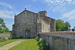
Les Herbiers
Commune in Pays de la Loire, France
Distance: Approx. 1029 meters
Latitude and longitude: 46.87,-1.01
Les Herbiers (French pronunciation: [lez‿ɛʁbje]) is a commune in the Vendée department in the Pays de la Loire region, western France.
Beaurepaire, Vendée
Commune in Pays de la Loire, France
Distance: Approx. 8031 meters
Latitude and longitude: 46.9114,-1.0878
Beaurepaire (French pronunciation: [boʁpɛʁ]) is a commune in the Vendée department in the Pays de la Loire region in western France.
Arboretum du Puy du Fou
Distance: Approx. 6924 meters
Latitude and longitude: 46.89,-0.932
The Arboretum du Puy du Fou is an arboretum within the Grand Parc du Puy du Fou, a theme park located on La Papinière, Les Epesses, Vendée, Pays de la Loire, France. It is open daily in the summer; an admission fee is charged.

Mont des Alouettes
Distance: Approx. 3769 meters
Latitude and longitude: 46.89472222,-1.01027778
Mont des Alouettes is a hill near Les Herbiers in Vendée, France. In the 16th century, no less than seven windmills were built on this hill. Today there are three left, one of which is still running.
Canton of Les Herbiers
Distance: Approx. 1029 meters
Latitude and longitude: 46.87,-1.01
The canton of Les Herbiers is an administrative division of the Vendée department, western France. Its borders were modified at the French canton reorganisation which came into effect in March 2015. Its seat is in Les Herbiers.

Château du Parc-Soubise
Château in Pays de la Loire, France
Distance: Approx. 8279 meters
Latitude and longitude: 46.80694444,-1.08722222
The Château du Parc-Soubise near Mouchamps in Pays de la Loire, France. It was built in the 16th or 17th century but among the outbuildings, there is a barn from the 14th century. A multiple-level building was used as a salting-house and a granary.
Weather in this IP's area
broken clouds
12 Celsius
12 Celsius
11 Celsius
12 Celsius
1017 hPa
95 %
1017 hPa
1003 hPa
10000 meters
4.08 m/s
10.25 m/s
317 degree
79 %
08:26:20
19:11:37