45.9.171.112 - IP Lookup: Free IP Address Lookup, Postal Code Lookup, IP Location Lookup, IP ASN, Public IP
Country:
 Hungary
Region:
City:
Location:
Time Zone:
Postal Code:
ISP:
ASN:
language:
User-Agent:
Proxy IP:
Blacklist:
IP information under different IP Channel
ip-api
Country
Region
City
ASN
Time Zone
ISP
Blacklist
Proxy
Latitude
Longitude
Postal
Route
db-ip
Country
Region
City
ASN
Time Zone
ISP
Blacklist
Proxy
Latitude
Longitude
Postal
Route
IPinfo
Country
Region
City
ASN
Time Zone
ISP
Blacklist
Proxy
Latitude
Longitude
Postal
Route
IP2Location
45.9.171.112Country
huRegion
szabolcs-szatmar-bereg
City
balkany
Time Zone
Europe/Budapest
ISP
Language
User-Agent
Latitude
Longitude
Postal
ipdata
Country
Region
City
ASN
Time Zone
ISP
Blacklist
Proxy
Latitude
Longitude
Postal
Route
Popular places and events near this IP address

Balkány
Place in Northern Great Plain, Hungary
Distance: Approx. 486 meters
Latitude and longitude: 47.7694,21.8569
Balkány (Hungarian pronunciation: [ˈbɒlkaːɲ]) is a town in Szabolcs-Szatmár-Bereg county, in the Northern Great Plain region of eastern Hungary.

Biri, Hungary
Place in Szabolcs-Szatmár-Bereg, Hungary
Distance: Approx. 5210 meters
Latitude and longitude: 47.81666667,21.85
Biri is a village in Szabolcs-Szatmár-Bereg county, in the Northern Great Plain region of eastern Hungary.
Bököny
Place in Szabolcs-Szatmár-Bereg, Hungary
Distance: Approx. 9432 meters
Latitude and longitude: 47.73333333,21.75
Bököny is a village in Szabolcs-Szatmár-Bereg county, in the Northern Great Plain region of eastern Hungary.
Érpatak
Place in Szabolcs-Szatmár-Bereg, Hungary
Distance: Approx. 7916 meters
Latitude and longitude: 47.8,21.76666667
Érpatak is a village in Szabolcs-Szatmár-Bereg county, in the Northern Great Plain region of eastern Hungary.

Szakoly
Place in Northern Great Plain, Hungary
Distance: Approx. 4033 meters
Latitude and longitude: 47.76666667,21.91666667
Szakoly is a village in Szabolcs-Szatmár-Bereg county, in the Northern Great Plain region of eastern Hungary. It is 135 miles (217 km) to the east of Budapest and 21 miles (34 km) to the north east of Debrecen. It is home to the Szakoly Power Plant.
Geszteréd
Place in Szabolcs-Szatmár-Bereg, Hungary
Distance: Approx. 5985 meters
Latitude and longitude: 47.76666667,21.78333333
Geszteréd is a village in Szabolcs-Szatmár-Bereg county, in the Northern Great Plain region of eastern Hungary. It covers an area of 33.52 km2 (13 sq mi) and has a population of 1718 people (2015).

Nyírgelse
Village in Szabolcs-Szatmár-Bereg, Hungary
Distance: Approx. 9288 meters
Latitude and longitude: 47.75,21.98333333
Nyírgelse is a village in Szabolcs-Szatmár-Bereg county, in the Northern Great Plain region of eastern Hungary.
Szakoly Power Plant
Biomass power plant
Distance: Approx. 4979 meters
Latitude and longitude: 47.7377,21.908
The Szakoly Power Plant is one of Hungary's largest biomass power plants having an installed electric capacity of 20 MW.

Nyírmihálydi
Village in Northern Great Plain, Hungary
Distance: Approx. 8479 meters
Latitude and longitude: 47.7325,21.96111111
Nyírmihálydi is a village in Szabolcs-Szatmár-Bereg County, Hungary. As of the 2011 Hungarian census the village had a population of 1,995, an increase of 155 from 2001.

Nyíradony District
Districts of Hungary in Hajdú-Bihar
Distance: Approx. 9399 meters
Latitude and longitude: 47.69,21.9
Nyíradony (Hungarian: Nyíradonyi járás) is a district in north-eastern part of Hajdú-Bihar County. Nyíradony is also the name of the town where the district seat is found. The district is located in the Northern Great Plain Statistical Region.
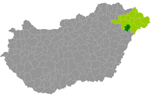
Nagykálló District
Districts of Hungary in Szabolcs-Szatmár-Bereg
Distance: Approx. 2634 meters
Latitude and longitude: 47.7833,21.8333
Nagykálló (Hungarian: Nagykállói járás) is a district in southern part of Szabolcs-Szatmár-Bereg County. Nagykálló is also the name of the town where the district seat is found. The district is located in the Northern Great Plain Statistical Region.
Weather in this IP's area
overcast clouds
1 Celsius
-2 Celsius
1 Celsius
1 Celsius
1037 hPa
58 %
1037 hPa
1019 hPa
10000 meters
2.51 m/s
3.08 m/s
115 degree
100 %