Country:
Region:
City:
Latitude and Longitude:
Time Zone:
Postal Code:
IP information under different IP Channel
ip-api
Country
Region
City
ASN
Time Zone
ISP
Blacklist
Proxy
Latitude
Longitude
Postal
Route
Luminati
Country
Region
ca
City
sanjose
ASN
Time Zone
America/Los_Angeles
ISP
XTOM
Latitude
Longitude
Postal
IPinfo
Country
Region
City
ASN
Time Zone
ISP
Blacklist
Proxy
Latitude
Longitude
Postal
Route
db-ip
Country
Region
City
ASN
Time Zone
ISP
Blacklist
Proxy
Latitude
Longitude
Postal
Route
ipdata
Country
Region
City
ASN
Time Zone
ISP
Blacklist
Proxy
Latitude
Longitude
Postal
Route
Popular places and events near this IP address

Dr. Martin Luther King Jr. Library
Distance: Approx. 328 meters
Latitude and longitude: 37.33545,-121.88496
The Dr. Martin Luther King Jr. Library (also known locally as the MLK Library or the King Library) is an 8-story public library and university library, located in downtown San Jose, California, which had its grand opening on August 16, 2003.
Arts Council Silicon Valley
Distance: Approx. 312 meters
Latitude and longitude: 37.33761,-121.88975
The Arts Council Silicon Valley (1982–2013) was the official Santa Clara County, United States arts council. Established in 1982 originally as the Cultural Council and later as Arts Council of Santa Clara County, Arts Council Silicon Valley (ACSV) was a private, nonprofit arts organization dedicated to improving the quality of life for Santa Clara County residents by creating and fostering arts and culture throughout the region. As a grant agency, the ACSV provided funding and fundraising support services to more than 140 local arts organizations and individual artists.
San Jose City Hall
Seat of the municipal government of San Jose, California
Distance: Approx. 48 meters
Latitude and longitude: 37.3378,-121.8861
San José City Hall is the seat of the municipal government of San Jose, California. Located in Downtown San Jose, it was designed by Pritzker Prize-winning architect Richard Meier in a Postmodern style. It consists of an 18-story tower, an iconic glass rotunda, and a city council chamber wing, laid out within a two-block-long public square known as San José Civic Plaza.

Ira F. Brilliant Center for Beethoven Studies
Museum and research institute in California
Distance: Approx. 329 meters
Latitude and longitude: 37.3354,-121.8851
The Ira F. Brilliant Center for Beethoven Studies serves as a museum, research center, and host of lectures and performances devoted solely to the life and works of Ludwig van Beethoven. It is the only institution of its kind in North America and holds the largest collection of Beethoven works and memorabilia outside Europe. The center is operated by San Jose State University and the American Beethoven Society.

First Unitarian Church of San Jose
Historic church in California, United States
Distance: Approx. 361 meters
Latitude and longitude: 37.33972778,-121.88990278
The First Unitarian Church of San Jose is located at 160 North Third Street in downtown San Jose, California, across from St. James Park, and was designed in "Richardsonian Romanesque" style by architect George Page, who also designed the Hayes Mansion. Local historian Linda Larson Boston called the building, “One of a handful of American churches patterned after Unitarian churches of Transylvania, it features a large triple-arched stained glass window on the facade, multiple domes and cupolas, and both round and square towers,” in her pamphlet, Highlights of San Jose, California’s St.

Downtown San José station
Planned underground BART stop
Distance: Approx. 388 meters
Latitude and longitude: 37.33635,-121.89002
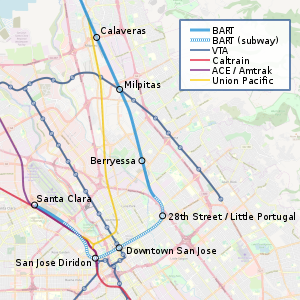
Downtown San José station is a proposed underground Bay Area Rapid Transit station underneath Santa Clara Street in Downtown San Jose, planned as part of Silicon Valley BART extension Phase II. The station would be co-located with the Santa Clara Valley Transportation Authority's existing Santa Clara light rail station, and be located between the proposed 28th Street/Little Portugal station and a transfer station at San Jose Diridon Station. The station eventually connects to the proposed Santa Clara BART station. Revenue service, which will be served by the Orange and Green Lines, is envisioned to start in 2036.

Trinity Episcopal Cathedral (San Jose, California)
Episcopal Cathedral in San Jose, California
Distance: Approx. 400 meters
Latitude and longitude: 37.337825,-121.89079722
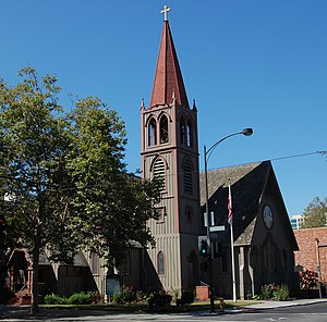
Trinity Episcopal Cathedral is an Episcopal cathedral in San Jose, California. It is the seat of the Episcopal Diocese of El Camino Real.

The 88 (San Jose)
Residential condominiums in San Jose, California
Distance: Approx. 395 meters
Latitude and longitude: 37.33472,-121.8872
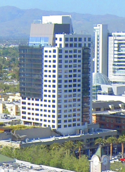
The 88 is a 22-story, 87.2 m (286 ft) residential skyscraper in downtown San Jose, California. Upon completion of the tower in 2008, the tower became the tallest building in the city, surpassing the 86.9 m (285 ft) San Jose City Hall that was completed in 2005.
First Presbyterian Church of San Jose
Distance: Approx. 191 meters
Latitude and longitude: 37.33855,-121.88841
The First Presbyterian Church of San Jose was a Presbyterian church in San Jose, California, United States. Founded in 1849, it was one of the oldest Protestant churches in California. The First Presbyterian building is located on 49 N. 4th Street in Downtown San Jose across from San Jose City Hall.

CreaTV San Jose
Distance: Approx. 334 meters
Latitude and longitude: 37.33583333,-121.88861111
CreaTV San Jose (abbreviated CRTV) is a nonprofit organization based in San Jose, California, United States, that broadcasts several public-access television channels in San Jose and the surrounding Silicon Valley area. Under federal law, CreaTV receives a share of the gross revenue of local cable franchisees Comcast and AT&T, which amounted to $1.2 million in 2009.

Saint Patrick School (San Jose, California)
Private, coeducational school in San Jose, California, United States
Distance: Approx. 407 meters
Latitude and longitude: 37.3409,-121.8832
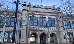
Saint Patrick School is a private Catholic school (kindergarten to eighth), located in San Jose, California. Founded in 1925, the school's historic gothic revival campus is located in Downtown San Jose, next to the Our Lady of La Vang Church, and designated as a city landmark.
27–29 Fountain Alley
Historic building in California, United States
Distance: Approx. 382 meters
Latitude and longitude: 37.33611111,-121.88972222
27–29 Fountain Alley is a historic commercial building located in San Jose, California. The building is architecturally significant as the only representative of late Victorian-style in this area. Its historically important for its association with Fountain Alley, one of San Jose oldest streets.
Weather in this IP's area
clear sky
22 Celsius
21 Celsius
19 Celsius
24 Celsius
1018 hPa
26 %
1018 hPa
1015 hPa
10000 meters
4.63 m/s
320 degree
06:40:08
17:02:37

