45.82.190.239 - IP Lookup: Free IP Address Lookup, Postal Code Lookup, IP Location Lookup, IP ASN, Public IP
Country:
Region:
City:
Location:
Time Zone:
Postal Code:
ISP:
ASN:
language:
User-Agent:
Proxy IP:
Blacklist:
IP information under different IP Channel
ip-api
Country
Region
City
ASN
Time Zone
ISP
Blacklist
Proxy
Latitude
Longitude
Postal
Route
db-ip
Country
Region
City
ASN
Time Zone
ISP
Blacklist
Proxy
Latitude
Longitude
Postal
Route
IPinfo
Country
Region
City
ASN
Time Zone
ISP
Blacklist
Proxy
Latitude
Longitude
Postal
Route
IP2Location
45.82.190.239Country
Region
fryslan
City
leeuwarden
Time Zone
Europe/Amsterdam
ISP
Language
User-Agent
Latitude
Longitude
Postal
ipdata
Country
Region
City
ASN
Time Zone
ISP
Blacklist
Proxy
Latitude
Longitude
Postal
Route
Popular places and events near this IP address

Friesland
Province of the Netherlands
Distance: Approx. 574 meters
Latitude and longitude: 53.20138889,5.8
Friesland ( FREEZ-lənd, Dutch: [ˈfrislɑnt] ; official West Frisian: Fryslân [ˈfrislɔ̃ːn] ), historically and traditionally known as Frisia, named after the Frisians, is a province of the Netherlands located in the country's northern part. It is situated west of Groningen, northwest of Drenthe and Overijssel, north of Flevoland, northeast of North Holland, and south of the Wadden Sea. As of January 2023, the province had a population of about 660,000, and a total area of 5,753 km2 (2,221 sq mi).

Leeuwarder Courant
Dutch newspaper
Distance: Approx. 722 meters
Latitude and longitude: 53.19666667,5.80138889
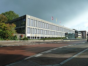
The Leeuwarder Courant is the oldest daily newspaper in the Netherlands. Founded by Abraham Ferwerda, it first appeared in 1752. The Leeuwarder Courant was the first paper in the Dutch province Friesland and its capital Leeuwarden.

Cambuur Stadion
Distance: Approx. 586 meters
Latitude and longitude: 53.20527778,5.81472222
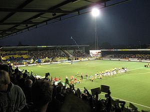
The Cambuur Stadion (Dutch pronunciation: [ˈkɑmbyːr ˌstaːdijɔn]) is a football stadium in the east side of the city of Leeuwarden, Netherlands. It was used for the home matches of SC Cambuur. The stadium is able to hold 10,500 people and it opened on 12 September 1936.

NHL Stenden University of Applied Sciences
University in The Netherlands
Distance: Approx. 1255 meters
Latitude and longitude: 53.2106,5.7975
NHL Stenden University of Applied Sciences (Dutch: NHL Stenden Hogeschool) is a state-funded vocational university in the north of the Netherlands. It was formed as a merger of NHL Hogeschool and Stenden Hogeschool in 2018. NHL Stenden University of Applied Sciences has more than 22,000 students from over 100 nationalities.

Stadhouderlijk Hof
Former residence of the Dutch royal family
Distance: Approx. 881 meters
Latitude and longitude: 53.2025,5.7955
Stadhouderlijk Hof in the city of Leeuwarden is a former residence of the Dutch royal family and was owned by them until 1971.

Tresoar
Museum, archive in Leeuwarden, Netherlands
Distance: Approx. 1242 meters
Latitude and longitude: 53.2035,5.790278
Tresoar (West Frisian for "treasure") is the short name for the Frysk Histoarysk en Letterkundich Sintrum ("Frisian History and Literature Center") in Leeuwarden. Tresoar manages digital archives about Friesland and its literature. There is a study room open to the public, and most catalogs are online and free to access.

Leeuwarden Achter de Hoven railway station
Railway station in Leeuwarden, Netherlands
Distance: Approx. 595 meters
Latitude and longitude: 53.19888889,5.81638889
Leeuwarden Achter de Hoven was a railway station serving eastern Leeuwarden, Netherlands. The station was first opened on 5 July 1915 but was closed between 19 May 1940 and 3 October 1954. It is located on the Harlingen–Nieuweschans railway between Leeuwarden and Groningen.

Fries Museum
Museum in Leeuwarden, Netherlands
Distance: Approx. 968 meters
Latitude and longitude: 53.1996,5.79444
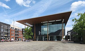
The Fries Museum (Frisian Museum) is a museum in Leeuwarden, Netherlands. It has won the Global Fine Art Award which is sometimes nicknamed the Museum-Oscar.

Huizum
Residential area in Friesland, Netherlands
Distance: Approx. 1141 meters
Latitude and longitude: 53.19138889,5.81138889
Huizum is a residential area of the municipality of Leeuwarden in the province of Friesland, Netherlands. It has approximately 9,000 inhabitants. Huizum was formerly part of Leeuwarderadeel and incorporates a former village.

Historisch Centrum Leeuwarden
Distance: Approx. 1177 meters
Latitude and longitude: 53.20386,5.7914
Historisch Centrum Leeuwarden (Historical Center Leeuwarden), located in Leeuwarden, Netherlands, preserves documents pertaining to the history of Leeuwarden.

Grote of Jacobijnerkerk
Distance: Approx. 801 meters
Latitude and longitude: 53.20417,5.797445
Grote of Jacobijnerkerk (transl. Great, or Jacobin Church) is a Protestant church in the city of Leeuwarden, Netherlands. The square surrounding the church is the Jacobijnerkerkhof.
Wetsus
Dutch water technology research centre
Distance: Approx. 661 meters
Latitude and longitude: 53.1963,5.8038
Wetsus - European Centre of Excellence for Sustainable Water Technology is a research centre for water technology in Leeuwarden, the Netherlands. Over one hundred companies and twenty knowledge institutes work together at Wetsus to develop solutions for global water issues.
Weather in this IP's area
clear sky
-1 Celsius
-3 Celsius
-1 Celsius
-1 Celsius
1019 hPa
95 %
1019 hPa
1019 hPa
10000 meters
2.01 m/s
2.23 m/s
277 degree
9 %