Country:
 Netherlands
Region:
City:
Latitude and Longitude:
Time Zone:
Postal Code:
IP information under different IP Channel
ip-api
Country
Region
City
ASN
Time Zone
ISP
Blacklist
Proxy
Latitude
Longitude
Postal
Route
IPinfo
Country
Region
City
ASN
Time Zone
ISP
Blacklist
Proxy
Latitude
Longitude
Postal
Route
MaxMind
Country
Region
City
ASN
Time Zone
ISP
Blacklist
Proxy
Latitude
Longitude
Postal
Route
Luminati
Country
NLRegion
nb
City
moergestel
ASN
Time Zone
Europe/Amsterdam
ISP
Qonnected B.V.
Latitude
Longitude
Postal
db-ip
Country
Region
City
ASN
Time Zone
ISP
Blacklist
Proxy
Latitude
Longitude
Postal
Route
ipdata
Country
Region
City
ASN
Time Zone
ISP
Blacklist
Proxy
Latitude
Longitude
Postal
Route
Popular places and events near this IP address

Oisterwijk
Municipality in North Brabant, Netherlands
Distance: Approx. 4755 meters
Latitude and longitude: 51.58333333,5.2
Oisterwijk (Dutch pronunciation: [ˈoːstərˌʋɛik] ) is a municipality and a city in the south of the Netherlands.

Berkel-Enschot
Town in North Brabant, Netherlands
Distance: Approx. 5514 meters
Latitude and longitude: 51.5825,5.14138889
Berkel-Enschot is a Dutch village, located in the municipality of Tilburg in the North Brabant province which borders Belgium.
De Koningshoeven Brewery
Dutch Trappist brewery
Distance: Approx. 4125 meters
Latitude and longitude: 51.54355,5.12661667
De Koningshoeven Brewery (Brouwerij de Koningshoeven) is a Dutch Trappist brewery founded in 1884 within the walls of Koningshoeven Abbey in Berkel-Enschot (near Tilburg).
Heukelom, North Brabant
Village in North Brabant, Netherlands
Distance: Approx. 4543 meters
Latitude and longitude: 51.57944444,5.16194444
Heukelom is a village in the Dutch province of North Brabant, next to Oisterwijk and Berkel-Enschot. Heukelom was home to 249 people in 1840. Heukelom used to be part of the municipality of Berkel-Enschot.

Brabantse Stedenrij
Megalopolis in Netherlands
Distance: Approx. 4847 meters
Latitude and longitude: 51.58333333,5.16666667
Brabantse Stedenrij (Dutch pronunciation: [ˈbraːbɑntsə ˌsteːdə(n)ˈrɛi]) is a term used in Dutch urban planning to designate the polycentric city region in the province of North Brabant, Netherlands. Its population is about 2 million. The main cities are 's-Hertogenbosch, Breda, Eindhoven, Helmond and Tilburg.

Moergestel
Village in North Brabant, Netherlands
Distance: Approx. 965 meters
Latitude and longitude: 51.55,5.18333333
Moergestel (Dutch pronunciation: [ˈmuːrˌɣɛstəl]) is a village in the Dutch province of North Brabant. It is located in the municipality of Oisterwijk, about 7 km East of Tilburg.
Heikant, Oisterwijk
Distance: Approx. 2552 meters
Latitude and longitude: 51.54916667,5.22083333
Heikant is a hamlet in the municipality of Oisterwijk, in the Dutch province of North Brabant. It is located about 4 km east of Moergestel.

Oisterwijk railway station
Railway station in the Netherlands
Distance: Approx. 4570 meters
Latitude and longitude: 51.58222222,5.19444444
Oisterwijk is a railway station located in the centre of Oisterwijk, Netherlands. The station was opened on 1 May 1865 and is located on the Breda–Eindhoven railway between Tilburg and Eindhoven. The train services are operated by Nederlandse Spoorwegen.
2005 European Cross Country Championships
International athletics championship event
Distance: Approx. 5541 meters
Latitude and longitude: 51.54888889,5.10694444
The 12th European Cross Country Championships were held at Tilburg in Netherlands on 11 December 2005. Serhiy Lebid won the men's competition for the sixth time and Lornah Kiplagat won the women's race.
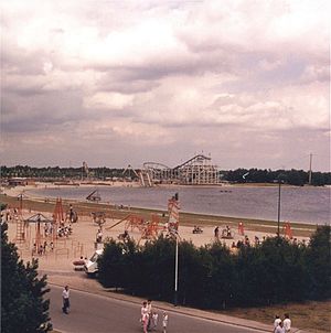
Speelland Beekse Bergen
Distance: Approx. 4528 meters
Latitude and longitude: 51.527,5.125
Speelland Beekse Bergen is an amusement park and playground near Hilvarenbeek, Netherlands. It is a part of the Beekse Bergen group, which also owns Safaripark Beekse Bergen. The park has been a part of Libéma Exploitatie since 1987.
De Swaen
Restaurant in Oisterwijk, Netherlands
Distance: Approx. 4472 meters
Latitude and longitude: 51.58106111,5.19735278
De Swaen is a defunct restaurant in Oisterwijk, Netherlands. The fine dining restaurant was awarded one or two Michelin stars each year in the period 1981–1998. In the period 1984-1991 it was awarded 2 Michelin stars.
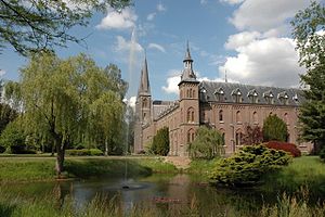
Koningshoeven Abbey
Monastery in North Brabant, Netherlands
Distance: Approx. 3910 meters
Latitude and longitude: 51.54361111,5.12972222
Koningshoeven Abbey (Dutch: Abdij Koningshoeven, Abdij Onze Lieve Vrouw van Koningshoeven) is a monastery of the Trappists (Order of the Cistercians of the Strict Observance) founded in 1881 in Berkel-Enschot in North Brabant, the Netherlands.
Weather in this IP's area
light rain
16 Celsius
16 Celsius
16 Celsius
17 Celsius
1015 hPa
85 %
1015 hPa
1014 hPa
10000 meters
5.14 m/s
200 degree
100 %
08:10:26
18:37:34