45.81.193.77 - IP Lookup: Free IP Address Lookup, Postal Code Lookup, IP Location Lookup, IP ASN, Public IP
Country:
Region:
City:
Location:
Time Zone:
Postal Code:
IP information under different IP Channel
ip-api
Country
Region
City
ASN
Time Zone
ISP
Blacklist
Proxy
Latitude
Longitude
Postal
Route
Luminati
Country
ASN
Time Zone
Europe/Paris
ISP
Quantic Telecom SAS
Latitude
Longitude
Postal
IPinfo
Country
Region
City
ASN
Time Zone
ISP
Blacklist
Proxy
Latitude
Longitude
Postal
Route
IP2Location
45.81.193.77Country
Region
centre-val de loire
City
saint-aignan
Time Zone
Europe/Paris
ISP
Language
User-Agent
Latitude
Longitude
Postal
db-ip
Country
Region
City
ASN
Time Zone
ISP
Blacklist
Proxy
Latitude
Longitude
Postal
Route
ipdata
Country
Region
City
ASN
Time Zone
ISP
Blacklist
Proxy
Latitude
Longitude
Postal
Route
Popular places and events near this IP address

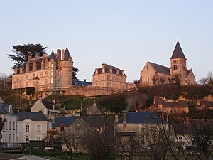
Saint-Aignan, Loir-et-Cher
Commune in Centre-Val de Loire, France
Distance: Approx. 72 meters
Latitude and longitude: 47.2694,1.3767
Saint-Aignan (French pronunciation: [sɛ̃.t‿ɛɲɑ̃]), also unofficially Saint-Aignan-sur-Cher (French pronunciation: [sɛ̃.t‿ɛɲɑ̃ syʁ ʃɛʁ], literally Saint-Aignan on Cher) is a commune and town in the Loir-et-Cher department in the administrative region of Centre-Val de Loire, France.

Lye, Indre
Commune in Centre-Val de Loire, France
Distance: Approx. 8678 meters
Latitude and longitude: 47.2286,1.4744
Lye (French pronunciation: [li]) is a commune in the Indre department in central France.

Châtillon-sur-Cher
Commune in Centre-Val de Loire, France
Distance: Approx. 9013 meters
Latitude and longitude: 47.2778,1.4947
Châtillon-sur-Cher (French pronunciation: [ʃatijɔ̃ syʁ ʃɛʁ]) is a commune in the Loir-et-Cher department in central France. It has a total area of 29.66 km sq (11.45 sq mi).
Couffy
Commune in Centre-Val de Loire, France
Distance: Approx. 5365 meters
Latitude and longitude: 47.2483,1.4403
Couffy (French pronunciation: [kufi], before 1998: Couffi) is a commune in the Loir-et-Cher department of central France.
Mareuil-sur-Cher
Commune in Centre-Val de Loire, France
Distance: Approx. 4434 meters
Latitude and longitude: 47.2933,1.3297
Mareuil-sur-Cher (French pronunciation: [maʁœj syʁ ʃɛʁ]) is a commune in the Loir-et-Cher department of central France.

Noyers-sur-Cher
Place in Centre-Val de Loire, France
Distance: Approx. 2083 meters
Latitude and longitude: 47.2775,1.4006
Noyers-sur-Cher (French pronunciation: [nwaje syʁ ʃɛʁ], literally Noyers on Cher) is a commune in the Loir-et-Cher department, central France.

Pouillé, Loir-et-Cher
Place in Centre-Val de Loire, France
Distance: Approx. 8621 meters
Latitude and longitude: 47.3189,1.2889
Pouillé (French pronunciation: [puje]) is a commune in the Loir-et-Cher department of central France.

Saint-Romain-sur-Cher
Commune in Centre-Val de Loire, France
Distance: Approx. 5929 meters
Latitude and longitude: 47.3197,1.3997
Saint-Romain-sur-Cher (French pronunciation: [sɛ̃ ʁomɛ̃ syʁ ʃɛʁ], literally Saint-Romain on Cher) is a commune in the Loir-et-Cher department of central France.

Seigy
Commune in Centre-Val de Loire, France
Distance: Approx. 2293 meters
Latitude and longitude: 47.2553,1.3989
Seigy (French pronunciation: [sɛʒi]) is a commune in the Loir-et-Cher department of central France.

Châteauvieux, Loir-et-Cher
Commune in Centre-Val de Loire, France
Distance: Approx. 4304 meters
Latitude and longitude: 47.2306,1.3839
Châteauvieux (French pronunciation: [ʃɑtovjø]) is a commune in the Loir-et-Cher department, central France.

Thésée, Loir-et-Cher
Commune in Centre-Val de Loire, France
Distance: Approx. 8425 meters
Latitude and longitude: 47.3269,1.3044
Thésée (French pronunciation: [teze] ) is a commune of the Loir-et-Cher department in central France.
Canton of Saint-Aignan
Distance: Approx. 477 meters
Latitude and longitude: 47.27,1.37
The canton of Saint-Aignan is an administrative division of the Loir-et-Cher department, central France. Its borders were modified at the French canton reorganisation which came into effect in March 2015. Its seat is in Saint-Aignan.
Weather in this IP's area
clear sky
2 Celsius
-2 Celsius
1 Celsius
3 Celsius
1030 hPa
92 %
1030 hPa
1020 hPa
10000 meters
3.46 m/s
8.79 m/s
220 degree
1 %