Country:
Region:
City:
Latitude and Longitude:
Time Zone:
Postal Code:
IP information under different IP Channel
ip-api
Country
Region
City
ASN
Time Zone
ISP
Blacklist
Proxy
Latitude
Longitude
Postal
Route
Luminati
Country
ASN
Time Zone
Europe/Paris
ISP
Luxnetwork S.A.
Latitude
Longitude
Postal
IPinfo
Country
Region
City
ASN
Time Zone
ISP
Blacklist
Proxy
Latitude
Longitude
Postal
Route
db-ip
Country
Region
City
ASN
Time Zone
ISP
Blacklist
Proxy
Latitude
Longitude
Postal
Route
ipdata
Country
Region
City
ASN
Time Zone
ISP
Blacklist
Proxy
Latitude
Longitude
Postal
Route
Popular places and events near this IP address

Dabo, Moselle
Commune in Grand Est, France
Distance: Approx. 282 meters
Latitude and longitude: 48.6542,7.2378
Dabo (German: Dagsburg) is a commune in the Moselle department in Grand Est in north-eastern France.

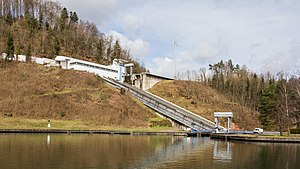
Saint-Louis-Arzviller inclined plane
Distance: Approx. 7222 meters
Latitude and longitude: 48.71583333,7.21833333
The Saint-Louis-Arzviller inclined plane is an inclined plane on the Marne-Rhine Canal (French: Canal de la Marne au Rhin) that enables the canal to cross the Vosges Mountains. It is located in the commune of Saint-Louis, between the towns of Saint-Louis and Arzviller in the département of the Moselle.
Reinhardsmunster
Commune in Grand Est, France
Distance: Approx. 6600 meters
Latitude and longitude: 48.6767,7.3175
Reinhardsmunster (German: Reinhardsmünster) is a commune in the Bas-Rhin department in Grand Est in north-eastern France.
Wangenbourg-Engenthal
Commune in Grand Est, France
Distance: Approx. 5313 meters
Latitude and longitude: 48.63,7.3
Wangenbourg-Engenthal (French pronunciation: [vaŋɡənbuʁ ɛŋɡəntal]; German: Wangenburg-Engenthal, Alsatian: Wàngeburi-Angedààl) is a commune in the Bas-Rhin department in Grand Est in north-eastern France. The commune was established in November 1974 from the former communes Engenthal and Wangenbourg.

Garrebourg
Commune in Grand Est, France
Distance: Approx. 6670 meters
Latitude and longitude: 48.7119,7.2339
Garrebourg (French pronunciation: [ɡaʁbuʁ]; German: Garburg) is a commune in the Moselle department in Grand Est, north-eastern France.

Harreberg
Commune in Grand Est, France
Distance: Approx. 5038 meters
Latitude and longitude: 48.6667,7.1711
Harreberg (French pronunciation: [aʁbɛʁ]; German: Haarberg) is a commune in the Moselle department in Grand Est in north-eastern France.

Haselbourg
Commune in Grand Est, France
Distance: Approx. 4394 meters
Latitude and longitude: 48.6861,7.2058
Haselbourg (German: Haselburg) is a commune in the Moselle department in Grand Est in north-eastern France.

Hommert
Commune in Grand Est, France
Distance: Approx. 5136 meters
Latitude and longitude: 48.6781,7.1783
Hommert (German: Hommert) is a commune in the Moselle department in Grand Est in north-eastern France.
Walscheid
Commune in Grand Est, France
Distance: Approx. 6265 meters
Latitude and longitude: 48.6547,7.1508
Walscheid (French pronunciation: [valʃaid]; Lorraine Franconian Wolscheid) is a commune in the Moselle department in Grand Est in north-eastern France.
Château de Wangenbourg
Ruined castle in Wangenbourg-Engenthal in the Bas-Rhin département of France
Distance: Approx. 6722 meters
Latitude and longitude: 48.62083333,7.31416667
The Château de Wangenbourg is a ruined castle in the commune of Wangenbourg-Engenthal in the Bas-Rhin département of France. In 1504, Holy Roman Emperor Maximilien I, having vanquished the Prince-elector, Philipp, in the war of succession of Bavaria, confiscated the castle from the Lords of Wangen, cousins Hans and Stephan von Wangen, for the favor to count Tiestein, who himself gave it to the Archbishop of Strasbourg, Wilhelm III von Hohnstein, in 1516. Nevertheless, a branch of descendants of the von Wangens, Georg and Hartmann, continued to occupy the castle.
Château du Freudeneck
Ruined medieval castle in Alsace, France
Distance: Approx. 7384 meters
Latitude and longitude: 48.62527778,7.32777778
The Château du Freudeneck is a ruined medieval castle situated in the commune of Wangenbourg-Engenthal in the Bas-Rhin département in Alsace, France.

Château d'Ochsenstein
Ruined castle in Bas-Rhin, France
Distance: Approx. 5816 meters
Latitude and longitude: 48.6828,7.2998
The Château d'Ochsenstein is a ruined castle located in the commune of Reinhardsmunster, in the Bas-Rhin département of France. It was home to the Ochsensteins, a powerful family from medieval Alsace. The castle sits upon three sandstone spurs and comprises three separate castles: le Grand Ochsenstein, le Petit Ochsenstein and a third building, thought to be called le Château de Wachelheim.
Weather in this IP's area
few clouds
5 Celsius
5 Celsius
4 Celsius
5 Celsius
1027 hPa
95 %
1027 hPa
967 hPa
10000 meters
0.6 m/s
0.63 m/s
239 degree
20 %
07:25:47
17:03:38


