Country:
Region:
City:
Latitude and Longitude:
Time Zone:
Postal Code:
IP information under different IP Channel
ip-api
Country
Region
City
ASN
Time Zone
ISP
Blacklist
Proxy
Latitude
Longitude
Postal
Route
Luminati
Country
Region
tx
City
dallas
ASN
Time Zone
America/Chicago
ISP
ROUTERHOSTING
Latitude
Longitude
Postal
IPinfo
Country
Region
City
ASN
Time Zone
ISP
Blacklist
Proxy
Latitude
Longitude
Postal
Route
db-ip
Country
Region
City
ASN
Time Zone
ISP
Blacklist
Proxy
Latitude
Longitude
Postal
Route
ipdata
Country
Region
City
ASN
Time Zone
ISP
Blacklist
Proxy
Latitude
Longitude
Postal
Route
Popular places and events near this IP address
Balch Springs, Texas
City in Texas, United States
Distance: Approx. 4955 meters
Latitude and longitude: 32.72,-96.62361111
Balch Springs ( BAHLK, BAHLTCH) is a city in Dallas County, Texas, United States. It is an inner-ring suburb of Dallas and part of the Dallas–Fort Worth metroplex. Its population was 23,728 at the 2010 census, and 25,007 at 2019's census estimates.
W. W. Samuell High School
Public, secondary school in Dallas, Texas, United States
Distance: Approx. 2863 meters
Latitude and longitude: 32.74611111,-96.66888889
W. W. Samuell High School and Early College is a public secondary school located in the Pleasant Grove area of Dallas, Texas, US. Samuell High enrolls students in grades 9–12 and is a part of the Dallas Independent School District. The school serves portions of southeast Dallas and a portion of the city of Balch Springs. In 2015, the school was rated "met standard" by the Texas Education Agency.
KEXB (AM)
Radio station in University Park, Texas
Distance: Approx. 5427 meters
Latitude and longitude: 32.75055556,-96.72277778
KEXB (1440 AM) is a radio station, licensed to University Park, Texas, and serving the Dallas/Fort Worth Metroplex. It is owned and operated by Relevant Radio, Inc., and carries a Catholic talk and teaching radio format. Most of the programming comes from the Wisconsin-based radio network known as "Relevant Radio." By day, KEXB transmits 50,000 watts, the maximum for AM radio stations licensed by the Federal Communications Commission, but at night, to protect other stations on 1440 AM, it reduces power to 350 watts.
H. Grady Spruce High School
Public, secondary school in Dallas, Texas, United States
Distance: Approx. 2494 meters
Latitude and longitude: 32.708698,-96.654401
H. Grady Spruce High School is a public school in the Spruce Square Development of Southeast Dallas in the state of Texas. H. Grady Spruce High School, which covers grades 9–12, is a part of the Dallas Independent School District. Spruce serves several sections of southeast Dallas, including Balch Springs.
Lake June station
DART light rail station in Dallas, Texas
Distance: Approx. 3329 meters
Latitude and longitude: 32.73245,-96.709431
Lake June station is an intermodal transit station in Dallas, Texas. It serves DART light rail's Green Line and bus routes for the Pleasant Grove neighborhood. The station opened on February 25, 2002 as Lake June Transit Center, a bus-only facility.
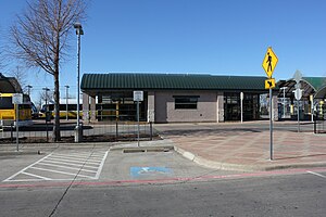
Buckner station
DART light rail station in Dallas, Texas
Distance: Approx. 798 meters
Latitude and longitude: 32.71846,-96.684369
Buckner station is a DART light rail station located in southeast Dallas, Texas for service on the Green Line. The station opened as part of the Green Line's expansion in December 2010. Buckner Station serves as the southern terminus of the Green Line.

Trinity River Audubon Center
Nature Center in Dallas, Texas
Distance: Approx. 3334 meters
Latitude and longitude: 32.7036,-96.7053
The Trinity River Audubon Center is a nature center in the Great Trinity Forest, a large urban open space park in Southeast Dallas, Texas.

Scyene, Dallas
Neighborhood in Texas, United States
Distance: Approx. 4758 meters
Latitude and longitude: 32.7635,-96.6838
Scyene ( sye-EEN) was a small town in East Central Dallas County, Texas, United States, 10 mi (16 km) east-southeast of downtown Dallas. It is now a neighborhood in east Dallas, just west of Mesquite. The town's location was bounded by South Sam Houston and Cheyenne roads on the east, Military Parkway on the north, North Prairie Creek (the creek, not the road) on the west, and Bruton Road on the south.
Cristo Rey Dallas College Prep
Catholic, college prep school in Dallas, Texas, United States
Distance: Approx. 2193 meters
Latitude and longitude: 32.73035,-96.65575833
Cristo Rey Dallas College Prep is a coeducational, Catholic, college preparatory school and a member of the Cristo Rey Network that follows the work-study model of education. The first criterion for admission is financial need, and the school is designed for students who cannot otherwise afford a college prep education.
Elam, Dallas
Distance: Approx. 768 meters
Latitude and longitude: 32.717,-96.683
Elam or Elam Station is a settlement in Southeast Dallas, Texas, United States, which was first settled in 1881 and acquired a post office April 9, 1884 with the name of Elam Station. On September 7, 1899, the name was changed to Elam. The Post Office continued to function until March 15, 1904, when mail was serviced by Rylie.
Balch Springs Christian Academy
Private school in Balch Springs, Texas, United States
Distance: Approx. 4883 meters
Latitude and longitude: 32.704598,-96.628249
Balch Springs Christian Academy (BSCA) is a private Christian school in Balch Springs, Texas, in the Dallas–Fort Worth area, serving grades K–12. It is a part of the Seagoville Road Baptist Church.
Trinity Forest Golf Club
Distance: Approx. 4530 meters
Latitude and longitude: 32.71,-96.723
Trinity Forest Golf Club is an 18-hole private golf club in the southern United States, located in Dallas, Texas. Southeast of downtown Dallas, the club was founded in 2014 and the course opened for play in autumn 2016. Built on a former landfill, the treeless links-style course was designed by Bill Coore and Ben Crenshaw and features diversely architectured holes over undulating terrain.
Weather in this IP's area
clear sky
17 Celsius
16 Celsius
16 Celsius
19 Celsius
1015 hPa
45 %
1015 hPa
998 hPa
10000 meters
3.09 m/s
130 degree
06:57:23
17:25:40

