45.5.248.69 - IP Lookup: Free IP Address Lookup, Postal Code Lookup, IP Location Lookup, IP ASN, Public IP
Country:
Region:
City:
Location:
Time Zone:
Postal Code:
IP information under different IP Channel
ip-api
Country
Region
City
ASN
Time Zone
ISP
Blacklist
Proxy
Latitude
Longitude
Postal
Route
Luminati
Country
Region
mg
City
contagem
ASN
Time Zone
America/Sao_Paulo
ISP
GM Telecom LTDA
Latitude
Longitude
Postal
IPinfo
Country
Region
City
ASN
Time Zone
ISP
Blacklist
Proxy
Latitude
Longitude
Postal
Route
IP2Location
45.5.248.69Country
Region
minas gerais
City
contagem
Time Zone
America/Sao_Paulo
ISP
Language
User-Agent
Latitude
Longitude
Postal
db-ip
Country
Region
City
ASN
Time Zone
ISP
Blacklist
Proxy
Latitude
Longitude
Postal
Route
ipdata
Country
Region
City
ASN
Time Zone
ISP
Blacklist
Proxy
Latitude
Longitude
Postal
Route
Popular places and events near this IP address

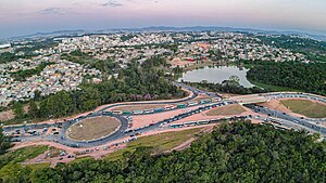
Contagem
Municipality in Southeast, Brazil
Distance: Approx. 41 meters
Latitude and longitude: -19.93194444,-44.05388889
Contagem (Portuguese pronunciation: [kõˈtaʒẽj]) is a city in the center of the state of Minas Gerais, in Brazil. It is only 21 kilometres (13 miles) from the capital, Belo Horizonte, and forms part of a metropolitan area with a population of 4.8 million.
Carlos Prates Airport
Airport in Brazil
Distance: Approx. 7195 meters
Latitude and longitude: -19.90916667,-43.98916667
Carlos Prates Airport (ICAO: SBPR) was one of the airports serving Belo Horizonte, Brazil. It was named after the neighborhood where it is located and this, in turn, was named after an Engineer that planned parts of Belo Horizonte. It was operated by Infraero.
Federal University of Minas Gerais Ecological Station
Distance: Approx. 9712 meters
Latitude and longitude: -19.887358,-43.97369
The Federal University of Minas Gerais Ecological Station (Portuguese: Estação Ecológica da Universidade Federal de Minas Gerais) is an ecological station in the state of Minas Gerais, Brazil.
Eldorado station
Belo Horizonte metro station
Distance: Approx. 2609 meters
Latitude and longitude: -19.93844444,-44.02972222
Eldorado is a Belo Horizonte Metro station on Line 1. It was opened on 1 August 1986 as the southern terminus of the inaugural section of the line, from Eldorado to Lagoinha. The adjacent station is Cidade Industrial.

Cidade Industrial station
Belo Horizonte metro station
Distance: Approx. 4181 meters
Latitude and longitude: -19.9455,-44.01644444
Cidade Industrial is a Belo Horizonte Metro station on Line 1. It was opened on 1 August 1986 as part of the inaugural section of the line, from Eldorado to Lagoinha. The station is located between Eldorado and Vila Oeste.

Vila Oeste station
Belo Horizonte metro station
Distance: Approx. 5352 meters
Latitude and longitude: -19.93866667,-44.003
Cidade Industrial is a Belo Horizonte Metro station on Line 1. It was opened on 30 July 1999, being added to already functioning section of the line from Eldorado to Minas Shopping. The station is located between Cidade Industrial and Gameleira.
Gameleira station
Belo Horizonte metro station
Distance: Approx. 6822 meters
Latitude and longitude: -19.92813889,-43.98852778
Gameleira is a Belo Horizonte Metro station on Line 1. It was opened on 1 August 1986 as part of the inaugural section of the line, from Eldorado to Lagoinha. The station is located between Vila Oeste and Calafate.

Calafate station
Belo Horizonte metro station
Distance: Approx. 8799 meters
Latitude and longitude: -19.92236111,-43.97011111
Calafate is a Belo Horizonte Metro station on Line 1. It was opened on 1 August 1986 as part of the inaugural section of the line, from Eldorado to Lagoinha. The station is located between Gameleira and Carlos Prates.

Arena MRV
Football stadium in the state of Minas Gerais, Brazil
Distance: Approx. 4103 meters
Latitude and longitude: -19.92986111,-44.01444444
Arena MRV is a football stadium located in the Brazilian city of Belo Horizonte. The arena belongs to Clube Atlético Mineiro, which hosts its home games there. With a capacity of 44,892, it is the second-largest football stadium in Belo Horizonte.
Weather in this IP's area
broken clouds
25 Celsius
25 Celsius
23 Celsius
25 Celsius
1013 hPa
70 %
1013 hPa
911 hPa
10000 meters
3.09 m/s
100 degree
75 %

