45.43.17.12 - IP Lookup: Free IP Address Lookup, Postal Code Lookup, IP Location Lookup, IP ASN, Public IP
Country:
Region:
City:
Location:
Time Zone:
Postal Code:
IP information under different IP Channel
ip-api
Country
Region
City
ASN
Time Zone
ISP
Blacklist
Proxy
Latitude
Longitude
Postal
Route
Luminati
Country
ASN
Time Zone
America/Chicago
ISP
RACKDOG-LLC
Latitude
Longitude
Postal
IPinfo
Country
Region
City
ASN
Time Zone
ISP
Blacklist
Proxy
Latitude
Longitude
Postal
Route
IP2Location
45.43.17.12Country
Region
new jersey
City
emerson
Time Zone
America/New_York
ISP
Language
User-Agent
Latitude
Longitude
Postal
db-ip
Country
Region
City
ASN
Time Zone
ISP
Blacklist
Proxy
Latitude
Longitude
Postal
Route
ipdata
Country
Region
City
ASN
Time Zone
ISP
Blacklist
Proxy
Latitude
Longitude
Postal
Route
Popular places and events near this IP address

Emerson, New Jersey
Borough in Bergen County, New Jersey, US
Distance: Approx. 569 meters
Latitude and longitude: 40.97499,-74.023248
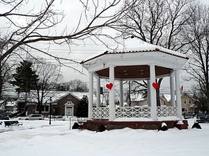
Emerson is a borough in Bergen County, in the U.S. state of New Jersey, a suburb in the New York City metropolitan area. Emerson is the most southern municipality in an area of the county known as the Pascack Valley. As of the 2020 United States census, the borough's population was 7,290, a decrease of 111 (−1.5%) from the 2010 census count of 7,401, which in turn reflected an increase of 204 (+2.8%) from the 7,197 counted in the 2000 census.
Westwood, New Jersey
Borough in Bergen County, New Jersey, US
Distance: Approx. 1614 meters
Latitude and longitude: 40.989032,-74.031872
Westwood (known as "The Hub of the Pascack Valley") is a borough in Bergen County, in the U.S. state of New Jersey. Westwood is part of the New York metropolitan area. Many of its residents regularly commute to New York City for work and leisure, many using public transportation.

Oradell, New Jersey
Borough in Bergen County, New Jersey, US
Distance: Approx. 2012 meters
Latitude and longitude: 40.956653,-74.032862
Oradell is a borough in Bergen County, in the U.S. state of New Jersey. As of the 2020 United States census, the borough's population was 8,244, an increase of 266 (+3.3%) from the 2010 census count of 7,978, which in turn reflected a decline of 69 (-0.9%) from the 8,047 counted in the 2000 census. The borough includes a dam on the Hackensack River that forms the Oradell Reservoir.

Oradell Reservoir
Reservoir in New Jersey on the Hackensack River
Distance: Approx. 2058 meters
Latitude and longitude: 40.956129,-74.029001
The Oradell Reservoir is a reservoir formed by the Oradell Dam on the Hackensack River in Bergen County, New Jersey, United States.
Emerson School District
School district in Bergen County, New Jersey, US
Distance: Approx. 33 meters
Latitude and longitude: 40.974835,-74.030247
The Emerson School District is a comprehensive community public school district that serves students in pre-kindergarten through twelfth grade from Emerson, in Bergen County, in the U.S. state of New Jersey As of the 2021–22 school year, the district, comprising three schools, had an enrollment of 1,085 students and 98.4 classroom teachers (on an FTE basis), for a student–teacher ratio of 11.0:1. The district is classified by the New Jersey Department of Education as being in District Factor Group "GH", the third-highest of eight groupings. District Factor Groups organize districts statewide to allow comparison by common socioeconomic characteristics of the local districts.

Emerson station (NJ Transit)
NJ Transit rail station
Distance: Approx. 234 meters
Latitude and longitude: 40.9751,-74.0273
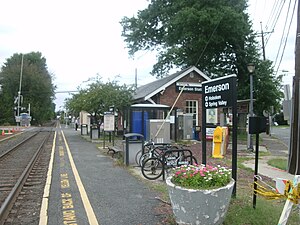
Emerson is an active commuter railroad station in the borough of Emerson, Bergen County, New Jersey. The station, serviced by trains of the Pascack Valley Line from Spring Valley in Rockland County, New York to Hoboken Terminal in Hudson County, New Jersey, is located at the intersection of Kinderkamack Road (County Route 503) and Linwood Avenue in Emerson. The next station to the north is Westwood while the next to the south is Oradell.

Westwood station (NJ Transit)
NJ Transit rail station
Distance: Approx. 1820 meters
Latitude and longitude: 40.9908,-74.0329
Westwood is an NJ Transit railroad station in Westwood, New Jersey. It is on the Pascack Valley Line and is located at Broadway and Westwood Avenue. The next station northbound, heading toward Spring Valley, New York, is Hillsdale.
Cedar Park Cemetery, New Jersey
Cemetery in Bergen County, New Jersey
Distance: Approx. 1842 meters
Latitude and longitude: 40.9714786,-74.0515276
Cedar Park and Beth El Cemetery is a cemetery located in Emerson and Paramus, in Bergen County, New Jersey, United States.
Emerson Junior-Senior High School
Place in Mercer County, New Jersey, US
Distance: Approx. 1171 meters
Latitude and longitude: 40.97403,-74.01609
Emerson Junior-Senior High School is a six-year public high school that serves students in seventh through twelfth grade from Emerson, in Bergen County, in the U.S. state of New Jersey, operating as the lone secondary school of the Emerson School District. The school has been accredited by the Middle States Association of Colleges and Schools Commission on Elementary and Secondary Schools since 1968. As of the 2023–24 school year, the school had an enrollment of 446 students and 46.1 classroom teachers (on an FTE basis), for a student–teacher ratio of 9.7:1.
Pascack Valley Hospital
Hospital in New Jersey, United States
Distance: Approx. 1711 meters
Latitude and longitude: 40.98520833,-74.01526389
Pascack Valley Hospital (PVH) is a former 291-bed hospital, located at 250 Old Hook Road, Westwood, New Jersey.

Pascack Valley Medical Center
Hospital in New Jersey, United States
Distance: Approx. 1711 meters
Latitude and longitude: 40.98520833,-74.01526389
Pascack Valley Medical Center formerly known as Hackensack University Medical Center at Pascack Valley is a full-service boutique hospital located in Westwood, New Jersey, at the site of the former Pascack Valley Hospital. Owned 35% by Hackensack University Medical Center (HackensackUMC) and 65% by Ardent Health Services, HackensackUMC at Pascack Valley serves the Pascack Valley and Northern Valley communities in northern Bergen County. In 2021 it was given a grade A by the Leapfrog patient safety organization.

Van Buskirk-Oakley House
Historic house in New Jersey, United States
Distance: Approx. 2034 meters
Latitude and longitude: 40.95638889,-74.03194444
Van Buskirk-Oakley House is located in Oradell, Bergen County, New Jersey, United States. The house was built in 1834 and was added to the National Register of Historic Places on July 3, 1979.
Weather in this IP's area
light rain
1 Celsius
-3 Celsius
0 Celsius
2 Celsius
998 hPa
70 %
998 hPa
990 hPa
10000 meters
4.63 m/s
310 degree
100 %
