Country:
Region:
City:
Latitude and Longitude:
Time Zone:
Postal Code:
IP information under different IP Channel
ip-api
Country
Region
City
ASN
Time Zone
ISP
Blacklist
Proxy
Latitude
Longitude
Postal
Route
Luminati
Country
ASN
Time Zone
Asia/Yangon
ISP
MYANMA POSTS AND TELECOMMUNICATIONS
Latitude
Longitude
Postal
IPinfo
Country
Region
City
ASN
Time Zone
ISP
Blacklist
Proxy
Latitude
Longitude
Postal
Route
db-ip
Country
Region
City
ASN
Time Zone
ISP
Blacklist
Proxy
Latitude
Longitude
Postal
Route
ipdata
Country
Region
City
ASN
Time Zone
ISP
Blacklist
Proxy
Latitude
Longitude
Postal
Route
Popular places and events near this IP address

Yangon
Largest city of Myanmar
Distance: Approx. 1220 meters
Latitude and longitude: 16.795,96.16
Yangon, formerly romanized as Rangoon, is the capital of the Yangon Region and the largest city of Myanmar. Yangon served as the capital of Myanmar until 2006, when the military government relocated the administrative functions to the purpose-built capital city of Naypyidaw in north central Myanmar. With over five million people, Yangon is Myanmar's most populous city and its most important commercial centre.
Rangoon bombing
1983 attempted killing of the South Korean president
Distance: Approx. 951 meters
Latitude and longitude: 16.802536,96.147658
The Rangoon bombing of 9 October 1983, was an assassination attempt against Chun Doo-hwan, the fifth president of South Korea, in Rangoon, Burma. The attempt was orchestrated by North Korea. Although Chun survived, 21 people died in the attack and 46 were injured.

Shwedagon Pagoda
Buddhist pagoda in Yangon, Myanmar
Distance: Approx. 1031 meters
Latitude and longitude: 16.798354,96.149705
The Shwedagon Pagoda (Burmese: ရွှေတိဂုံဘုရား; MLCTS: shwe ti. gon bhu. ra:, IPA: [ʃwèdəɡòʊɰ̃ pʰəjá]; Mon: ကျာ်ဒဂုၚ်), officially named Shwedagon Zedi Daw (Burmese: ရွှေတိဂုံစေတီတော်, [ʃwèdəɡòʊɰ̃ zèdìdɔ̀], lit. 'Golden Dagon Pagoda'), and also known as the Great Dagon Pagoda and the Golden Pagoda, is a gilded stupa located in Yangon, Myanmar.

International School Yangon
International school in Yangon, Myanmar, Yangon Region, Myanmar
Distance: Approx. 960 meters
Latitude and longitude: 16.8132094,96.152517
The International School Yangon (ISY; Burmese: အပြည်ပြည်ဆိုင်ရာကလေးများကျောင်း၊ ရန်ကုန်မြို့) is a private, co-educational day school, which offers an educational program from Pre-Kindergarten through Grade 12 for students of all nationalities who desire a U.S. education. The school was founded in 1955 and is widely considered to be the most prestigious secondary school in Myanmar due to its selectivity, academic rigor, breadth of on-campus facilities, and distinguished alumni. The school year typically begins the second week of August and ends the first week of June.
Singuttara Hill
Hill in Myanmar
Distance: Approx. 1051 meters
Latitude and longitude: 16.79833333,96.14944444
Siṅguttara Hill (Burmese: သိင်္ဂုတ္တရကုန်းတော် [θèɪɰ̃ɡoʊʔtəɹa̰ ɡóʊɰ̃dɔ̀]; also spelt "Theingottara Hill") is a small hill in Yangon, Myanmar (formerly Burma), crowned by the Shwedagon Pagoda, the most famous pagoda in the country.

Bogyoke Aung San Museum
House museum in Yangon, Myanmar
Distance: Approx. 794 meters
Latitude and longitude: 16.80383889,96.16338889
The Bogyoke Aung San Museum (Burmese: ဗိုလ်ချုပ် အောင်ဆန်း ပြတိုက်), located in Bahan, Yangon, is a museum dedicated to General Aung San, the founder of modern Myanmar (Burma). Established in 1962, the two-story museum was Aung San's last residence before his assassination in July 1947. It is a colonial-era villa, built in 1921, where his daughter Aung San Suu Kyi grew up as a child.

Bahan Township
Township of Yangon in Myanmar
Distance: Approx. 515 meters
Latitude and longitude: 16.80805556,96.15222222
Bahan Township (Burmese: ဗဟန်း မြို့နယ်, pronounced [bəháɰ̃ mjo̰nɛ̀]) is located in the north central part of Yangon. The township comprises 22 wards, and shares borders with Yankin Township and Mayangon Township in the north, Sanchaung Township and Kamayut Township in the west, Tamwe Township in the east, and Dagon Township and Mingala Taungnyunt Township in the south. Bahan is one of the most prosperous townships in Yangon.

Ngahtatgyi Buddha Temple
Buddhist temple in Bahan Township, Yangon
Distance: Approx. 775 meters
Latitude and longitude: 16.808389,96.162613
Ngahtatgyi Buddha Temple (Burmese: ငါးထပ်ကြီးဘုရားကြီး) is a Buddhist temple in Bahan Township, Yangon, Burma, located off Shwegondine Road. A distinct five-tiered pagoda houses the original 20.5 feet (6.2 m) high Buddha image was donated by Prince Minyedeippa in 1558. A Buddha statue, 45.5 feet (13.9 m) on a pedestal, 30 feet (9.1 m) high and 46 feet (14 m) wide was erected at the temple in 1900.
Singu Min Bell
Monument in Shwedagon Pagoda, Yangon, Myanmar (Burma)
Distance: Approx. 1051 meters
Latitude and longitude: 16.79833333,96.14944444
The Singu Min Bell (Burmese: စဉ့်ကူးမင်း ခေါင်းလောင်းတော်), also known as the Maha Gandha Bell, is a large bell located at the Shwedagon Pagoda in Yangon, Myanmar (Burma). It was donated in 1779 by King Singu, the fourth king of Konbaung Dynasty. The official Pali name of the bell is Maha Gandha, which means "Great Sound".
Tharrawaddy Min Bell
42-ton bronze bell
Distance: Approx. 1051 meters
Latitude and longitude: 16.79833333,96.14944444
The Tharrawaddy Min Bell (Burmese: သာယာဝတီမင်း ခေါင်းလောင်းတော်), also known as the Maha Tissada Gandha Bell, is a large bell located at the Shwedagon Pagoda in Yangon, Myanmar (Burma). It was donated in 1841 by King Tharrawaddy, of Konbaung Dynasty. The official Pali name of the bell is Maha Tissada Gandha, which means "Great Three-toned Sweet Sound".

Chaukhtatgyi Buddha Temple
Buddhist temple in Yangon, Myanmar
Distance: Approx. 1078 meters
Latitude and longitude: 16.811623,96.163764
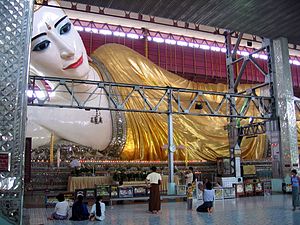
Chaukhtatgyi Buddha Temple (Burmese: ခြောက်ထပ်ကြီးဘုရားကြီး) is the most well-known Buddhist temple in Bahan Township, Yangon, Yangon Region, Myanmar. It houses one of the most revered reclining Buddha images in the country. The Buddha image is 66 metres (217 ft) long, and one of the largest in Burma.

Martyrs' Mausoleum
Mausoleum in Myanmar
Distance: Approx. 968 meters
Latitude and longitude: 16.8025,96.1475
The Martyrs' Mausoleum (Burmese: အာဇာနည်ဗိမာန်) is a Mausoleum in Yangon, Myanmar (Burma), located near the northern gate of Shwedagon Pagoda. The mausoleum is dedicated to Aung San and other leaders of the pre-independence interim government, all of whom were assassinated on 19 July 1947. It is customary for high-ranking government officials to visit the mausoleum on 19 July to pay respects, and 19 July was designated as Martyrs' Day, a public holiday.
Weather in this IP's area
scattered clouds
31 Celsius
36 Celsius
31 Celsius
31 Celsius
1010 hPa
66 %
1010 hPa
1007 hPa
8000 meters
2.57 m/s
350 degree
27 %
06:10:11
17:30:24

