45.4.82.96 - IP Lookup: Free IP Address Lookup, Postal Code Lookup, IP Location Lookup, IP ASN, Public IP
Country:
Region:
City:
Location:
Time Zone:
Postal Code:
ISP:
ASN:
language:
User-Agent:
Proxy IP:
Blacklist:
IP information under different IP Channel
ip-api
Country
Region
City
ASN
Time Zone
ISP
Blacklist
Proxy
Latitude
Longitude
Postal
Route
db-ip
Country
Region
City
ASN
Time Zone
ISP
Blacklist
Proxy
Latitude
Longitude
Postal
Route
IPinfo
Country
Region
City
ASN
Time Zone
ISP
Blacklist
Proxy
Latitude
Longitude
Postal
Route
IP2Location
45.4.82.96Country
Region
rio de janeiro
City
teresopolis
Time Zone
America/Sao_Paulo
ISP
Language
User-Agent
Latitude
Longitude
Postal
ipdata
Country
Region
City
ASN
Time Zone
ISP
Blacklist
Proxy
Latitude
Longitude
Postal
Route
Popular places and events near this IP address

Serra dos Órgãos National Park
National park in Brazil
Distance: Approx. 6326 meters
Latitude and longitude: -22.461,-42.997
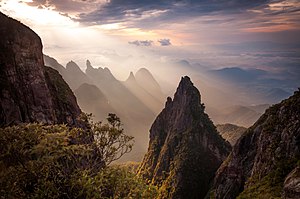
Serra dos Órgãos National Park (Portuguese: Parque Nacional da Serra dos Órgãos: "Organs Range") is a national park in the state of Rio de Janeiro, Brazil. It protects the Serra dos Órgãos mountain range and the water sources in the range. It was the third national park to be created in Brazil.

Granja Comary
Brazilian national football headquarters
Distance: Approx. 4235 meters
Latitude and longitude: -22.44888889,-42.97638889
Granja Comary football complex is the headquarters and main training center of the Brazil national football team, which is managed by the Brazilian Football Confederation. It is located in the Carlos Guinle neighborhood in the Brazilian city of Teresópolis, Rio de Janeiro, and occupies an area of 149,000 m2 (1,600,000 sq ft) with 8,500 m2 (91,000 sq ft) of built area. It was opened on 31 January 1987.
Morro dos Pinheiros
Distance: Approx. 631 meters
Latitude and longitude: -22.4175,-42.96333333
Morro dos Pinheiros is a neighborhood located in Teresópolis, Rio de Janeiro state, Brazil. In 2010 it had 2.114 inhabitants. The neighborhood is named after the Pine population located in the place.

Serra dos Órgãos
Mountain range in the state of Rio de Janeiro, Brazil
Distance: Approx. 8809 meters
Latitude and longitude: -22.463576,-43.030613
The Serra dos Órgãos ("Organ Range") is a mountain range in the state of Rio de Janeiro, Brazil. It contains the Serra dos Órgãos National Park.
Paraíso Ecological Station
Distance: Approx. 9927 meters
Latitude and longitude: -22.473402,-42.895322
The Paraíso Ecological Station (Portuguese: Paraíso Ecological Station Paraíso) was an ecological station in the state of Rio de Janeiro, Brazil. In 2013, it was absorbed into the Três Picos State Park.
Floresta do Jacarandá Environmental Protection Area
Distance: Approx. 4423 meters
Latitude and longitude: -22.424326,-42.924568
The Floresta do Jacarandá Environmental Protection Area (Portuguese: Área de Proteção Ambiental Floresta do Jacarandá) was an environmental protection area in the state of Rio de Janeiro, Brazil.
Weather in this IP's area
overcast clouds
19 Celsius
19 Celsius
19 Celsius
19 Celsius
1015 hPa
93 %
1015 hPa
928 hPa
10000 meters
1.27 m/s
1.03 m/s
332 degree
85 %