45.239.79.47 - IP Lookup: Free IP Address Lookup, Postal Code Lookup, IP Location Lookup, IP ASN, Public IP
Country:
Region:
City:
Location:
Time Zone:
Postal Code:
IP information under different IP Channel
ip-api
Country
Region
City
ASN
Time Zone
ISP
Blacklist
Proxy
Latitude
Longitude
Postal
Route
Luminati
Country
Region
coa
ASN
Time Zone
America/Monterrey
ISP
Tu Casa Inalambrica de Mexico
Latitude
Longitude
Postal
IPinfo
Country
Region
City
ASN
Time Zone
ISP
Blacklist
Proxy
Latitude
Longitude
Postal
Route
IP2Location
45.239.79.47Country
Region
coahuila de zaragoza
City
ramos arizpe
Time Zone
America/Monterrey
ISP
Language
User-Agent
Latitude
Longitude
Postal
db-ip
Country
Region
City
ASN
Time Zone
ISP
Blacklist
Proxy
Latitude
Longitude
Postal
Route
ipdata
Country
Region
City
ASN
Time Zone
ISP
Blacklist
Proxy
Latitude
Longitude
Postal
Route
Popular places and events near this IP address

Saltillo Airport
International airport serving Saltillo, Coahuila, Mexico
Distance: Approx. 3826 meters
Latitude and longitude: 25.54944444,-100.92861111
Saltillo International Airport (Spanish: Aeropuerto Internacional de Saltillo); officially Aeropuerto Internacional Plan de Guadalupe (Plan de Guadalupe International Airport) (IATA: SLW, ICAO: MMIO), is an international airport situated in Ramos Arizpe, Coahuila, Mexico. Serving the metropolitan area of Saltillo–Ramos Arizpe, the airport does not currently operate scheduled passenger public services. Passengers traveling to and from Saltillo commonly utilize Monterrey International Airport, located 85 kilometres (53 mi) northeast of Saltillo.

Ramos Arizpe
City in the Mexican state of Coahuila
Distance: Approx. 3 meters
Latitude and longitude: 25.55,-100.96666667
Ramos Arizpe (Spanish pronunciation: [ˈramos aˈɾispe]) is a city and seat of the surrounding municipality of the same name in the Mexican state of Coahuila. Ramos Arizpe is located 11 km from the state capital of Saltillo. It is part of the Saltillo metropolitan area.

Ramos Arizpe Municipality
Municipality in the Mexican state of Coahuila
Distance: Approx. 1933 meters
Latitude and longitude: 25.54055556,-100.95055556
Ramos Arizpe is one of the 38 municipalities of Coahuila, in north-eastern Mexico. The municipal seat lies at Ramos Arizpe. The municipality covers an area of 5306.6 km2.

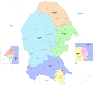
8th federal electoral district of Coahuila
Federal electoral district of Mexico
Distance: Approx. 2501 meters
Latitude and longitude: 25.53333333,-100.95
The 8th federal electoral district of Coahuila (Distrito electoral federal 08 de Coahuila) is one of the 300 electoral districts into which the territory of Mexico is divided and one of the eight that are located in the state of Coahuila. It elects one deputy to the Chamber of Deputies for each three-year legislative session by means of the first-past-the-post system. Votes cast in the district also count towards the calculation of proportional representation ("plurinominal") deputies elected from the second region.

USA Jet Airlines Flight 199
2008 aviation accident
Distance: Approx. 3905 meters
Latitude and longitude: 25.55916667,-100.92916667
USA Jet Airlines Flight 199 was a cargo flight from Shrevenport to Saltillo Airport. On July 6 2008 the McDonnell Douglas DC-9 operating the flight crashed on approach to its destination killing the captain, the first officer was seriously injured and taken to the hospital.
Weather in this IP's area
broken clouds
4 Celsius
1 Celsius
4 Celsius
4 Celsius
1023 hPa
81 %
1023 hPa
845 hPa
10000 meters
3.09 m/s
350 degree
75 %