45.232.98.81 - IP Lookup: Free IP Address Lookup, Postal Code Lookup, IP Location Lookup, IP ASN, Public IP
Country:
 Argentina
Region:
City:
Location:
Time Zone:
Postal Code:
ISP:
ASN:
language:
User-Agent:
Proxy IP:
Blacklist:
IP information under different IP Channel
ip-api
Country
Region
City
ASN
Time Zone
ISP
Blacklist
Proxy
Latitude
Longitude
Postal
Route
db-ip
Country
Region
City
ASN
Time Zone
ISP
Blacklist
Proxy
Latitude
Longitude
Postal
Route
IPinfo
Country
Region
City
ASN
Time Zone
ISP
Blacklist
Proxy
Latitude
Longitude
Postal
Route
IP2Location
45.232.98.81Country
arRegion
buenos aires
City
san nicolas de los arroyos
Time Zone
America/Argentina/Buenos_Aires
ISP
Language
User-Agent
Latitude
Longitude
Postal
ipdata
Country
Region
City
ASN
Time Zone
ISP
Blacklist
Proxy
Latitude
Longitude
Postal
Route
Popular places and events near this IP address
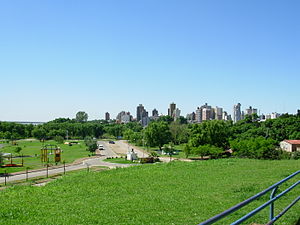
San Nicolás de los Arroyos
City and Port in Buenos Aires, Argentina
Distance: Approx. 861 meters
Latitude and longitude: -33.33333333,-60.21666667
San Nicolás de los Arroyos (usually shortened to San Nicolás) is a city in the province of Buenos Aires, Argentina, on the western shore of the Paraná River, 61 km (38 mi) from Rosario. It has about 133,000 inhabitants (2010 census [INDEC]). It is the administrative seat of the partido of the same name.

Arroyo del Medio
Distance: Approx. 6254 meters
Latitude and longitude: -33.30444444,-60.28111111
The Arroyo del Medio (Spanish, lit. "Middle Creek" or "Middle Stream") is a small river of Argentina, located on (and serving as) the border between the provinces of Buenos Aires and Santa Fe. Its catchment basin comprises about 3,200 square kilometres (1,200 sq mi).
Estadio Fortunato Bonelli
Indoor arena in San Nicolás de los Arroyos, Argentina
Distance: Approx. 434 meters
Latitude and longitude: -33.3379,-60.2214
The Estadio Fortunato Bonelli is an indoor arena in San Nicolás de los Arroyos, Argentina. It is primarily used for basketball and is the home arena of the Belgrano de San Nicolás. It holds 2,600 people.
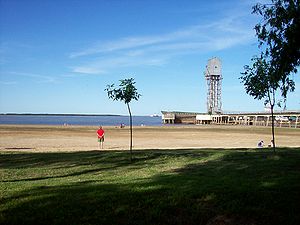
Port of San Nicolás de los Arroyos
Port in Paraná River, Argentina
Distance: Approx. 5502 meters
Latitude and longitude: -33.355,-60.17083333
The Port of San Nicolás de los Arroyos is a port on the western shore of the lower course of the Paraná River (343 km) in Argentina, located in the jurisdiction of the city of San Nicolás de los Arroyos, Buenos Aires Province. It has a depth of 34 feet, and is capable of serving large vessels coming upstream from the Atlantic Ocean through the Río de la Plata. The port is accessible by way of National Route 188.
Ramallo, Buenos Aires
Place in Buenos Aires, Argentina
Distance: Approx. 3188 meters
Latitude and longitude: -33.31666667,-60.2
Ramallo is a town in Buenos Aires Province, Argentina. It is the administrative centre for Ramallo Partido. It is located on the Río Paraná.
La Emilia
Place in Buenos Aires, Argentina
Distance: Approx. 8631 meters
Latitude and longitude: -33.35,-60.31666667
La Emilia is a small town in the San Nicolás Partido of Buenos Aires Province, Argentina.

Battle of San Nicolás
1811 naval engagement in the Argentine War of Independence
Distance: Approx. 8588 meters
Latitude and longitude: -33.36027778,-60.13777778
The Battle of San Nicolás was a naval engagement on 2 March 1811 on the Paraná River between the Spanish royalists from Montevideo, and the first flotilla created by the revolutionary government of Buenos Aires. It was the first engagement between the two fleets in the Río de la Plata region since the revolution, and a royalist victory.
Theobald, Argentina
Town in Santa Fe, Argentina
Distance: Approx. 8755 meters
Latitude and longitude: -33.31666667,-60.31666667
Theobald is a small town located in the province of Santa Fe, Argentina. It is located within the Constitución Department near the border between the provinces of Santa Fe and Buenos Aires. The town is home to 529 inhabitants as of 2010.
USS LST-970
1944 LST-542-class tank landing ship
Distance: Approx. 1676 meters
Latitude and longitude: -33.329885,-60.208885
USS LST-970 was an LST-542-class tank landing ship in the United States Navy. Like many of her class, she was not named and is properly referred to by her hull designation.
Autódromo San Nicolás
Distance: Approx. 7418 meters
Latitude and longitude: -33.4,-60.20361111
Autódromo San Nicolás, officially called the Autódromo Juan María Traverso is a 4.000 km (2.485 mi) motorsports circuit located in San Nicolás de los Arroyos, Argentina. The circuit was inaugurated on 7 October 2018. It has hosted national events, such as Turismo Carretera, TC2000 Championship and Turismo Nacional.

Estadio Único de San Nicolás
Football stadium in San Nicolás de los Arroyos, Argentina
Distance: Approx. 3735 meters
Latitude and longitude: -33.3439,-60.2644
Estadio Único de San Nicolás is a football stadium located in the city San Nicolás de los Arroyos in the homonymous partido of Buenos Aires Province, Argentina. Owned by the local Municipality and inaugurated in 2019, it is the main stadium in the region. The stadium is located on km 234 of National Route 9 (also known as the "Buenos Aires–Rosario Highway") and has a capacity of 25,000 spectators (sporting events) and 35,000 (other events).
Weather in this IP's area
overcast clouds
23 Celsius
23 Celsius
23 Celsius
23 Celsius
1012 hPa
86 %
1012 hPa
1009 hPa
10000 meters
3.4 m/s
5.23 m/s
114 degree
100 %