Country:
 Brazil
Region:
City:
Latitude and Longitude:
Time Zone:
Postal Code:
IP information under different IP Channel
ip-api
Country
Region
City
ASN
Time Zone
ISP
Blacklist
Proxy
Latitude
Longitude
Postal
Route
IPinfo
Country
Region
City
ASN
Time Zone
ISP
Blacklist
Proxy
Latitude
Longitude
Postal
Route
MaxMind
Country
Region
City
ASN
Time Zone
ISP
Blacklist
Proxy
Latitude
Longitude
Postal
Route
Luminati
Country
BRRegion
pe
City
jaboataodosguararapes
ASN
Time Zone
America/Recife
ISP
PE
Latitude
Longitude
Postal
db-ip
Country
Region
City
ASN
Time Zone
ISP
Blacklist
Proxy
Latitude
Longitude
Postal
Route
ipdata
Country
Region
City
ASN
Time Zone
ISP
Blacklist
Proxy
Latitude
Longitude
Postal
Route
Popular places and events near this IP address

Second Battle of Guararapes
Part of the Pernambucana Insurrection (1649)
Distance: Approx. 192 meters
Latitude and longitude: -8.11222222,-35.01555556
The Second Battle of Guararapes was the second and decisive battle in the Insurrection of Pernambuco between Dutch and Portuguese forces in February 1649 at Jaboatão dos Guararapes in Pernambuco. The defeat convinced the Dutch "that the Portuguese were formidable opponents, something which they had hitherto refused to concede." The Dutch still retained a presence in Brazil until 1654 and a treaty was signed in 1661.

Federal University of Pernambuco
Public university in Recife, Brazil
Distance: Approx. 9837 meters
Latitude and longitude: -8.05166667,-34.95083333
Federal University of Pernambuco (Portuguese: Universidade Federal de Pernambuco, UFPE) is a public university in Recife, Brazil, established in 1946. UFPE has 70 undergraduate courses and 175 postgraduate courses. As of 2007, UFPE had 35,000 students and 2,000 professors.
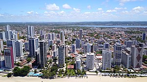
Jaboatão dos Guararapes
Municipality in Northeast, Brazil
Distance: Approx. 192 meters
Latitude and longitude: -8.11222222,-35.01555556
Jaboatão dos Guararapes (Portuguese pronunciation: [ʒabwaˈtɐ̃w duz ɡwaɾaˈɾapis]) is a city in the state of Pernambuco, Brazil. It is a part of the Recife metro area. The population was 706,867 according to the Brazilian Institute of Geography and Statistics (IBGE) in 2020, making it the second most-populous city in the state of Pernambuco and the 27th in Brazil, ahead of major Brazilian state capitals such as Cuiabá and Aracaju.

Moreno, Pernambuco
Distance: Approx. 8583 meters
Latitude and longitude: -8.11861111,-35.09222222
Moreno is a city in the state of Pernambuco, Brazil. It's integrated in the Recife metropolitan area with another 13 cities.

Arena Pernambuco
Stadium in São Lourenço da Mata, Brazil
Distance: Approx. 8160 meters
Latitude and longitude: -8.04055556,-35.00833333
Arena Pernambuco (Portuguese: Arena de Pernambuco), officially named Estádio Governador Carlos Wilson Campos, is a multi-use stadium with a capacity of 45,440 spectators located in the western suburbs of the Recife metropolitan area, in São Lourenço da Mata, Brazil. It is mostly used for football matches and was notably used to host some matches during the 2014 FIFA World Cup. In 2012 Clube Náutico Capibaribe, one of three professional football clubs in the Recife metro area, signed an agreement to become part owners of the new stadium.

Federal Institute of Pernambuco
Distance: Approx. 9837 meters
Latitude and longitude: -8.05166667,-34.95083333
The Pernambuco Federal Institute of Education, Science, and Technology (Portuguese: Instituto Federal de Educação, Ciência e Tecnologia de Pernambuco, IFPE) is a Brazilian institution of higher education located in Pernambuco State, Brazil. Its rectory is headquartered in Recife, Pernambuco. The IFPE is one of the oldest and most traditional among the Federal Institutes, it has 9 campuses and offers Technical, undergraduate and postgraduate courses, as well as researches and scientific production.
Weather in this IP's area
scattered clouds
26 Celsius
26 Celsius
26 Celsius
26 Celsius
1013 hPa
78 %
1013 hPa
1007 hPa
10000 meters
4.12 m/s
100 degree
40 %
05:03:07
17:14:36