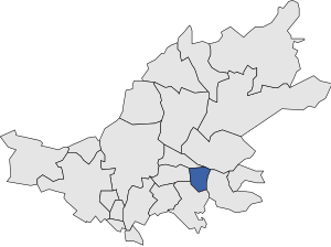
Country:
Region:
City:
Latitude and Longitude:
Time Zone:
Postal Code:
IP information under different IP Channel
ip-api
Country
Region
City
ASN
Time Zone
ISP
Blacklist
Proxy
Latitude
Longitude
Postal
Route
Luminati
Country
Region
ct
City
santjaumedelsdomenys
ASN
Time Zone
Europe/Madrid
ISP
Adamo Telecom Iberia S.A.
Latitude
Longitude
Postal
IPinfo
Country
Region
City
ASN
Time Zone
ISP
Blacklist
Proxy
Latitude
Longitude
Postal
Route
db-ip
Country
Region
City
ASN
Time Zone
ISP
Blacklist
Proxy
Latitude
Longitude
Postal
Route
ipdata
Country
Region
City
ASN
Time Zone
ISP
Blacklist
Proxy
Latitude
Longitude
Postal
Route
Popular places and events near this IP address
Valls
Municipality in Catalonia, Spain
Distance: Approx. 4906 meters
Latitude and longitude: 41.28833333,1.25194444
Valls (Catalan pronunciation: [baʎs]) is a city and municipality in the Camp de Tarragona region in Catalonia, Spain. It is the capital of the comarca of Alt Camp. In 2014, it had a population of 24,570.

Alt Camp
Comarca in Catalonia, Spain
Distance: Approx. 5144 meters
Latitude and longitude: 41.28333333,1.25
Alt Camp (Catalan pronunciation: [ˈal ˈkam]) is a comarca (county) located in the region of Camp de Tarragona, in Catalonia, Spain. The capital is the city of Valls.
Vilardida
Distance: Approx. 4804 meters
Latitude and longitude: 41.28333333,1.36666667
Vilardida is a village in the Alt Camp, Tarragona, Catalonia, Spain. Its latitude is 41.2833/41º16'60 N and its longitude is 1.36667/01º22'0 E. The population in 2003 is indicated by Municat as three and also as 27 people. This confusion is probably because the village falls under the jurisdiction of two municipalities: Vila-rodona and Montferri.

Santes Creus
Former Cistercian monastery in Catalonia, Spain
Distance: Approx. 7548 meters
Latitude and longitude: 41.34722222,1.36277778
The Monastery of Santa Maria de Santes Creus, (Catalan: Reial Monestir de Santa Maria de Santes Creus) is a former Cistercian monastery in the municipality of Aiguamúrcia, Catalonia, Spain. The abbey was erected in the 12th century, in today's municipality of Aiguamúrcia, in the village of Santes Creus, in the province of Tarragona (Catalonia). However, it was in the thirteenth century when Peter III of Aragon expressed his desire to be buried in the monastery and a royal crypt was built for himself and his son, King James II that many of the local nobility established the custom to choose this place for burial.

Alió
Municipality in Catalonia, Spain
Distance: Approx. 1245 meters
Latitude and longitude: 41.3,1.3
Alió (Catalan pronunciation: [əliˈo]) is a municipality in the comarca of Alt Camp, Tarragona, Catalonia, Spain.

Bràfim
Municipality in Catalonia, Spain
Distance: Approx. 3529 meters
Latitude and longitude: 41.271,1.342
Bràfim (Catalan pronunciation: [ˈbɾafim]) is a municipality in the comarca of Alt Camp, province of Tarragona, Catalonia, in north-eastern Spain. This town produces quite good table wine.

Vallmoll
Municipality in Catalonia, Spain
Distance: Approx. 8258 meters
Latitude and longitude: 41.23333333,1.25
Vallmoll (Catalan pronunciation: [ˌbaʎˈmɔʎ], lit. 'wet/soft valley') is a municipality in the comarca of Alt Camp, Tarragona, Catalonia, Spain. The village contains around 1250 inhabitants. It is located just off the N-240 road.

Vilabella
Municipality in Catalonia, Spain
Distance: Approx. 5054 meters
Latitude and longitude: 41.25,1.33333333
Vilabella (Catalan pronunciation: [ˌviləˈβeʎə]) is a municipality in the comarca of Alt Camp, Tarragona, Catalonia, Spain.
Salomó
Municipality in Catalonia, Spain
Distance: Approx. 8791 meters
Latitude and longitude: 41.22972222,1.375
Salomó (Catalan pronunciation: [səluˈmo]) is a municipality in the shire of Tarragonès, Catalonia, Spain. Well known for the "Ball del Sant Crist de Salomó" of Salomó, a medieval play declared a "National Traditional Festival of Interest" by the Government of Catalonia.

Gaià River
River in Spain
Distance: Approx. 8499 meters
Latitude and longitude: 41.22,1.34416667
The Gaià (Catalan pronunciation: [gəˈja]) is a 59 km long river in Tarragona Province, Catalonia.

Vilabella railway station
Railway station in Catalonia, Spain
Distance: Approx. 5878 meters
Latitude and longitude: 41.23946,1.31739
Vilabella is a railway station owned by ADIF located in the town of Vilabella in the Alt Camp region of Catalonia, Spain. The station is situated on the Barcelona–Vilanova–Valls railway and is served by trains of the R13 line of Rodalies de Catalunya regional services, operated by Renfe Operadora. This station on the Vilanova and Valls line entered service in 1883 when the section built by the Companyia dels Ferrocarrils de Valls a Vilanova i Barcelona (VVB) between Calafell and Valls was opened, one year after the opening of the line between Vilanova i la Geltrú and Calafell.

Valls railway station
Railway station in Valls, Spain
Distance: Approx. 4331 meters
Latitude and longitude: 41.28963,1.25872
Valls railway station is a railway station owned by Adif, located in the town of Valls, in the Alt Camp region. The station is on the Barcelona-Vilanova-Valls railway line and serves trains on the R13 line of Rodalies de Catalunya, operated by Renfe Operadora. In 2016, the station recorded 28,000 passenger entries.
Weather in this IP's area
broken clouds
13 Celsius
12 Celsius
11 Celsius
14 Celsius
1023 hPa
86 %
1023 hPa
993 hPa
10000 meters
0.66 m/s
1.49 m/s
160 degree
78 %
07:43:23
17:35:40

