Country:
Region:
City:
Latitude and Longitude:
Time Zone:
Postal Code:
IP information under different IP Channel
ip-api
Country
Region
City
ASN
Time Zone
ISP
Blacklist
Proxy
Latitude
Longitude
Postal
Route
Luminati
Country
Region
rj
City
mage
ASN
Time Zone
America/Sao_Paulo
ISP
Net Telecom MD Ltda-ME
Latitude
Longitude
Postal
IPinfo
Country
Region
City
ASN
Time Zone
ISP
Blacklist
Proxy
Latitude
Longitude
Postal
Route
db-ip
Country
Region
City
ASN
Time Zone
ISP
Blacklist
Proxy
Latitude
Longitude
Postal
Route
ipdata
Country
Region
City
ASN
Time Zone
ISP
Blacklist
Proxy
Latitude
Longitude
Postal
Route
Popular places and events near this IP address

Magé
Place in Southeast, Brazil
Distance: Approx. 693 meters
Latitude and longitude: -22.65277778,-43.04083333
Magé (Portuguese pronunciation: [maˈʒɛ]) is a municipality located in the Brazilian state of Rio de Janeiro. Magepe-Mirim (pronounced [maˈʒɛpi miˈɾĩ]) was established in 1566 by Portuguese colonists. It is considered to be a calm place, especially compared to nearby Rio.

Guapimirim Environmental Protection Area
Protected coastal marine area in Rio de Janeiro, Brazil
Distance: Approx. 8319 meters
Latitude and longitude: -22.72,-42.994
Guapimirim Environmental Protection Area (Portuguese: Área de Proteção Ambiental de Guapimirim) is a coastal marine protected area on Guanabara Bay in the state of Rio de Janeiro, southeastern Brazil.
Caceribu River
River in Brazil
Distance: Approx. 8638 meters
Latitude and longitude: -22.73333333,-43.01666667
The Caceribu River is a river of Rio de Janeiro state in southeastern Brazil.
Guaxindiba River
River in Brazil
Distance: Approx. 9487 meters
Latitude and longitude: -22.7432,-43.0265
The Guaxindiba River (Portuguese: Rio Guaxindiba) is a river of Rio de Janeiro state in southeastern Brazil. The Guaxindiba River flows through a flat region of mangroves in the 1,936 hectares (4,780 acres) Guanabara Ecological Station before discharging into the east of Guanabara Bay near the city of Rio de Janeiro.
Iriri River (Rio de Janeiro)
River of Rio de Janeiro state in southeastern Brazil
Distance: Approx. 5141 meters
Latitude and longitude: -22.68333333,-43.08333333
The Iriri River is a river of Rio de Janeiro state in southeastern Brazil.
Macacu River
River in Brazil
Distance: Approx. 3935 meters
Latitude and longitude: -22.693625,-43.033074
The Macacu River (Portuguese: Rio Macacu) is a river of Rio de Janeiro state in southeastern Brazil.
Magé River
River in Brazil
Distance: Approx. 4661 meters
Latitude and longitude: -22.7,-43.05
The Magé River is a river of Rio de Janeiro state in southeastern Brazil.
Suruí River
River in Brazil
Distance: Approx. 8216 meters
Latitude and longitude: -22.693387,-43.111574
The Suruí River (Portuguese: Rio Suruí) is a river of Rio de Janeiro state in southeastern Brazil.

Guanabara Ecological Station
Distance: Approx. 7189 meters
Latitude and longitude: -22.719049,-43.01504
The Guanabara Ecological Station (Portuguese: Estação Ecológica da Guanabara) is an ecological station in the state of Rio de Janeiro, Brazil. It protects an area of mangroves in Guanabara Bay, not far from the city of Rio de Janeiro.
Soberbo River
River in Brazil
Distance: Approx. 8937 meters
Latitude and longitude: -22.6591,-42.9538
Soberbo River (Portuguese: Rio Soberbo) is the river that cuts off the city of Guapimirim in the state of Rio de Janeiro. The Soberbo River originates in the Serra dos Órgãos and has several waterfalls throughout its course, flowing into the Macacu River. On rainy days on the top of the mountain range, the river will often fill up rapidly and cause the phenomenon known as "waterhead".
Weather in this IP's area
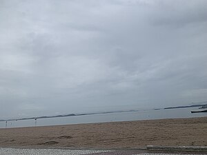
overcast clouds
32 Celsius
37 Celsius
29 Celsius
34 Celsius
1007 hPa
60 %
1007 hPa
1006 hPa
10000 meters
2.86 m/s
5.45 m/s
346 degree
100 %
05:03:48
18:07:58
