Country:
Region:
City:
Latitude and Longitude:
Time Zone:
Postal Code:
IP information under different IP Channel
ip-api
Country
Region
City
ASN
Time Zone
ISP
Blacklist
Proxy
Latitude
Longitude
Postal
Route
Luminati
Country
Region
f
City
kissidougou
ASN
Time Zone
Africa/Conakry
ISP
GUILAB-AS
Latitude
Longitude
Postal
IPinfo
Country
Region
City
ASN
Time Zone
ISP
Blacklist
Proxy
Latitude
Longitude
Postal
Route
db-ip
Country
Region
City
ASN
Time Zone
ISP
Blacklist
Proxy
Latitude
Longitude
Postal
Route
ipdata
Country
Region
City
ASN
Time Zone
ISP
Blacklist
Proxy
Latitude
Longitude
Postal
Route
Popular places and events near this IP address
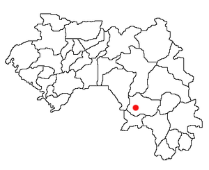
Kissidougou
Sub-prefecture and town in Faranah Region, Guinea
Distance: Approx. 446 meters
Latitude and longitude: 9.18333333,-10.1
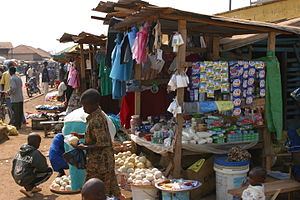
Kissidougou (N'Ko: ߞߛߌ߬ߘߎ߯; pronounced like Kiss-eh-dow-goo) is a city in southern Guinea. It is the capital of in the Kissidougou Prefecture. As of 2014 it had a population of 102,675 people.

Kissidougou Prefecture
Prefecture in Faranah Region, Guinea
Distance: Approx. 461 meters
Latitude and longitude: 9.18694444,-10.10694444
Kissidougou (N'Ko: ߞߛߌ߬ߘߎ߯ ߡߙߊ߬ߓߊ߰ߘߊ߮) is a prefecture located in the Faranah Region of Guinea. The capital is Kissidougou. The prefecture covers an area of 8,300 km² and has a population of 283,609.

Kissidougou Airport
Airport in Guinea
Distance: Approx. 3438 meters
Latitude and longitude: 9.16111111,-10.125
Kissidougou Airport (IATA: KSI, ICAO: GUKU) is an airport serving Kissidougou, a city in the Faranah Region of Guinea. The airport is 3 kilometres (1.9 mi) southwest of the city. The Kissidougou non-directional beacon (Ident: KU) is located on the field.
Beindou, Kissidougou
Sub-prefecture and town in Faranah Region, Guinea
Distance: Approx. 9561 meters
Latitude and longitude: 9.11666667,-10.05
Beindou is a town and sub-prefecture in the Kissidougou Prefecture in the Faranah Region of Guinea. As of 2014 it had a population of 14,679 people.
Fermessadou-Pombo
Sub-prefecture and town in Faranah Region, Guinea
Distance: Approx. 7574 meters
Latitude and longitude: 9.13333333,-10.15
Fermessadou-Pombo is a town and sub-prefecture in the Kissidougou Prefecture in the Faranah Region of Guinea. As of 2014 it had a population of 19,489 people.
Musée Préfectoral de Kissidougou
Distance: Approx. 823 meters
Latitude and longitude: 9.188,-10.0977
The Musée Préfectoral de Kissidougou is a regional museum in Kissidougou, Guinea. Created in 1971, it is noted for its collection of masks, which are believed to have magical powers. In a 2019 interview, the museum director discussed a major renovation of the museum.

Niandan
Distance: Approx. 3475 meters
Latitude and longitude: 9.176302,-10.073358
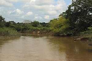
The Niandan river is a tributary of the Niger river.
Weather in this IP's area
scattered clouds
33 Celsius
33 Celsius
33 Celsius
33 Celsius
1008 hPa
33 %
1008 hPa
953 hPa
10000 meters
1.71 m/s
4.7 m/s
50 degree
46 %
06:34:29
18:16:17
