Country:
 Canada
Region:
City:
Latitude and Longitude:
Time Zone:
Postal Code:
IP information under different IP Channel
ip-api
Country
Region
City
ASN
Time Zone
ISP
Blacklist
Proxy
Latitude
Longitude
Postal
Route
IPinfo
Country
Region
City
ASN
Time Zone
ISP
Blacklist
Proxy
Latitude
Longitude
Postal
Route
MaxMind
Country
Region
City
ASN
Time Zone
ISP
Blacklist
Proxy
Latitude
Longitude
Postal
Route
Luminati
Country
CARegion
ns
City
dartmouth
ASN
Time Zone
America/Halifax
ISP
FRONTIER
Latitude
Longitude
Postal
db-ip
Country
Region
City
ASN
Time Zone
ISP
Blacklist
Proxy
Latitude
Longitude
Postal
Route
ipdata
Country
Region
City
ASN
Time Zone
ISP
Blacklist
Proxy
Latitude
Longitude
Postal
Route
Popular places and events near this IP address

Halifax Transit
Canadian public transport service
Distance: Approx. 1163 meters
Latitude and longitude: 44.69277778,-63.58455556
Halifax Transit is a Canadian public transport service operating buses and ferries in Halifax, Nova Scotia. Founded as Metro Transit in March 1981, the agency runs two ferry routes, 66 conventional bus routes (including corridor, local, and express services), three regional express routes (called MetroX), and three rural routes. Halifax Transit also operates Access-a-Bus, a door-to-door paratransit service for senior and disabled citizens.
Crichton Park, Nova Scotia
Neighbourhood in Halifax Regional Municipality, Nova Scotia, Canada
Distance: Approx. 855 meters
Latitude and longitude: 44.68111111,-63.56752778
Crichton Park is a residential neighbourhood in the Dartmouth area of the Halifax Regional Municipality, Nova Scotia. It is located in the north end of Dartmouth close to the MacDonald and MacKay bridges, Brightwood Golf and Country Club, Mic Mac Mall and Lake Banook. Crichton Park is home to Crichton Park Elementary school.
Highfield Park
Neighborhood in Halifax Regional Municipality, Nova Scotia, Canada
Distance: Approx. 963 meters
Latitude and longitude: 44.68741111,-63.58864722
Highfield Park is a neighbourhood located in the north end of the community of Dartmouth in Nova Scotia's Halifax Regional Municipality. Highfield Park is located in the larger neighbourhood of Albro Lake (also a part of the North End) and is situated on the former site of the Royal Canadian Navy's Naval Radio Station Albro Lake. Following the merger of Canada's military to form the unified Canadian Forces in 1968, Naval Radio Station Albro Lake was closed and the land surrounding the lake was opened for development during the 1970s and 1980s.
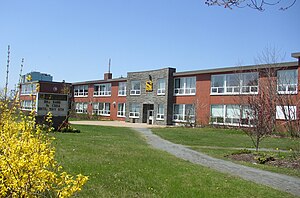
Dartmouth High School (Nova Scotia)
High school in Dartmouth, Nova Scotia, Canada
Distance: Approx. 1390 meters
Latitude and longitude: 44.671598,-63.572474
Dartmouth High School is a Canadian public high school located in the Brightwood neighbourhood of Dartmouth, Nova Scotia, Canada. Encompassing grades 9 through 12, Dartmouth High School has always had a diverse student body with many ethnic groups, along with a wide variety of courses and educational opportunities for students. Along with English, the school also offers the French immersion program.
Brightwood, Nova Scotia
Neighbourhood in Halifax Regional Municipality, Nova Scotia, Canada
Distance: Approx. 1028 meters
Latitude and longitude: 44.6752,-63.5721
Brightwood is a neighbourhood in Dartmouth, and part of District 5 of the Halifax Regional Municipality in Nova Scotia, Canada. Brightwood is located between Thistle Street and Woodland Avenue (Highway 118), and contains the Brightwood Golf Course. The primary streets of the small neighbourhood are Victoria Road (Route 322) and Slayter Street.
Albro Lake, Nova Scotia
Neighbourhood in Halifax Regional Municipality, Nova Scotia, Canada
Distance: Approx. 294 meters
Latitude and longitude: 44.68416667,-63.58138889
Albro Lake is a neighbourhood in the North End of the community of Dartmouth in Nova Scotia's Halifax Regional Municipality. The neighbourhood includes the Highfield Park and Crystal Heights. A newer development Lancaster Ridge is built on the former Department of National Defence housing lands.
Crystal Heights, Nova Scotia
Neighborhood in Halifax Regional Municipality, Nova Scotia, Canada
Distance: Approx. 545 meters
Latitude and longitude: 44.68721667,-63.582275
Crystal Heights is a neighborhood in the north end of the Dartmouth area in Nova Scotia's Halifax Regional Municipality. Part of the larger neighbourhood of Albro Lake, Crystal Heights is a development comprising high-density apartment buildings. It is adjacent to Highfield Park, a similar development dating to the 1970s.
Harbour View Elementary School
Elementary school
Distance: Approx. 970 meters
Latitude and longitude: 44.68141667,-63.58969444
Harbour View Elementary School, also called "Harbour View School", is a public school located in the Tufts Cove neighbourhood of north-end Dartmouth, serving about 380 children from pre-primary through to sixth grade. The school's preschool program, student services offices, and dental clinic are in the building. The principal is Fournier, Dan.

Dartmouth North Community Centre
Distance: Approx. 865 meters
Latitude and longitude: 44.68398056,-63.58871389
Dartmouth North Community Centre is a Community centre in Albro Lake a neighbourhood in the north end of the community of Dartmouth in Nova Scotia's Halifax Regional Municipality. Albro Lake is also known as District 9.

Albro Lake
Distance: Approx. 604 meters
Latitude and longitude: 44.68886111,-63.57663889
Albro Lake is a lake of Halifax Regional Municipality, in Nova Scotia, Canada in the community of Dartmouth. The lake lends its name to the surrounding Albro Lake neighbourhood of Dartmouth. There are several public parks along the shores of the lake, including the Albro Lake Beach and Albro Lake Park.
Little Albro Lake
Distance: Approx. 134 meters
Latitude and longitude: 44.68416667,-63.57638889
Little Albro Lake is a lake of Halifax Regional Municipality, Nova Scotia, Canada in the community of Dartmouth. Little Albro Lake has a plant named the yellow floating heart that is Invasive to the area.

Tufts Cove, Nova Scotia
Neighbourhood in Halifax Regional Municipality, Nova Scotia, Canada
Distance: Approx. 1519 meters
Latitude and longitude: 44.6822,-63.5969
Tufts Cove is an urban neighbourhood in the community of Dartmouth, Nova Scotia, Canada. It is situated on the eastern shore of Halifax Harbour in the North End of Dartmouth. The neighbourhood boundaries of Tufts Cove are approximately from Albro Lake Road in the south to Highway 111 in the north, and from Victoria Road in the east with the harbour to the west.
Weather in this IP's area
few clouds
15 Celsius
13 Celsius
13 Celsius
15 Celsius
1028 hPa
47 %
1028 hPa
1020 hPa
10000 meters
5.66 m/s
40 degree
20 %
07:33:53
18:24:31