45.184.95.4 - IP Lookup: Free IP Address Lookup, Postal Code Lookup, IP Location Lookup, IP ASN, Public IP
Country:
Region:
City:
Location:
Time Zone:
Postal Code:
IP information under different IP Channel
ip-api
Country
Region
City
ASN
Time Zone
ISP
Blacklist
Proxy
Latitude
Longitude
Postal
Route
Luminati
Country
Region
cr
City
riocomayagua
ASN
Time Zone
America/Tegucigalpa
ISP
INTESA S. DE R.L.
Latitude
Longitude
Postal
IPinfo
Country
Region
City
ASN
Time Zone
ISP
Blacklist
Proxy
Latitude
Longitude
Postal
Route
IP2Location
45.184.95.4Country
Region
comayagua
City
comayagua
Time Zone
America/Tegucigalpa
ISP
Language
User-Agent
Latitude
Longitude
Postal
db-ip
Country
Region
City
ASN
Time Zone
ISP
Blacklist
Proxy
Latitude
Longitude
Postal
Route
ipdata
Country
Region
City
ASN
Time Zone
ISP
Blacklist
Proxy
Latitude
Longitude
Postal
Route
Popular places and events near this IP address

Comayagua
Municipality in Comayagua Department, Honduras
Distance: Approx. 596 meters
Latitude and longitude: 14.45222222,-87.63833333
Comayagua (Spanish pronunciation: [komaˈʝaɣwa]) is a city, municipality and old capital of Honduras, located 80 km (50 mi) northwest of Tegucigalpa on the highway to San Pedro Sula and 594 m (1,949 ft) above sea level. The accelerated growth experienced by the city of Comayagua led the municipal authorities to structure a territorial reorganization plan. Between the years of 1945 -1975 the population of the city quadrupled due to the high rate of population growth achieved at that time (4.8%) and to migratory movements in the interior of the country.
Operation Golden Pheasant
1988 deployment of US troops in Honduras
Distance: Approx. 6591 meters
Latitude and longitude: 14.392,-87.621
Operation Golden Pheasant was an emergency deployment of U.S. troops to Honduras in 1988, in response to Nicaraguan attacks on Contra logistics in Honduras.

Comayagua Department
Department in Honduras
Distance: Approx. 4 meters
Latitude and longitude: 14.45,-87.63333333
Comayagua (Spanish pronunciation: [komaˈʝaɣwa]) is one of the 18 departments (departamentos) into which Honduras is divided. The departmental capital is Comayagua.
Soto Cano Air Base
Honduran military base
Distance: Approx. 7628 meters
Latitude and longitude: 14.3825,-87.62111111
Soto Cano Air Base is a Honduran military base 5 mi (8.0 km) to the south of Comayagua in Honduras. It houses 1,200–1,500 U.S. troops and is also used by the Honduran Air Force academy. The airbase became operational in 1940, changing the old location of the Honduras Air Force Academy in Toncontin, Tegucigalpa to Palmerola.
Estadio Carlos Miranda
Distance: Approx. 2568 meters
Latitude and longitude: 14.4538,-87.6568
Estadio Municipal Carlos Miranda is a multi-purpose stadium in Comayagua, Honduras. It is currently used mostly for football matches and is the home stadium of Hispano FC. The stadium holds 10,000 people.

Roman Catholic Diocese of Comayagua
Roman Catholic diocese in Honduras
Distance: Approx. 1406 meters
Latitude and longitude: 14.4602,-87.641
The Roman Catholic Diocese of Comayagua is a Latin suffragan bishopric in the ecclesiastical province of the Archdiocese of Tegucigalpa. The present diocese, erected 13 March 1963, revives a larger colonial bishopric. Its present cathedral episcopal see is the Catedral de la Inmaculada Concepción, devoted to the Immaculate Concepcion, in Comayagua, which city also has the former cathedral: Iglesia de La Merced Iglesia de La Merced, devoted to Our Lady of Mercy.
Comayagua prison fire
Deadly 2012 fire in Honduras
Distance: Approx. 1090 meters
Latitude and longitude: 14.44652778,-87.64275
A deadly fire occurred on 14–15 February 2012 at the National Penitentiary in Comayagua, Honduras, killing 361 people. Prisoners trapped in their cells died by burning or suffocation; dozens were burned beyond recognition. The fire started late in the evening of 14 February.

Immaculate Conception Cathedral, Comayagua
Church in Comayagua, Honduras
Distance: Approx. 2588 meters
Latitude and longitude: 14.4667,-87.65
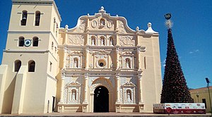
The Immaculate Conception Cathedral (Spanish: Catedral de la Inmaculada Concepción) also called Comayagua Cathedral It is dedicated to the Virgin Mary and is located in the Central Square of the city of Comayagua in Honduras, it is one of the oldest cathedrals in Central America, it went through construction phases that date from the 16th century until it was completed inaugurated on December 8, 1711, and blessed in 1715, and many modifications since the 18th century.

La Merced Church (Honduras)
Historic monument in Comayagua (Honduras)
Distance: Approx. 1065 meters
Latitude and longitude: 14.45738,-87.63958
The Merced church (Spanish: Iglesia de la Merced) is a Catholic church in Comayagua, Honduras built in 1550 during the colonial era of New Spain. It is the oldest church in Honduras, being built in 1550 by Fray Gaspar de Quintanilla with the name of Iglesia de la Inmaculada Concepción. It was also the first Honduran church to receive the cathedral designation in 1561 meaning that is the oldest church still in foot in Honduras, although it now functions as a parish.

Comayagua International Airport
Airport serving Tegucigalpa, Honduras
Distance: Approx. 7628 meters
Latitude and longitude: 14.3825,-87.62111111
Comayagua International Airport (IATA: XPL, ICAO: MHPR), also known as Palmerola International Airport, is an international airport located 6 km (4 mi) south of the centre of Comayagua, Honduras. The airport was inaugurated in October 2021 as the country's new international airport for civil and commercial use. It was built at the facilities of the Soto Cano Air Base.
Weather in this IP's area
broken clouds
29 Celsius
29 Celsius
29 Celsius
29 Celsius
1017 hPa
50 %
1017 hPa
892 hPa
10000 meters
1.59 m/s
1.86 m/s
63 degree
77 %
