45.179.40.83 - IP Lookup: Free IP Address Lookup, Postal Code Lookup, IP Location Lookup, IP ASN, Public IP
Country:
Region:
City:
Location:
Time Zone:
Postal Code:
IP information under different IP Channel
ip-api
Country
Region
City
ASN
Time Zone
ISP
Blacklist
Proxy
Latitude
Longitude
Postal
Route
Luminati
Country
Region
rs
City
sapiranga
ASN
Time Zone
America/Sao_Paulo
ISP
Fonseca Telecomunicacoes ME
Latitude
Longitude
Postal
IPinfo
Country
Region
City
ASN
Time Zone
ISP
Blacklist
Proxy
Latitude
Longitude
Postal
Route
IP2Location
45.179.40.83Country
Region
rio grande do sul
City
sapiranga
Time Zone
America/Sao_Paulo
ISP
Language
User-Agent
Latitude
Longitude
Postal
db-ip
Country
Region
City
ASN
Time Zone
ISP
Blacklist
Proxy
Latitude
Longitude
Postal
Route
ipdata
Country
Region
City
ASN
Time Zone
ISP
Blacklist
Proxy
Latitude
Longitude
Postal
Route
Popular places and events near this IP address

Campo Bom
City in Rio Grande do Sul, Brazil
Distance: Approx. 6342 meters
Latitude and longitude: -29.67888889,-51.05277778
Campo Bom is a town located in the valley of the Sinos River, in the State of Rio Grande do Sul, Brazil. It belongs to the Greater Porto Alegre area. The city is known as "The little giant of the valley", and it has a diversified industrial economy, including automotive, metallurgical, chemical, pottery and glass industries.
Estádio Sady Arnildo Schmidt
Distance: Approx. 6609 meters
Latitude and longitude: -29.682,-51.053
Estádio Sady Arnildo Schmidt is a multi-use stadium located in Campo Bom, Brazil. It is used mostly for football matches and hosts the home matches of Clube 15 de Novembro. The stadium has a maximum capacity of 3,500 people.

Araricá
Municipality in Rio Grande do Sul, Brazil
Distance: Approx. 8032 meters
Latitude and longitude: -29.615998,-50.927989
Araricá (Portuguese: [a.ɾa.ɾiˈka] ) is a municipality in Rio Grande do Sul, Brazil. The town was incorporated from Sapiranga in 1996.
Dois Irmãos
Municipality in Rio Grande do Sul, Brazil
Distance: Approx. 9941 meters
Latitude and longitude: -29.58,-51.085
Dois Irmãos is a municipality in the state of Rio Grande do Sul, Brazil. Its original German name was Baumschneis.

Sapiranga
City in Brazil
Distance: Approx. 860 meters
Latitude and longitude: -29.63333333,-51
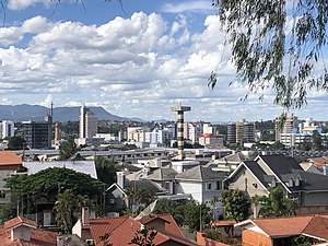
Sapiranga is a city in Brazil in the state of Rio Grande do Sul with a population of roughly 80,000 inhabitants. It is located in an industrial area called "Vale dos Sinos", by the Rio dos Sinos (River of the Bells). The town's economy relies heavily on the shoe industry.
Weather in this IP's area
clear sky
30 Celsius
34 Celsius
29 Celsius
31 Celsius
1009 hPa
64 %
1009 hPa
986 hPa
10000 meters
3.33 m/s
2.06 m/s
156 degree
9 %
