Country:
 Chile
ChileRegion:
City:
Latitude and Longitude:
Time Zone:
Postal Code:
IP information under different IP Channel
ip-api
Country
Region
City
ASN
Time Zone
ISP
Blacklist
Proxy
Latitude
Longitude
Postal
Route
IPinfo
Country
Region
City
ASN
Time Zone
ISP
Blacklist
Proxy
Latitude
Longitude
Postal
Route
MaxMind
Country
Region
City
ASN
Time Zone
ISP
Blacklist
Proxy
Latitude
Longitude
Postal
Route
Luminati
Country
CLRegion
rm
City
paine
ASN
Time Zone
America/Santiago
ISP
Comercial Netxtreme LTDA
Latitude
Longitude
Postal
db-ip
Country
Region
City
ASN
Time Zone
ISP
Blacklist
Proxy
Latitude
Longitude
Postal
Route
ipdata
Country
Region
City
ASN
Time Zone
ISP
Blacklist
Proxy
Latitude
Longitude
Postal
Route
Popular places and events near this IP address

Maipo Province
Province in Santiago Metropolitan, Chile
Distance: Approx. 7978 meters
Latitude and longitude: -33.75,-70.76666667
Maipo Province (Spanish: Provincia de Maipo) is one of six provinces in the Santiago Metropolitan Region of central Chile. Its capital is San Bernardo.
Buin, Chile
City and Commune in Santiago, Chile
Distance: Approx. 9709 meters
Latitude and longitude: -33.73333333,-70.73333333
Buin is a city and commune of Chile, in the Maipo Province, Metropolitan Region of Santiago, which forms part of Greater Santiago. It is a city composed of the towns of Maipo, Viluco, Linderos, Valdivia de Paine, Alto Jahuel, Los Guindos and El Recurso. Buin is located about 35 km (22 mi) south of Santiago in the Maipo Valley wine region.

Paine, Chile
City and Commune in Santiago, Metropolitan Region, Chile
Distance: Approx. 440 meters
Latitude and longitude: -33.81666667,-70.75
Paine (in mapudungún: Payne ‘celestal’)is a Chilean city, forming part of Greater Santiago, and a commune in the Maipo Province, Santiago Metropolitan Region.
Mansel Airport
Airport
Distance: Approx. 5292 meters
Latitude and longitude: -33.86305556,-70.77083333
Mansel Airport (Spanish: Aeropuerto de Paine Mansel, (ICAO: SCMN) is a former airport 6 kilometres (4 mi) south-southwest of Paine, a city in the Santiago Metropolitan Region of Chile. Google Earth Historical Imagery (2/28/2010) shows the airport was converted to agricultural use after 2010. The "SCMN" ICAO code has been reassigned to Mónaco Airport.
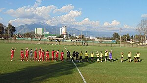
Estadio Lautaro
Distance: Approx. 9233 meters
Latitude and longitude: -33.73722222,-70.73777778
Estadio Lautaro is a stadium in Buin, Santiago Metropolitan Region. It is currently used mostly for football matches and is the home stadium of Lautaro de Buin. The stadium holds 3,700 people.
Weather in this IP's area
overcast clouds
18 Celsius
17 Celsius
16 Celsius
18 Celsius
1016 hPa
41 %
1016 hPa
970 hPa
10000 meters
0.49 m/s
0.45 m/s
313 degree
100 %
07:34:34
19:38:01