Country:
Region:
City:
Latitude and Longitude:
Time Zone:
Postal Code:
IP information under different IP Channel
ip-api
Country
Region
City
ASN
Time Zone
ISP
Blacklist
Proxy
Latitude
Longitude
Postal
Route
Luminati
Country
Region
cmx
City
mexicocity
ASN
Time Zone
America/Mexico_City
ISP
Bicentel SA de CV
Latitude
Longitude
Postal
IPinfo
Country
Region
City
ASN
Time Zone
ISP
Blacklist
Proxy
Latitude
Longitude
Postal
Route
db-ip
Country
Region
City
ASN
Time Zone
ISP
Blacklist
Proxy
Latitude
Longitude
Postal
Route
ipdata
Country
Region
City
ASN
Time Zone
ISP
Blacklist
Proxy
Latitude
Longitude
Postal
Route
Popular places and events near this IP address

Buenavista metro station
Mexico City metro station
Distance: Approx. 527 meters
Latitude and longitude: 19.446603,-99.153199
Buenavista is a station on the Mexico City Metro, in the Colonia Buenavista neighborhood of the Cuauhtémoc borough. It is the southwestern terminal station of Line B (the green-on-silver line, Buenavista-Ciudad Azteca). It also offers connections to the Insurgentes Metrobús bus rapid transit line.

San Cosme metro station
Mexico City metro station
Distance: Approx. 1003 meters
Latitude and longitude: 19.441706,-99.161096
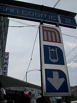
San Cosme is a station on Line 2 of the Mexico City Metro system. It is located in the Cuauhtémoc municipality of Mexico City, northwest of the city centre, on Avenue Ribera de San Cosme a few blocks before it becomes Calzada México-Tacuba. The southern exit leads to Colonia San Rafael while the Northern one leads to Colonia Santa María la Ribera.

Biblioteca Vasconcelos
Library in Mexico City
Distance: Approx. 686 meters
Latitude and longitude: 19.4475,-99.15083333
Biblioteca Vasconcelos, also known as the Megabiblioteca by the press, is a library in the Buenavista neighborhood of Mexico City. It is dedicated to José Vasconcelos, the philosopher and former president of the National Library of Mexico. The library is spread across 38,000 square metres (409,000 sq ft), and had an initial planned cost of 954 million pesos (roughly US$98 million).
Colonia Santa María la Ribera
Neighborhood of Mexico City in Cuauhtémoc
Distance: Approx. 63 meters
Latitude and longitude: 19.44935556,-99.157275
Colonia Santa María la Ribera is a colonia located in the Cuauhtémoc borough of Mexico City, just west of the historic center. It was created in the late 19th century for the affluent who wanted homes outside of the city limits. The colonia reached its height between 1910 and 1930.

Buenavista railway station
Commuter rail terminus in Mexico City
Distance: Approx. 541 meters
Latitude and longitude: 19.4478,-99.1522
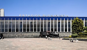
Buenavista is a commuter railway station in Mexico City. The station provided intercity train services from Ferrocarriles Nacionales de México. Since June 2008, the station serves as the terminus of the Tren Suburbano commuter rail service.

Torre Insignia
Mexico City skyscraper
Distance: Approx. 805 meters
Latitude and longitude: 19.4545369,-99.1511089
Torre Insignia (also called Torre Banobras and the Nonoalco Tlatelolco Tower) is a building designed by Mario Pani Darqui located on the corner of Avenida Ricardo Flores Magón and Avenida de los Insurgentes Norte, in the Tlatelolco housing complex in Cuauhtémoc in Mexico City. At its completion in 1962, the tower became the second tallest building in Mexico after the Torre Latinoamericana. The tower is not currently in use and is being renovated.
Colonia Atlampa
Neighborhood of Mexico City in Cuauhtémoc
Distance: Approx. 886 meters
Latitude and longitude: 19.457325,-99.15414444
Colonia Atlampa is a colonia or neighborhood located in the Cuauhtémoc borough, northwest of the historic center of Mexico City. The boundaries of the area are marked by the following streets: Calzada de Nonoalco or Ricardo Flores Magón Street to the south, Circuito Interior Paseo de las Jacarandas to the north, Avenida Insurgentes Norte to the east and Circuito Interior Instituto Politécnico Industrial to the west. The neighborhood is considered lower class and working class.

Colonia Buenavista
Neighbourhood of Mexico City in Cuauhtémoc
Distance: Approx. 549 meters
Latitude and longitude: 19.44797778,-99.15204167
Colonia Buenavista is a colonia or neighbourhood in the Cuauhtémoc borough located northwest of the historic center of Mexico City. What would become the city's main train terminal, Buenavista Station, stood here 1873–1958, and a new Buenavista Station opened in its place in 1961. Though there is no longer intercity passenger service to or from Mexico City, the station is still the terminus of the Tren Suburbano commuter rail line, in a complex together with a major shopping mall, the Forum Buenavista.

Museo Universitario del Chopo
Museum in Mexico City, Mexico
Distance: Approx. 880 meters
Latitude and longitude: 19.4419,-99.1567
The Museo Universitario del Chopo (meaning, "poplar"; locally nicknamed Crystal Palace or simply El Chopo, in Spanish) (Chopo University Museum) is located at Doctor Enrique González Martínez Street in the Colonia Santa María la Ribera of Mexico City. It has collections in contemporary art, and is part of the National Autonomous University of Mexico (UNAM).

Morisco Kiosk
Distance: Approx. 15 meters
Latitude and longitude: 19.44966667,-99.15686111
The Morisco Kiosk (Local: Kiosco Morisco, English: Moorish Kiosk) is a kiosk structure in Colonia Santa María la Ribera in Mexico City, Mexico. It is situated in the Alameda Park in the center of the Colonia neighborhood, at the intersection of Dr. Atl and Salvador Miron Streets, near Metro Buenavista.

Buenavista railway station (1873)
Former railway station in Mexico City, Mexico
Distance: Approx. 541 meters
Latitude and longitude: 19.4478,-99.1522
Buenavista Station (Spanish: Estación Buenavista), also called Buenavista Terminal (Spanish: Terminal Buenavista), was a passenger train station in Mexico City. The station opened in 1873 and since 1909, the station was fully operated by Ferrocarriles Nacionales de México. The station was closed in 2005.

Taquería El Califa de León
Mexican restaurant in Mexico City
Distance: Approx. 996 meters
Latitude and longitude: 19.44111111,-99.15916667
Taquería El Califa de León is a taqueria in Colonia San Rafael, Cuauhtémoc, Mexico City. It was founded in 1968 by Juan Hernández González. Its menu is limited to a small variety of beef tacos made with hand-made tortillas.
Weather in this IP's area
overcast clouds
21 Celsius
20 Celsius
21 Celsius
21 Celsius
1013 hPa
42 %
1013 hPa
786 hPa
10000 meters
5.81 m/s
350 degree
95 %
06:44:31
17:58:00

