45.164.255.214 - IP Lookup: Free IP Address Lookup, Postal Code Lookup, IP Location Lookup, IP ASN, Public IP
Country:
Region:
City:
Location:
Time Zone:
Postal Code:
IP information under different IP Channel
ip-api
Country
Region
City
ASN
Time Zone
ISP
Blacklist
Proxy
Latitude
Longitude
Postal
Route
Luminati
Country
Region
pi
City
parnaiba
ASN
Time Zone
America/Fortaleza
ISP
tomaz da luz de castro filho
Latitude
Longitude
Postal
IPinfo
Country
Region
City
ASN
Time Zone
ISP
Blacklist
Proxy
Latitude
Longitude
Postal
Route
IP2Location
45.164.255.214Country
Region
maranhao
City
araioses
Time Zone
America/Fortaleza
ISP
Language
User-Agent
Latitude
Longitude
Postal
db-ip
Country
Region
City
ASN
Time Zone
ISP
Blacklist
Proxy
Latitude
Longitude
Postal
Route
ipdata
Country
Region
City
ASN
Time Zone
ISP
Blacklist
Proxy
Latitude
Longitude
Postal
Route
Popular places and events near this IP address

Ilha Grande, Piauí
Place in Northeast, Brazil
Distance: Approx. 9825 meters
Latitude and longitude: -2.85777778,-41.82083333
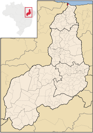
Ilha Grande is one of the four coastal cities of Piauí, Brazil. It is also the northernmost city of the state. The municipality contains part of the 313,800 hectares (775,000 acres) Delta do Parnaíba Environmental Protection Area, created in 1996.

Araioses
Municipality in Northeast, Brazil
Distance: Approx. 36 meters
Latitude and longitude: -2.89,-41.90277778
Araioses is the easternmost city in the Brazilian state of Maranhão. It lies near the Parnaíba River's delta, and its territory also include the Canárias, Desgraça, Coroatá and Grande de Paulino islands, apart from several smaller islands.
Magu River
River in Brazil
Distance: Approx. 5054 meters
Latitude and longitude: -2.93333333,-41.91666667
The Magu River is a river of Maranhão state in northeastern Brazil.
Weather in this IP's area
scattered clouds
26 Celsius
26 Celsius
26 Celsius
26 Celsius
1009 hPa
85 %
1009 hPa
1009 hPa
10000 meters
3.97 m/s
8.89 m/s
83 degree
40 %