45.164.254.26 - IP Lookup: Free IP Address Lookup, Postal Code Lookup, IP Location Lookup, IP ASN, Public IP
Country:
Region:
City:
Location:
Time Zone:
Postal Code:
IP information under different IP Channel
ip-api
Country
Region
City
ASN
Time Zone
ISP
Blacklist
Proxy
Latitude
Longitude
Postal
Route
Luminati
Country
Region
pi
City
parnaiba
ASN
Time Zone
America/Fortaleza
ISP
tomaz da luz de castro filho
Latitude
Longitude
Postal
IPinfo
Country
Region
City
ASN
Time Zone
ISP
Blacklist
Proxy
Latitude
Longitude
Postal
Route
IP2Location
45.164.254.26Country
Region
piaui
City
parnaiba
Time Zone
America/Fortaleza
ISP
Language
User-Agent
Latitude
Longitude
Postal
db-ip
Country
Region
City
ASN
Time Zone
ISP
Blacklist
Proxy
Latitude
Longitude
Postal
Route
ipdata
Country
Region
City
ASN
Time Zone
ISP
Blacklist
Proxy
Latitude
Longitude
Postal
Route
Popular places and events near this IP address

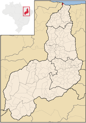
Parnaíba
City in Northeast, Brazil
Distance: Approx. 43 meters
Latitude and longitude: -2.905,-41.77694444
Parnaíba (Portuguese: [paʁnaˈibɐ]) is a city in the Brazilian state of Piauí. Having a population of over 169,000 inhabitants according to IBGE's 2024 estimates, it is the second most populous city in the state, after the capital Teresina. It is one of the four coastal municipalities in Piauí (besides Ilha Grande, Luís Correia, and Cajueiro da Praia), all of which make up the city's metropolitan area.

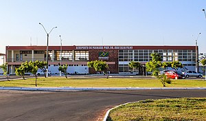
Parnaíba-Prefeito Dr. João Silva Filho International Airport
Airport
Distance: Approx. 5314 meters
Latitude and longitude: -2.89333333,-41.73027778
Parnaíba–Prefeito Dr. João Silva Filho International Airport (IATA: PHB, ICAO: SBPB) is the airport serving Parnaíba, Brazil. It is informally known as Santos Dumont Airport because of its architectonical similarities with Santos Dumont Airport in Rio de Janeiro.

Ilha Grande, Piauí
Place in Northeast, Brazil
Distance: Approx. 7167 meters
Latitude and longitude: -2.85777778,-41.82083333
Ilha Grande is one of the four coastal cities of Piauí, Brazil. It is also the northernmost city of the state. The municipality contains part of the 313,800 hectares (775,000 acres) Delta do Parnaíba Environmental Protection Area, created in 1996.
Weather in this IP's area
light rain
27 Celsius
30 Celsius
27 Celsius
27 Celsius
1011 hPa
86 %
1011 hPa
1009 hPa
10000 meters
4.43 m/s
8.59 m/s
61 degree
78 %