Country:
 Ireland
Region:
City:
Latitude and Longitude:
Time Zone:
Postal Code:
IP information under different IP Channel
ip-api
Country
Region
City
ASN
Time Zone
ISP
Blacklist
Proxy
Latitude
Longitude
Postal
Route
IPinfo
Country
Region
City
ASN
Time Zone
ISP
Blacklist
Proxy
Latitude
Longitude
Postal
Route
MaxMind
Country
Region
City
ASN
Time Zone
ISP
Blacklist
Proxy
Latitude
Longitude
Postal
Route
Luminati
Country
IEASN
Time Zone
Europe/Dublin
ISP
Internet Protocol Telecom Ltd
Latitude
Longitude
Postal
db-ip
Country
Region
City
ASN
Time Zone
ISP
Blacklist
Proxy
Latitude
Longitude
Postal
Route
ipdata
Country
Region
City
ASN
Time Zone
ISP
Blacklist
Proxy
Latitude
Longitude
Postal
Route
Popular places and events near this IP address
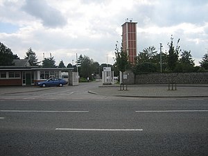
Red Cow interchange
Road junction
Distance: Approx. 1381 meters
Latitude and longitude: 53.31836111,-6.36822222
The Red Cow interchange is a major road junction in west Dublin, Ireland on the M50, meeting the N7 Naas Road (to Cork and Limerick) at a free-flow grade-separated junction which incorporates a tram line. The N7 route commences at this junction, junction 1 on the N7 and junction 9 on the M50, and the Naas Road from the city centre via Inchicore to the Red Cow interchange comprises part of the R110 and the R810. The junction is the busiest road junction in Ireland.

Park West and Cherry Orchard railway station
Railway station in County Dublin, Ireland
Distance: Approx. 506 meters
Latitude and longitude: 53.335,-6.365
Park West and Cherry Orchard railway station is an Iarnród Éireann railway station in Ballyfermot, Dublin, Ireland, serving the Park West and the Cherry Orchard area.

Park West, Dublin
Distance: Approx. 747 meters
Latitude and longitude: 53.33166667,-6.375
Park West (Irish: Páirc an Iarthair) is a large business park within west Dublin, Ireland, notable for its public art and with some residential development. Over 300 companies, with over 10,000 employees, are based there.

Bluebell, Dublin
Southside locality or small suburb, Dublin city, Ireland
Distance: Approx. 617 meters
Latitude and longitude: 53.329,-6.355
Bluebell (Irish: An Cloigín Gorm) is a small suburb of Dublin, Ireland. Situated approximately 6 kilometres south-west of the city centre, on the Camac, a Liffey tributary, the suburb borders the Grand Canal and Ballyfermot to the west, Walkinstown & Drimnagh to the east, Inchicore to the north, and Clondalkin to the south. Bluebell is in the Dublin South-Central Dáil constituency and is administered by Dublin City Council at the local government level.

Ballyfermot College of Further Education
College in Dublin, Ireland
Distance: Approx. 1365 meters
Latitude and longitude: 53.34067,-6.352449
Ballyfermot College of Further Education (BCFE; Irish: Coláiste Breisoideachais Bhaile Formaid) is an educational institution in Ballyfermot, Dublin, Ireland, a college of further and higher education.
Bluebell United F.C.
Football club
Distance: Approx. 1046 meters
Latitude and longitude: 53.32111111,-6.36472222
Bluebell United Football Club is an Irish association football club originally based in Bluebell, Dublin. The club's senior team plays in the Leinster Senior League Senior Division. The club has also fielded teams to compete in the FAI Cup, the FAI Intermediate Cup and the Leinster Senior Cup.
TOG (hackerspace)
Distance: Approx. 1189 meters
Latitude and longitude: 53.33013,-6.34605
TOG is a hackerspace in Dublin, Ireland. tóg is a word in the Irish language; one of its meanings is 'to build or construct'.
Cherry Orchard, Dublin
Suburb in Dublin, Ireland
Distance: Approx. 1032 meters
Latitude and longitude: 53.337,-6.375
Cherry Orchard (Irish: Gort na Silíní) is a suburb and townland within South Dublin, Ireland. It is located near Ballyfermot, Inchicore, Drimnagh, Kilmainham and Clondalkin.
Foróige
Distance: Approx. 641 meters
Latitude and longitude: 53.33038889,-6.37357611
Foróige is an Irish organisation whose purpose is "to enable young people to involve themselves consciously and actively in their development and in the development of society". Macra na Tuaithe, the youth branch of Macra na Feirme, was formed on 14 March 1952 (1952-03-14). In 1981, the organisation changed its name to Foróige, derived from forbairt na hóige, which means "development of youth".
Cherry Orchard Hospital
Hospital in County Dublin, Ireland
Distance: Approx. 1642 meters
Latitude and longitude: 53.34286,-6.37741
Cherry Orchard Hospital (Irish: Ospidéal Ghort na Silíní) is a public hospital in Ballyfermot, Dublin, Ireland.

Kylemore Luas stop
Tram stop in Dublin, Ireland
Distance: Approx. 1429 meters
Latitude and longitude: 53.3267,-6.3434
Kylemore (Irish: An Choill Mhóir) is a stop on the Luas light-rail tram system in Dublin, Ireland. It opened in 2004 as a stop on the Red Line. The stop is located on a section of reserved track in a wide central reservation on the Naas Road dual carriageway near the intersection with Kylemore road, and is virtually identical to Bluebell Luas stop.

Church of Our Lady of the Assumption, Ballyfermot
Church in BallyfermotCounty Dublin, Ireland
Distance: Approx. 1653 meters
Latitude and longitude: 53.3428,-6.35
Church of Our Lady of the Assumption is a Roman Catholic church at NW side of the roundabout where Kylemore and Ballyfermot roads meet in Ballyfermot, Dublin, Ireland. St. Raphael's National School is beside it.
Weather in this IP's area
scattered clouds
15 Celsius
15 Celsius
15 Celsius
17 Celsius
1008 hPa
92 %
1008 hPa
1003 hPa
10000 meters
1.34 m/s
1.6 m/s
338 degree
26 %
06:47:43
19:58:42