45.156.141.13 - IP Lookup: Free IP Address Lookup, Postal Code Lookup, IP Location Lookup, IP ASN, Public IP
Country:
Region:
City:
Location:
Time Zone:
Postal Code:
IP information under different IP Channel
ip-api
Country
Region
City
ASN
Time Zone
ISP
Blacklist
Proxy
Latitude
Longitude
Postal
Route
Luminati
Country
ASN
Time Zone
Europe/Ljubljana
ISP
SOFTNET d.o.o.
Latitude
Longitude
Postal
IPinfo
Country
Region
City
ASN
Time Zone
ISP
Blacklist
Proxy
Latitude
Longitude
Postal
Route
IP2Location
45.156.141.13Country
Region
centar
City
skopje
Time Zone
Europe/Skopje
ISP
Language
User-Agent
Latitude
Longitude
Postal
db-ip
Country
Region
City
ASN
Time Zone
ISP
Blacklist
Proxy
Latitude
Longitude
Postal
Route
ipdata
Country
Region
City
ASN
Time Zone
ISP
Blacklist
Proxy
Latitude
Longitude
Postal
Route
Popular places and events near this IP address

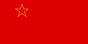
Socialist Republic of Macedonia
Federated state of Yugoslavia (1944–1991)
Distance: Approx. 35 meters
Latitude and longitude: 42,21.43333333
The Socialist Republic of Macedonia (Macedonian: Социјалистичка Република Македонија, romanized: Socijalistička Republika Makedonija), or SR Macedonia, commonly referred to as Socialist Macedonia, Yugoslav Macedonia or simply Macedonia, was one of the six constituent republics of the post-World War II Socialist Federal Republic of Yugoslavia, and a nation state of the Macedonians. After the transition of the political system to parliamentary democracy in 1990, the Republic changed its official name to Republic of Macedonia in 1991, and with the beginning of the breakup of Yugoslavia, it declared itself an independent country and held a referendum on 8 September 1991 on which a sovereign and independent state of Macedonia, with a right to enter into any alliance with sovereign states of Yugoslavia was approved. Geographically, SR Macedonia bordered Albania to the west, Greece to the south and Bulgaria to the east.

Battle of Skopje
Battle in 1004 near the Bulgarian city of Skopje
Distance: Approx. 35 meters
Latitude and longitude: 42,21.43333333
The Battle of Skopje occurred in 1004 within the vicinity of the city of Skopje. The battled was waged between forces of the Bulgarian Empire and the Byzantine Empire. The result was Byzantine victory.

Skopje Statistical Region
Statistical region in North Macedonia
Distance: Approx. 34 meters
Latitude and longitude: 42,21.4333
The Skopje Statistical Region (Macedonian: Скопски Регион; Albanian: Rajoni i Shkupit) is one of eight statistical regions of North Macedonia. The region is located in the north of the country, bordering Kosovo. Internally, it borders the Vardar, Polog, Northeastern, Eastern, and Southwestern statistical regions.
Mustafa Pasha Mosque
Ottoman-era mosque in the Old Bazaar of Skopje, North Macedonia
Distance: Approx. 310 meters
Latitude and longitude: 42.00194444,21.43541667
Mustafa Pasha Mosque (Macedonian: Мустафа-пашина џамија; Albanian: Xhamia e Mustafa Pashës; Turkish: Mustafa Paşa Camii) is an Ottoman-era mosque located in the Old Bazaar of Skopje, North Macedonia.

Stone Bridge (Skopje)
Bridge in Skopje, Macedonia
Distance: Approx. 302 meters
Latitude and longitude: 41.996992,21.433071
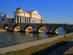
The Stone Bridge ([] Error: {{Langx}}: transliteration of latn script (help); Albanian: Ura e gurit; Turkish: Taş köprüsü) is a bridge across the Vardar River in Skopje, the capital of North Macedonia, built by Sultan Mehmed the Conqueror. The bridge is considered a symbol of Skopje and is the main element of the coat of arms of the city, which in turn is incorporated in the city's flag. It is located in Centar Municipality and it connects Macedonia Square to the Old Bazaar.
International Balkan University
International Balkan University is a private university in Skopje, North Macedonia
Distance: Approx. 253 meters
Latitude and longitude: 42.00166667,21.43472222
International Balkan University (abbreviated IBU) is a private, foundation-owned, not-for-profit university with its campus located in Skopje, North Macedonia. It was founded in 2006 by the Foundation for Education and Culture "ÜSKÜP".

Church of the Ascension of Jesus, Skopje
Macedonian Orthodox Church in Skopje, North Macedonia
Distance: Approx. 252 meters
Latitude and longitude: 42.00083333,21.43583333
The Church of the Ascension of Jesus (Macedonian: Црква „Св. Спас“) is an Eastern Orthodox church in Skopje, North Macedonia. It is situated east of Kale Fortress.
Holocaust Memorial Center for the Jews of Macedonia
Holocaust memorial in North Macedonia
Distance: Approx. 126 meters
Latitude and longitude: 41.99861111,21.43361111
The Holocaust Memorial Center for the Jews of Macedonia (Macedonian: Меморијален центар на холокаустот на Евреите од Македонија, Memorijalen centar na holokaustot na Evreite od Makedonija; Ladino: Sentro Memorial del Holokausto de los Djudios de la Makedonia) is a memorial to the Holocaust of the 7,148 Jews from North Macedonia and the history of the Jews in the Balkans, located in Skopje, the capital city of North Macedonia.

Museum of the Macedonian Struggle (Skopje)
Distance: Approx. 183 meters
Latitude and longitude: 41.99805556,21.43305556
The Museum of the Macedonian Struggle (Macedonian: Музеј на македонската борба) is a national museum of North Macedonia located in the capital city of Skopje. Construction of the museum began on 11 June 2008 and it was opened to the public on the 20th anniversary of the declaration of independence on 8 September 2011. The building lies on the former location of the Skopje branch of the National Bank of Yugoslavia, between the Archaeological Museum of North Macedonia, the Holocaust Museum of Macedonia, the Stone Bridge and the Vardar River.

National Gallery (North Macedonia)
National art museum in Skopje, North Macedonia
Distance: Approx. 233 meters
Latitude and longitude: 41.9986,21.4356
The National Gallery (Macedonian: Национална галерија) is a national art museum of North Macedonia in the Old Bazaar, located in the capital city of Skopje. Its permanent collection is housed in the 15th century Turkish Bath building known as the Daut Pasha Baths (Macedonian: Даут-пашин амам), but the museum also features a smaller exhibition at the nearby Čifte Hammam. Founded in 1948, the museum's collection dates from the 14th century.

Sultan Murad Mosque
Ottoman-era mosque in Skopje, North Macedonia
Distance: Approx. 310 meters
Latitude and longitude: 42.00194444,21.43541667
The Sultan Murad Mosque (Macedonian: Султан-муратовата џамија; Albanian: Xhamia e Sulltan Muratit; Turkish: Sultan Murat Camii) is an Ottoman-era mosque in Skopje, North Macedonia. It was built in the 15th century on top of the Monastery of Saint George which was destroyed when Ottoman commander Pasha Yiğit Bey captured Skopje from Vuk Branković in 1392.

Skopje East Gate
Shopping mall in Skopje, North Macedonia
Distance: Approx. 35 meters
Latitude and longitude: 42,21.43330556
Skopje East Gate (Macedonian: Скопје ист гејт), simply known as East Gate, is a mixed-development project incorporating a shopping and entertainment center, a residential complex and an office park based in Skopje, North Macedonia. It is located about 3 kilometers east from the center of Skopje. The shopping and entertainment center called East Gate Mall, opened on October 29 and by far is the largest shopping mall in North Macedonia, and the third largest overall in the region of the Balkans.
Weather in this IP's area
clear sky
-3 Celsius
-3 Celsius
-3 Celsius
-3 Celsius
1012 hPa
93 %
1012 hPa
958 hPa
10000 meters
1.03 m/s
110 degree
