45.155.136.231 - IP Lookup: Free IP Address Lookup, Postal Code Lookup, IP Location Lookup, IP ASN, Public IP
Country:
Region:
City:
Location:
Time Zone:
Postal Code:
IP information under different IP Channel
ip-api
Country
Region
City
ASN
Time Zone
ISP
Blacklist
Proxy
Latitude
Longitude
Postal
Route
Luminati
Country
Region
ni
City
melle
ASN
Time Zone
Europe/Berlin
ISP
BWI GmbH
Latitude
Longitude
Postal
IPinfo
Country
Region
City
ASN
Time Zone
ISP
Blacklist
Proxy
Latitude
Longitude
Postal
Route
IP2Location
45.155.136.231Country
Region
nordrhein-westfalen
City
meckenheim
Time Zone
Europe/Berlin
ISP
Language
User-Agent
Latitude
Longitude
Postal
db-ip
Country
Region
City
ASN
Time Zone
ISP
Blacklist
Proxy
Latitude
Longitude
Postal
Route
ipdata
Country
Region
City
ASN
Time Zone
ISP
Blacklist
Proxy
Latitude
Longitude
Postal
Route
Popular places and events near this IP address

Buschhoven
German farming village
Distance: Approx. 7372 meters
Latitude and longitude: 50.68333333,6.98333333
Buschhoven is a farming village 10 kilometres (6.2 mi) west of Bonn, Germany. It is part of the municipality Swisttal. It is surrounded by fields and various farms, with good transport links to the nearby main cities of Bonn and Cologne.

Meckenheim
Town in North Rhine-Westphalia, Germany
Distance: Approx. 1382 meters
Latitude and longitude: 50.63333333,7.01666667
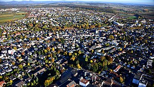
Meckenheim (German: [ˈmɛkŋ̍haɪm] ; Kölsch: Meckem) is a town in the Rhein-Sieg district, in North Rhine-Westphalia, Germany.
Rheinbach
Town in North Rhine-Westphalia, Germany
Distance: Approx. 5704 meters
Latitude and longitude: 50.63333333,6.95
Rheinbach is a town in the Rhein-Sieg-Kreis district (Landkreis), in North Rhine-Westphalia, Germany. It belongs to the administrative district (Regierungsbezirk) of Cologne.

Morenhoven
Distance: Approx. 7354 meters
Latitude and longitude: 50.66666667,6.95
Morenhoven is a farming village in the municipality Swisttal in the North Rhine-Westphalian Rhein-Sieg district. It is situated approximately 12 km west of Bonn. In 2007 it had 1650 inhabitants.

TIRA
Radar facility in Germany
Distance: Approx. 7123 meters
Latitude and longitude: 50.6166,7.1296
The Tracking & Imaging Radar (TIRA) system serves as the central experimental facility for the development and investigation of radar techniques for the detection and reconnaissance of objects in space, and (to a certain degree) of air targets. TIRA is located at the FGAN (50.6166°N 7.1296°E / 50.6166; 7.1296) site, in Wachtberg near Bonn, Germany. It is run by the Fraunhofer-Gesellschaft-FHR – the Fraunhofer-Institut für Hochfrequenzphysik und Radartechnik (High Frequency Physics and Radar Techniques), part of the German Fraunhofer Society.

Flerzheim
Stadtteil of Rheinbach in North Rhine-Westphalia, Germany
Distance: Approx. 3912 meters
Latitude and longitude: 50.6469,6.9875
Flerzheim is a part (Stadtteil) of Rheinbach in the Rhein-Sieg-Kreis in North Rhine-Westphalia, Germany.

Villiper Bach
River of North Rhine-Westphalia, Germany
Distance: Approx. 6397 meters
Latitude and longitude: 50.6722,7.0785
Villiper Bach is a river of North Rhine-Westphalia, Germany.

Tomburg Castle
Distance: Approx. 5024 meters
Latitude and longitude: 50.59580556,6.97374722
The Tomburg is a castle ruin near Wormersdorf, a village in the municipality of Rheinbach near the German city of Bonn. It is located in a small nature reserve that contains a number of rare plant species, on the 316 m above sea level (NN) high Tomberg hill. The Tomberg is a relic of the Tertiary.

Villip, Wachtberg
Distance: Approx. 4789 meters
Latitude and longitude: 50.6368,7.0941
Villip is a village in the municipality of Wachtberg in the Rhein-Sieg-Kreis in the state of North Rhine-Westphalia close to the town of Meckenheim in Germany. The village was first referenced on 10 June 873 as Philuppa. The king, Louis the German, included it under the manor of the monastery of Stablo.

Kottenforst
Distance: Approx. 4899 meters
Latitude and longitude: 50.6677,7.0227
The Kottenforst is a large forest, about 40 km2 in area, to the south, west and north of the city of Bonn in Germany. It is part of the Rhineland Nature Park (1,045 km2) and forms its eastern side.

Rheinbach station
Railway station in Germany
Distance: Approx. 5784 meters
Latitude and longitude: 50.6291,6.9479
Rheinbach station is a railway station in the municipality of Rheinbach, located in the Rhein-Sieg-Kreis district in North Rhine-Westphalia, Germany.
Rheinbach Römerkanal station
Railway station in Germany
Distance: Approx. 4392 meters
Latitude and longitude: 50.6283,6.9676
Rheinbach Römerkanal station is a railway station in the eastern part of the municipality of Rheinbach, located in the Rhein-Sieg-Kreis district in North Rhine-Westphalia, Germany.
Weather in this IP's area
broken clouds
4 Celsius
-0 Celsius
3 Celsius
4 Celsius
1021 hPa
83 %
1021 hPa
993 hPa
10000 meters
5.01 m/s
11.87 m/s
225 degree
83 %
