45.153.150.73 - IP Lookup: Free IP Address Lookup, Postal Code Lookup, IP Location Lookup, IP ASN, Public IP
Country:
Region:
City:
Location:
Time Zone:
Postal Code:
ISP:
ASN:
language:
User-Agent:
Proxy IP:
Blacklist:
IP information under different IP Channel
ip-api
Country
Region
City
ASN
Time Zone
ISP
Blacklist
Proxy
Latitude
Longitude
Postal
Route
db-ip
Country
Region
City
ASN
Time Zone
ISP
Blacklist
Proxy
Latitude
Longitude
Postal
Route
IPinfo
Country
Region
City
ASN
Time Zone
ISP
Blacklist
Proxy
Latitude
Longitude
Postal
Route
IP2Location
45.153.150.73Country
Region
baranya
City
boly
Time Zone
Europe/Budapest
ISP
Language
User-Agent
Latitude
Longitude
Postal
ipdata
Country
Region
City
ASN
Time Zone
ISP
Blacklist
Proxy
Latitude
Longitude
Postal
Route
Popular places and events near this IP address

Bóly
Town in Baranya, Hungary
Distance: Approx. 11 meters
Latitude and longitude: 45.96729,18.51825
Bóly (German: Bohl; Croatian: Boja) is a town in Baranya County, Hungary. Today Hungarian, the town was historically home to a large Danube Swabian population.

Babarc
Municipality in Southern Transdanubia, Hungary
Distance: Approx. 4871 meters
Latitude and longitude: 46.00323,18.55403
Babarc (German: Bawarz; Croatian: Babrac) is a village and municipality (Hungarian: község) in Baranya county, Hungary. Until the end of World War II, the inhabitants were Danube Swabians, also called locally as Stifolder, because their ancestors were from Fulda (district). Most of the former German settlers were expelled to Germany and Austria in 1945–1948, as a result of the Potsdam Agreement.

Szajk
Place in Baranya, Hungary
Distance: Approx. 3004 meters
Latitude and longitude: 45.99169,18.53461
Szajk (Croatian: Sajka) is a village in Baranya county, Hungary.

Versend
Place in Baranya, Hungary
Distance: Approx. 3249 meters
Latitude and longitude: 45.99617,18.51318
Versend (Croatian: Vršenda; German: Werschend) is a village in Baranya County, Hungary.
Belvárdgyula
Municipality in Southern Transdanubia, Hungary
Distance: Approx. 6833 meters
Latitude and longitude: 45.97416667,18.43055556
Belvárdgyula (Croatian: Belvar, German: Belward) is a village and municipality (Hungarian: község) in Baranya county, Hungary.
Borjád
Municipality in Southern Transdanubia, Hungary
Distance: Approx. 5494 meters
Latitude and longitude: 45.93333333,18.46666667
Borjád (German: Burjad; Croatian: Borjat) is a village and municipality (Hungarian: község) in Baranya county, Hungary.
Monyoród
Municipality in Southern Transdanubia, Hungary
Distance: Approx. 5396 meters
Latitude and longitude: 46.00783889,18.48026111
Monyoród (Croatian: Minjorod; German: Munjerod) is a village and municipality (Hungarian: község) in Baranya County, Hungary. Until the end of World War II, the majority of the inhabitants was Danube Swabian, also called locally as Stifolder, because their ancestors arrived in the 17th and 18th centuries from Fulda (district). Most of the former German settlers were expelled to allied-occupied Germany and allied-occupied Austria in 1945–1948, as a result of the Potsdam Agreement.
Nagybudmér
Municipality in Southern Transdanubia, Hungary
Distance: Approx. 6706 meters
Latitude and longitude: 45.93666667,18.44361111
Nagybudmér (German: Großbudmer; Croatian: Veliki Budmir) is a village and municipality (Hungarian: község) in Baranya County, Hungary. Residents are Magyars, with minority of Germans.

Nagynyárád
Village in Baranya, Hungary
Distance: Approx. 5385 meters
Latitude and longitude: 45.95,18.58333333
Nagynyárád (German: Großnaarad) is a village in Baranya County, Hungary.

Szederkény
Village in Baranya, Hungary
Distance: Approx. 6422 meters
Latitude and longitude: 46,18.45
Szederkény (German: Surgetin) is a village in Baranya County, Hungary.

Töttös
Village in Baranya, Hungary
Distance: Approx. 6137 meters
Latitude and longitude: 45.91666667,18.55
Töttös is a village in Baranya county, Hungary. Until the end of World War II, the majority of the inhabitants was Danube Swabian, also called locally as Stifolder, because their ancestors arrived in the 17th and 18th centuries from Fulda (district). Most of the former German settlers were expelled to allied-occupied Germany and allied-occupied Austria in 1945–1948, pursuant to the 1945 Potsdam Agreement.

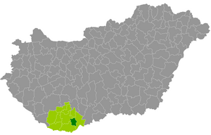
Bóly District
Districts of Hungary in Baranya
Distance: Approx. 812 meters
Latitude and longitude: 45.96,18.52
Bóly (Hungarian: Bólyi járás) is a district in central-eastern part of Baranya County. Bóly is also the name of the town where the district seat is located. The district is in the Southern Transdanubia Statistical Region.
Weather in this IP's area
clear sky
-2 Celsius
-2 Celsius
-3 Celsius
-2 Celsius
1042 hPa
83 %
1042 hPa
1026 hPa
10000 meters
0.38 m/s
0.44 m/s
163 degree
6 %

