45.149.216.111 - IP Lookup: Free IP Address Lookup, Postal Code Lookup, IP Location Lookup, IP ASN, Public IP
Country:
 Germany
Region:
City:
Location:
Time Zone:
Postal Code:
ISP:
ASN:
language:
User-Agent:
Proxy IP:
Blacklist:
IP information under different IP Channel
ip-api
Country
Region
City
ASN
Time Zone
ISP
Blacklist
Proxy
Latitude
Longitude
Postal
Route
db-ip
Country
Region
City
ASN
Time Zone
ISP
Blacklist
Proxy
Latitude
Longitude
Postal
Route
IPinfo
Country
Region
City
ASN
Time Zone
ISP
Blacklist
Proxy
Latitude
Longitude
Postal
Route
IP2Location
45.149.216.111Country
deRegion
thuringen
City
geunitz
Time Zone
Europe/Berlin
ISP
Language
User-Agent
Latitude
Longitude
Postal
ipdata
Country
Region
City
ASN
Time Zone
ISP
Blacklist
Proxy
Latitude
Longitude
Postal
Route
Popular places and events near this IP address

Orlamünde
Town in Thuringia, Germany
Distance: Approx. 6380 meters
Latitude and longitude: 50.77527778,11.53138889
Orlamünde () is a small town in the Saale-Holzland district, in Thuringia, Germany. It is part of the Verwaltungsgemeinschaft ("collective municipality") Südliches Saaletal.

Orla (Saale)
River in Thuringia, Germany
Distance: Approx. 7365 meters
Latitude and longitude: 50.7732,11.5462
The Orla is a 35 km (22 mi) long river in eastern Thuringia, Germany. With its source near the town of Triptis, it is a right tributary to the river Saale. The Orla flows west through the towns Neustadt an der Orla and Pößneck, into the Saale in Orlamünde, 17 km (11 mi) south of Jena.

Bibra, Saale-Holzland
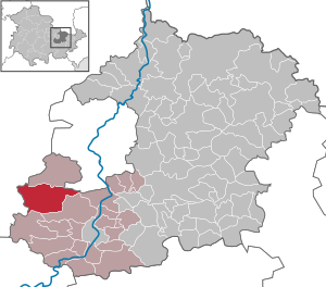
Municipality in Thuringia, Germany
Distance: Approx. 6166 meters
Latitude and longitude: 50.80416667,11.54611111
Bibra is a municipality in the district Saale-Holzland, in Thuringia, Germany.

Eichenberg, Saale-Holzland
Municipality in Thuringia, Germany
Distance: Approx. 5284 meters
Latitude and longitude: 50.79388889,11.52972222
Eichenberg is a municipality in the district Saale-Holzland, in Thuringia, Germany.
Milda, Germany
Municipality in Thuringia, Germany
Distance: Approx. 4519 meters
Latitude and longitude: 50.85,11.46666667
Milda is a municipality in the district Saale-Holzland, in Thuringia, Germany.

Altenberga
Municipality in Thuringia, Germany
Distance: Approx. 5858 meters
Latitude and longitude: 50.83333333,11.53333333
Altenberga is a municipality in the district Saale-Holzland, in Thuringia, Germany.
Freienorla
Municipality in Thuringia, Germany
Distance: Approx. 7411 meters
Latitude and longitude: 50.76944444,11.54277778
Freienorla is located in the German state of Thuringia. Although quite small and obscure, the municipality is known locally for its Gothic church as well as its lower mill, a watermill facility thought to be built in the tenth century. The Orlabahn railroad has a station located in Freienorla.

Gumperda
Municipality in Thuringia, Germany
Distance: Approx. 4533 meters
Latitude and longitude: 50.81,11.52333333
Gumperda is a municipality in the district Saale-Holzland, in Thuringia, Germany.

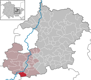
Reinstädt
Municipality in Thuringia, Germany
Distance: Approx. 1078 meters
Latitude and longitude: 50.80888889,11.47416667
Reinstädt is a municipality in the district Saale-Holzland, in Thuringia, Germany.

Großkochberg
Distance: Approx. 7123 meters
Latitude and longitude: 50.78333333,11.36666667
Großkochberg is a former municipality in the district Saalfeld-Rudolstadt, in Thuringia, Germany. Since 1 December 2007, it is part of the municipality Uhlstädt-Kirchhasel.
Heilingen
Distance: Approx. 4787 meters
Latitude and longitude: 50.767,11.467
Heilingen is a former municipality in the district Saalfeld-Rudolstadt, in Thuringia, Germany. Since 1 December 2007, it is part of the municipality Uhlstädt-Kirchhasel. As of 31 December 2006, it had 336 inhabitants.

Walpersberg
Distance: Approx. 7049 meters
Latitude and longitude: 50.79583333,11.55666667
The Walpersberg is a sandstone mesa on the west bank of the Saale near Kahla in Thuringia, Germany, formed around 60 million years ago.
Weather in this IP's area
light snow
-3 Celsius
-7 Celsius
-3 Celsius
-2 Celsius
1018 hPa
93 %
1018 hPa
980 hPa
6529 meters
3.3 m/s
4.62 m/s
9 degree
100 %