Country:
Region:
City:
Latitude and Longitude:
Time Zone:
Postal Code:
IP information under different IP Channel
ip-api
Country
Region
City
ASN
Time Zone
ISP
Blacklist
Proxy
Latitude
Longitude
Postal
Route
Luminati
Country
ASN
Time Zone
Europe/Berlin
ISP
PFALZKOM GmbH
Latitude
Longitude
Postal
IPinfo
Country
Region
City
ASN
Time Zone
ISP
Blacklist
Proxy
Latitude
Longitude
Postal
Route
db-ip
Country
Region
City
ASN
Time Zone
ISP
Blacklist
Proxy
Latitude
Longitude
Postal
Route
ipdata
Country
Region
City
ASN
Time Zone
ISP
Blacklist
Proxy
Latitude
Longitude
Postal
Route
Popular places and events near this IP address
Bergstraße (district)
District in Hesse, Germany
Distance: Approx. 3976 meters
Latitude and longitude: 49.640712,8.64433
Bergstraße (German: [ˈbɛʁkˌʃtʁaːsə]; "Mountain Road") is a Kreis (district) in the south of Hesse, Germany. It is at the northern end of the Bergstraße route. Neighboring districts are Groß-Gerau, Darmstadt-Dieburg, Odenwaldkreis, Rhein-Neckar-Kreis, the urban district Mannheim, the Rhein-Pfalz-Kreis, and the urban district of Worms.

Bensheim
Town in Hesse, Germany
Distance: Approx. 538 meters
Latitude and longitude: 49.66666667,8.61666667
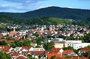
Bensheim (German pronunciation: [ˈbɛnsˌhaɪ̯m] ) is a town in the Bergstraße district in southern Hessen, Germany. Bensheim lies on the Bergstraße and at the edge of the Odenwald mountains while at the same time having an open view over the Rhine plain. With about 40,000 inhabitants (2016), it is the district's biggest town.
Heppenheim
Town in Hesse, Germany
Distance: Approx. 3558 meters
Latitude and longitude: 49.64305556,8.63888889
Heppenheim (Bergstraße) is the seat of Bergstraße district in Hesse, Germany, lying on the Bergstraße on the edge of the Odenwald. It is best known for being the birthplace of Sebastian Vettel, a four-time Formula One World Champion and the place of founding of the Free Democratic Party (Germany).

Lorsch Abbey
UNESCO World Heritage Site in Hesse, Germany
Distance: Approx. 3906 meters
Latitude and longitude: 49.65361111,8.56972222
Lorsch Abbey, otherwise the Imperial Abbey of Lorsch (German: Reichsabtei Lorsch; Latin: Laureshamense Monasterium or Laurissa), is a former Imperial abbey in Lorsch, Germany, about 10 km (6.2 mi) east of Worms. It was one of the most important monasteries of the Carolingian Empire. Even in its ruined state, its remains are among the most important pre-Romanesque–Carolingian style buildings in Germany.
Starkenburg Observatory
Observatory
Distance: Approx. 3754 meters
Latitude and longitude: 49.6469,8.652
The Starkenburg Observatory (German: Starkenburg-Sternwarte) is an astronomical observatory in Heppenheim, Germany. It was founded in 1970, and currently has about 150 members. The observatory was the venue for the 1997 and 2003 meetings of the European Radio Astronomy Congress.

Lorsch
Town in Hesse, Germany
Distance: Approx. 4030 meters
Latitude and longitude: 49.65388889,8.5675
Lorsch (German pronunciation: [lɔʁʃ] ) is a town in the Bergstraße district in Hessen, Germany, 60 km south of Frankfurt.

Hemsberg
Distance: Approx. 1694 meters
Latitude and longitude: 49.66861111,8.63944444
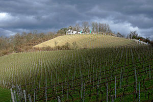
Hemsberg is a hill in Hesse, Germany.

Kirchberg (Bensheim)
Distance: Approx. 1958 meters
Latitude and longitude: 49.68777778,8.62666667
Kirchberg is a low hill of Hesse, Germany.

Auer (Odenwald)
River in Germany
Distance: Approx. 3580 meters
Latitude and longitude: 49.70222222,8.60166667
The Auer (also called Mühlbach or Ziegelbach) is a river in Hesse, Germany which springs from the western edge of the Felsberg in the Hessian Odenwald between Balkhausen and Bensheim-Hochstädten. It measures 6.7 kilometers in length and is part of the Rhine river system.

Bensheim station
Railway station in Hesse, Germany
Distance: Approx. 1225 meters
Latitude and longitude: 49.6825,8.61666667
Bensheim station is in the town of Bensheim on the Main-Neckar Railway, connecting Frankfurt and Heidelberg, in the German state of Hesse. The station is also the beginning and end of the single-track non-electrified Worms–Bensheim line (Nibelung Railway). 114 trains stop at Bensheim station every day, of which about one-third are long-distance services.

Heppenheim (Bergstraße) station
Railway station in Heppenheim, Germany
Distance: Approx. 3539 meters
Latitude and longitude: 49.64166667,8.63333333
Heppenheim (Bergstraße) station is a station in the town of Heppenheim and it is the most southerly station in the German state of Hesse on the Main-Neckar Railway between Frankfurt and Heidelberg. It is served by regional services and an S-Bahn service. On weekdays the station is served by one Intercity services on the long-distance network of Deutsche Bahn.

Bensheim-Auerbach station
Railway station in Bensheim-Auerbach, Germany
Distance: Approx. 3396 meters
Latitude and longitude: 49.70194444,8.61333333
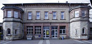
Bensheim-Auerbach station is a station on the Main-Neckar Railway in the Bensheim district of Auerbach on the Mountain Road in the German state of Hesse. It has a heritage-listed entrance building. The station is classified by Deutsche Bahn (DB) as a category 5 station.
Weather in this IP's area
clear sky
6 Celsius
4 Celsius
5 Celsius
7 Celsius
1026 hPa
95 %
1026 hPa
1014 hPa
10000 meters
1.72 m/s
1.86 m/s
79 degree
07:19:43
16:58:27

