45.148.217.160 - IP Lookup: Free IP Address Lookup, Postal Code Lookup, IP Location Lookup, IP ASN, Public IP
Country:
Region:
City:
Location:
Time Zone:
Postal Code:
IP information under different IP Channel
ip-api
Country
Region
City
ASN
Time Zone
ISP
Blacklist
Proxy
Latitude
Longitude
Postal
Route
Luminati
Country
ASN
Time Zone
Europe/Berlin
ISP
PFALZKOM GmbH
Latitude
Longitude
Postal
IPinfo
Country
Region
City
ASN
Time Zone
ISP
Blacklist
Proxy
Latitude
Longitude
Postal
Route
IP2Location
45.148.217.160Country
Region
hessen
City
bensheim
Time Zone
Europe/Berlin
ISP
Language
User-Agent
Latitude
Longitude
Postal
db-ip
Country
Region
City
ASN
Time Zone
ISP
Blacklist
Proxy
Latitude
Longitude
Postal
Route
ipdata
Country
Region
City
ASN
Time Zone
ISP
Blacklist
Proxy
Latitude
Longitude
Postal
Route
Popular places and events near this IP address

Bensheim
Town in Hesse, Germany
Distance: Approx. 1911 meters
Latitude and longitude: 49.66666667,8.61666667
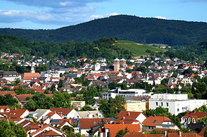
Bensheim (German pronunciation: [ˈbɛnsˌhaɪ̯m] ) is a town in the Bergstraße district in southern Hessen, Germany. Bensheim lies on the Bergstraße and at the edge of the Odenwald mountains while at the same time having an open view over the Rhine plain. With about 40,000 inhabitants (2016), it is the district's biggest town.

Zwingenberg, Hesse
Town in Hesse, Germany
Distance: Approx. 3661 meters
Latitude and longitude: 49.71666667,8.61666667
Zwingenberg lies in the Bergstraße district in southern Hessen, Germany, south of Frankfurt and Darmstadt, and with the granting of town rights coming in 1274 it is the oldest town on the Hessen Bergstraße.

Auerbach Castle
Distance: Approx. 2990 meters
Latitude and longitude: 49.70916667,8.63194444
Auerbach Castle is one of several fortresses along the Bergstrasse in southern Hesse, Germany. The castle was originally built by King Charlemagne (Emperor of the Holy Roman Empire) and rebuilt by Count Diether IV of the Katzenelnbogen dynasty in the second quarter of the 13th century. Today it remains standing atop a hill known as Urberg (part of the Melibokus) above the town of Bensheim-Auerbach.

Hessische Bergstraße
Wine-producing region
Distance: Approx. 3697 meters
Latitude and longitude: 49.717,8.617
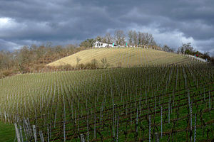
The Hessische Bergstraße (German pronunciation: [ˈhɛsɪʃə ˈbɛʁk.ʃtʁaːsə]; lit. 'Hessian Mountain Road') is a defined region (Anbaugebiet) for wine in Germany located in the state of Hesse among the northern and western slopes of the Odenwald mountain chain. With only 467 hectares (1,150 acres) of vineyards it is the smallest of the 13 German quality wine regions. At 21% red grape varieties and 79% white varieties, it is planted with primarily Riesling (40% as of 2019), Pinot gris (12%) and Spätburgunder (Pinot Noir, 11%).
Niederwaldsee
Distance: Approx. 4090 meters
Latitude and longitude: 49.715927,8.590753
The Niederwaldsee is a lake in Bensheim. Bensheim is a town in the Bergstraße district in southern Hesse, Germany.

Hemsberg
Distance: Approx. 2276 meters
Latitude and longitude: 49.66861111,8.63944444
Hemsberg is a hill in Hesse, Germany.

Kirchberg (Bensheim)
Distance: Approx. 748 meters
Latitude and longitude: 49.68777778,8.62666667
Kirchberg is a low hill of Hesse, Germany.

Nibelungensteig
Distance: Approx. 4724 meters
Latitude and longitude: 49.72586,8.60955
The Nibelungensteig is a hiking trail in the German states of Hesse, Bavaria and Baden-Württemberg. It traverses the Odenwald, a hill range or Mittelgebirge located between the rivers Rhine and Main. The trail starts in Zwingenberg (Bergstraße) and ends in Freudenberg (Main).

Auer (Odenwald)
River in Germany
Distance: Approx. 2375 meters
Latitude and longitude: 49.70222222,8.60166667
The Auer (also called Mühlbach or Ziegelbach) is a river in Hesse, Germany which springs from the western edge of the Felsberg in the Hessian Odenwald between Balkhausen and Bensheim-Hochstädten. It measures 6.7 kilometers in length and is part of the Rhine river system.

Bensheim station
Railway station in Hesse, Germany
Distance: Approx. 186 meters
Latitude and longitude: 49.6825,8.61666667
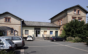
Bensheim station is in the town of Bensheim on the Main-Neckar Railway, connecting Frankfurt and Heidelberg, in the German state of Hesse. The station is also the beginning and end of the single-track non-electrified Worms–Bensheim line (Nibelung Railway). 114 trains stop at Bensheim station every day, of which about one-third are long-distance services.

Zwingenberg (Bergstraße) station
Railway station in Hesse, Germany
Distance: Approx. 4706 meters
Latitude and longitude: 49.725672,8.609295
Zwingenberg (Bergstr) station is a station on the Main-Neckar Railway in the town of Zwingenberg on the Mountain Road in the German state of Hesse. It has a heritage-listed entrance building. The station is classified by Deutsche Bahn (DB) as a category 5 station.

Bensheim-Auerbach station
Railway station in Bensheim-Auerbach, Germany
Distance: Approx. 2051 meters
Latitude and longitude: 49.70194444,8.61333333
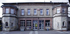
Bensheim-Auerbach station is a station on the Main-Neckar Railway in the Bensheim district of Auerbach on the Mountain Road in the German state of Hesse. It has a heritage-listed entrance building. The station is classified by Deutsche Bahn (DB) as a category 5 station.
Weather in this IP's area
broken clouds
3 Celsius
0 Celsius
1 Celsius
4 Celsius
1025 hPa
94 %
1025 hPa
1012 hPa
10000 meters
2.25 m/s
5.47 m/s
286 degree
81 %