45.147.231.56 - IP Lookup: Free IP Address Lookup, Postal Code Lookup, IP Location Lookup, IP ASN, Public IP
Country:
Region:
City:
Location:
Time Zone:
Postal Code:
IP information under different IP Channel
ip-api
Country
Region
City
ASN
Time Zone
ISP
Blacklist
Proxy
Latitude
Longitude
Postal
Route
Luminati
Country
ASN
Time Zone
Europe/Berlin
ISP
aurologic GmbH
Latitude
Longitude
Postal
IPinfo
Country
Region
City
ASN
Time Zone
ISP
Blacklist
Proxy
Latitude
Longitude
Postal
Route
IP2Location
45.147.231.56Country
Region
bayern
City
mauern
Time Zone
Europe/Berlin
ISP
Language
User-Agent
Latitude
Longitude
Postal
db-ip
Country
Region
City
ASN
Time Zone
ISP
Blacklist
Proxy
Latitude
Longitude
Postal
Route
ipdata
Country
Region
City
ASN
Time Zone
ISP
Blacklist
Proxy
Latitude
Longitude
Postal
Route
Popular places and events near this IP address

Grafrath
Municipality in Bavaria, Germany
Distance: Approx. 1802 meters
Latitude and longitude: 48.11666667,11.16666667
Grafrath is a municipality in the district of Fürstenfeldbruck in Bavaria in Germany. It takes its name from Saint Rasso (Ratho), a count (Graf) who founded a Benedictine abbey in the 10th century, and which existed until 1803.

Inning am Ammersee
Municipality in Bavaria, Germany
Distance: Approx. 5558 meters
Latitude and longitude: 48.06666667,11.15
Inning is a municipality in Bavaria, Germany, in the district of Starnberg, in the Regierungsbezirk of Oberbayern. It lies on the shores of lake Ammersee.

Kottgeisering
Municipality in Bavaria, Germany
Distance: Approx. 4170 meters
Latitude and longitude: 48.11666667,11.13333333
Kottgeisering is a municipality in the district of Fürstenfeldbruck in Bavaria, Germany.

Schöngeising
Municipality in Bavaria, Germany
Distance: Approx. 2790 meters
Latitude and longitude: 48.13333333,11.2
Schöngeising is a municipality in the district of Fürstenfeldbruck in Bavaria in Germany.

Eching am Ammersee
Municipality in Bavaria, Germany
Distance: Approx. 2790 meters
Latitude and longitude: 48.13333333,11.2
Eching am Ammersee is a municipality in the district of Landsberg in Bavaria in Germany. It has a size of 6.15km2. Situated at the northern shore of the Ammersee at an elevation of 541m, it borders the Naturschutzgebiet "Ampermoos" and the wooded recreation area "Weingarten".

Wörthsee (municipality)
Municipality in Bavaria, Germany
Distance: Approx. 3038 meters
Latitude and longitude: 48.08333333,11.2
Wörthsee is a municipality in the district of Starnberg in Bavaria, Germany. It is located on the northeastern shore of the lake called Wörthsee, and is about 15 kilometers northwest of the county town of Starnberg.

Forstlicher Versuchsgarten Grafrath
Distance: Approx. 3282 meters
Latitude and longitude: 48.1312,11.1585
The Forstlicher Versuchsgarten Grafrath is an arboretum in Grafrath, Bavaria, Germany. The arboretum is located at Jesenwanger Strasse 11, Grafrath. It is 34 hectares (84 acres) large.
Windach (river)
River of Bavaria, Germany
Distance: Approx. 5212 meters
Latitude and longitude: 48.0809,11.1329
Windach is a river of Bavaria, Germany. It flows into the Amper near Eching am Ammersee.
Steinebach station
Railway station in Bavaria, Germany
Distance: Approx. 5554 meters
Latitude and longitude: 48.061122,11.206663
Steinebach station is a railway station in the municipality of Wörthsee, located in the Starnberg district in Upper Bavaria, Germany.

Grafrath station
Railway station in Bavaria, Germany
Distance: Approx. 3649 meters
Latitude and longitude: 48.13216,11.15291
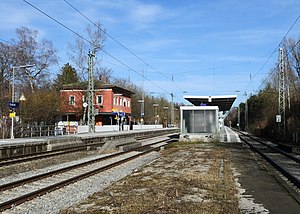
Grafrath station (German: Bahnhof Grafrath) is a railway station in the municipality of Grafrath, located in the Fürstenfeldbruck district in Bavaria, Germany.
Bauernhofmuseum Jexhof
Museum in Bavaria, Germany
Distance: Approx. 1514 meters
Latitude and longitude: 48.116,11.2063
Bauernhofmuseum Jexhof is a farm museum located in the southern part of the Fürstenfeldbruck District in Bavaria, Germany. It lies approximately 700 meters southeast of the district road FFB 7, which runs between Schöngeising and Mauern (part of the community of Grafrath). Located in the hamlet of Jexhof within the Schöngeising municipality, the farm sits in a valley at the western edge of the Wildmoos nature reserve.

Holy Cross Church (Holzhausen)
Church in Bavaria, Germany
Distance: Approx. 4708 meters
Latitude and longitude: 48.13869444,11.23425
The Holy Cross Church of Holzhausen, Alling is a Roman Catholic church in Upper Bavaria. The church, first built in the thirteenth century in the Late Gothic style, was heavily redone in the Baroque style towards the end of the seventeenth century. The church is dedicated to the Holy Cross of Christ, the cross that Jesus Christ was crucified on.
Weather in this IP's area
few clouds
-6 Celsius
-6 Celsius
-8 Celsius
-6 Celsius
1042 hPa
93 %
1042 hPa
966 hPa
10000 meters
0.51 m/s
20 %


