45.146.139.67 - IP Lookup: Free IP Address Lookup, Postal Code Lookup, IP Location Lookup, IP ASN, Public IP
Country:
Region:
City:
Location:
Time Zone:
Postal Code:
IP information under different IP Channel
ip-api
Country
Region
City
ASN
Time Zone
ISP
Blacklist
Proxy
Latitude
Longitude
Postal
Route
Luminati
Country
ASN
Time Zone
Europe/Berlin
ISP
GHOSTnet GmbH
Latitude
Longitude
Postal
IPinfo
Country
Region
City
ASN
Time Zone
ISP
Blacklist
Proxy
Latitude
Longitude
Postal
Route
IP2Location
45.146.139.67Country
Region
bayern
City
soden
Time Zone
Europe/Berlin
ISP
Language
User-Agent
Latitude
Longitude
Postal
db-ip
Country
Region
City
ASN
Time Zone
ISP
Blacklist
Proxy
Latitude
Longitude
Postal
Route
ipdata
Country
Region
City
ASN
Time Zone
ISP
Blacklist
Proxy
Latitude
Longitude
Postal
Route
Popular places and events near this IP address

Bessenbach
Municipality in Bavaria, Germany
Distance: Approx. 5736 meters
Latitude and longitude: 49.96666667,9.26666667
Bessenbach is a community in the Aschaffenburg district in the Regierungsbezirk of Lower Franconia (Unterfranken) in Bavaria, Germany.

Haibach, Lower Franconia
Municipality in Bavaria, Germany
Distance: Approx. 4789 meters
Latitude and longitude: 49.9675,9.19694444
Haibach is a community in the Aschaffenburg district in the Regierungsbezirk of Lower Franconia (Unterfranken) in Bavaria, Germany. It has a population of around 8,300.

Mespelbrunn
Municipality in Bavaria, Germany
Distance: Approx. 4897 meters
Latitude and longitude: 49.91666667,9.28333333
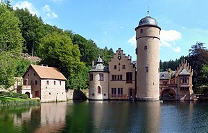
Mespelbrunn is a community in the Aschaffenburg district in the Regierungsbezirk of Lower Franconia (Unterfranken) in Bavaria, Germany and a member of the Verwaltungsgemeinschaft (municipal association) of Mespelbrunn, whose seat is in Heimbuchenthal. It is the site of Mespelbrunn Castle, one of the most famous landmarks of the Spessart region, and of the Wallfahrtskirche Hessenthal, for more than 700 years the destination of a Christian pilgrimage.

Großwallstadt
Municipality in Bavaria, Germany
Distance: Approx. 5988 meters
Latitude and longitude: 49.88333333,9.16666667
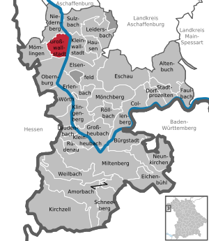
Großwallstadt (or Grosswallstadt) is a community in the Miltenberg district in the Regierungsbezirk of Lower Franconia (Unterfranken) in Bavaria, Germany.

Hausen, Miltenberg
Municipality in Bavaria, Germany
Distance: Approx. 6326 meters
Latitude and longitude: 49.86972222,9.21027778
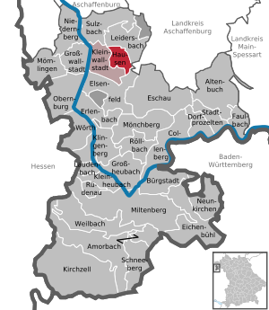
Hausen is a community in the Miltenberg district in the Regierungsbezirk of Lower Franconia (Unterfranken) in Bavaria, Germany and a member of the Verwaltungsgemeinschaft (Administrative Community) of Kleinwallstadt.

Leidersbach
Municipality in Bavaria, Germany
Distance: Approx. 2939 meters
Latitude and longitude: 49.9,9.21666667
Leidersbach is a community in the Miltenberg district in the Regierungsbezirk of Lower Franconia (Unterfranken) in Bavaria, Germany.

Niedernberg
Municipality in Bavaria, Germany
Distance: Approx. 6072 meters
Latitude and longitude: 49.91666667,9.13333333
Niedernberg is a municipality in the Miltenberg district in the Regierungsbezirk of Lower Franconia (Unterfranken) in Bavaria, Germany.

Sulzbach am Main
Municipality in Bavaria, Germany
Distance: Approx. 4776 meters
Latitude and longitude: 49.90777778,9.15666667
Sulzbach am Main (officially Sulzbach a.Main) is a market municipality in the Miltenberg district in the Regierungsbezirk of Lower Franconia (Unterfranken) in Bavaria, Germany.

Hohe Wart
Distance: Approx. 3802 meters
Latitude and longitude: 49.91444444,9.26638889
Hohe Wart is a wooded hill of the Spessart range in Bavaria, Germany. It is located in the unincorporated area Forst Hohe Wart, between the districts of Aschaffenburg and Miltenberg. Hohe Wart is part of the latter and is bordered by Bessenbach, Mespelbrunn, Leidersbach and Sulzbach am Main.
Pfaffenberg (Spessart)
Distance: Approx. 1821 meters
Latitude and longitude: 49.9325,9.24027778
Pfaffenberg is a 432-meter-high (1,417 ft) hill of Bavaria, Germany. The Pfaffenberg hill lies in the Spessart range in the districts of Aschaffenburg and Miltenberg.
Michelbach (Bessenbach)
River in Germany
Distance: Approx. 5928 meters
Latitude and longitude: 49.9741,9.2535
Michelbach is a river of Bavaria, Germany. It is a right tributary of the Bessenbach near Keilberg.
Sulzbach (Main)
River in Germany
Distance: Approx. 5336 meters
Latitude and longitude: 49.91416667,9.14472222
Sulzbach is a river of Bavaria, Germany. It is a right tributary of the Main in Sulzbach am Main.
Weather in this IP's area
light rain
4 Celsius
2 Celsius
3 Celsius
5 Celsius
1032 hPa
90 %
1032 hPa
1007 hPa
10000 meters
1.62 m/s
3.52 m/s
176 degree
100 %


