Country:
Region:
City:
Latitude and Longitude:
Time Zone:
Postal Code:
IP information under different IP Channel
ip-api
Country
Region
City
ASN
Time Zone
ISP
Blacklist
Proxy
Latitude
Longitude
Postal
Route
IPinfo
Country
Region
City
ASN
Time Zone
ISP
Blacklist
Proxy
Latitude
Longitude
Postal
Route
MaxMind
Country
Region
City
ASN
Time Zone
ISP
Blacklist
Proxy
Latitude
Longitude
Postal
Route
Luminati
Country
ASN
Time Zone
Europe/Berlin
ISP
nexserv GmbH
Latitude
Longitude
Postal
db-ip
Country
Region
City
ASN
Time Zone
ISP
Blacklist
Proxy
Latitude
Longitude
Postal
Route
ipdata
Country
Region
City
ASN
Time Zone
ISP
Blacklist
Proxy
Latitude
Longitude
Postal
Route
Popular places and events near this IP address
Amt Neuhaus
Municipality in Lower Saxony, Germany
Distance: Approx. 9710 meters
Latitude and longitude: 53.28527778,10.93222222
Amt Neuhaus is a municipality in the District of Lüneburg, in Lower Saxony, Germany. Amt means "municipal office" in German. The original "municipal office of Neuhaus" existed since at least the 17th century until 1885, consecutively as part of Saxe-Lauenburg (which ceased to exist in 1689), Electorate of Hanover (1689-1810), Kingdom of Hanover (1814-1866), and the Prussian Province of Hanover (1866-1885).

Lübtheen
Town in Mecklenburg-Vorpommern, Germany
Distance: Approx. 672 meters
Latitude and longitude: 53.3,11.08333333
Lübtheen (German pronunciation: [lʏpˈteːn]) is a municipality in the Ludwigslust-Parchim district, in Mecklenburg-Western Pomerania, Germany. It is situated 28 km west of Ludwigslust, and 37 km southwest of Schwerin. It is part of the Hamburg Metropolitan Region.

Belsch
Municipality in Mecklenburg-Vorpommern, Germany
Distance: Approx. 7453 meters
Latitude and longitude: 53.31666667,11.18333333
Belsch is a municipality in the Ludwigslust-Parchim district, in Mecklenburg-Vorpommern, Germany.

Pritzier
Municipality in Mecklenburg-Vorpommern, Germany
Distance: Approx. 7966 meters
Latitude and longitude: 53.36666667,11.08333333
Pritzier is a municipality in the Ludwigslust-Parchim district of Mecklenburg-Vorpommern, Germany. The Pritzier municipality consists of three villages: Pritzier, Pritzier Bahnhof, and Schwechow.

Redefin
Municipality in Mecklenburg-Vorpommern, Germany
Distance: Approx. 8237 meters
Latitude and longitude: 53.33333333,11.18333333
Redefin is a municipality in the Ludwigslust-Parchim district, in Mecklenburg-Vorpommern, Germany. Redefin is mostly known because of the state stud farm (Landgestüt) of Mecklenburg-Vorpommern, which was founded in 1812.

Vielank
Municipality in Mecklenburg-Vorpommern, Germany
Distance: Approx. 9129 meters
Latitude and longitude: 53.21666667,11.11666667
Vielank is a municipality in the Ludwigslust-Parchim district, in Mecklenburg-Vorpommern, Germany.

Warlitz
Municipality in Mecklenburg-Vorpommern, Germany
Distance: Approx. 8787 meters
Latitude and longitude: 53.36666667,11.13333333
Warlitz is a municipality in the Ludwigslust-Parchim district, in Mecklenburg-Vorpommern, Germany.

Rögnitz (river)
River in Germany
Distance: Approx. 8897 meters
Latitude and longitude: 53.3182,10.9491
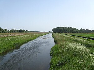
Rögnitz is a river of Mecklenburg-Vorpommern and Lower Saxony, Germany. It flows into the Sude in Sückau.
Schmaar
River in Mecklenburg-Vorpommern, Germany
Distance: Approx. 7737 meters
Latitude and longitude: 53.3388,11.1678
The Schmaar is a river of Mecklenburg-Vorpommern, Germany. Its source lies between Wittenburg and Hagenow. It flows through Hagenow, and flows into the Sude near Redefin.

Mecklenburg Elbe Valley Nature Park
Distance: Approx. 5924 meters
Latitude and longitude: 53.336,11.02
The Mecklenburg Elbe Valley Nature Park (German: Mecklenburgisches Elbetal) is part of the UNESCO biosphere reserve of Elbe River Landscape. At over 400 river kilometres long, the Elbe River Landscape Biosphere Reserve runs through the five German states of: Saxony-Anhalt, Brandenburg, Lower Saxony, Mecklenburg-Vorpommern and Schleswig-Holstein. It lies in the district of Ludwigslust-Parchim in Mecklenburg-Vorpommern.
Weather in this IP's area
moderate rain
14 Celsius
14 Celsius
14 Celsius
14 Celsius
983 hPa
95 %
983 hPa
981 hPa
7715 meters
4.96 m/s
12.69 m/s
140 degree
100 %
07:33:34
18:31:20
