Country:
Region:
City:
Latitude and Longitude:
Time Zone:
Postal Code:
IP information under different IP Channel
ip-api
Country
Region
City
ASN
Time Zone
ISP
Blacklist
Proxy
Latitude
Longitude
Postal
Route
IPinfo
Country
Region
City
ASN
Time Zone
ISP
Blacklist
Proxy
Latitude
Longitude
Postal
Route
MaxMind
Country
Region
City
ASN
Time Zone
ISP
Blacklist
Proxy
Latitude
Longitude
Postal
Route
Luminati
Country
ASN
Time Zone
Europe/Paris
ISP
ADISTA SAS
Latitude
Longitude
Postal
db-ip
Country
Region
City
ASN
Time Zone
ISP
Blacklist
Proxy
Latitude
Longitude
Postal
Route
ipdata
Country
Region
City
ASN
Time Zone
ISP
Blacklist
Proxy
Latitude
Longitude
Postal
Route
Popular places and events near this IP address

Épinay-sur-Orge
Commune in Île-de-France, France
Distance: Approx. 2282 meters
Latitude and longitude: 48.6726,2.3239
Épinay-sur-Orge (French pronunciation: [epinɛ syʁ ɔʁʒ] , literally Épinay on Orge) is a commune in the Essonne department in Île-de-France in northern France. It is situated near Orly Airport some 17 km (11 mi) south of Paris on the A6 motorway. Épinay is served by two stations on different branches of line C of the RER suburban railway system: Épinay-sur-Orge and Petit-Vaux.
Yvette (river)
River in France
Distance: Approx. 2945 meters
Latitude and longitude: 48.66722222,2.33833333
The Yvette (French pronunciation: [ivɛt]) is a small river in southern Île-de-France (France), left tributary of the Orge, which is a tributary of the Seine. It is 39.3 km (24.4 mi) long. Its source is in Les Essarts-le-Roi, north of Rambouillet, in the Yvelines department.

Villiers-sur-Orge
Commune in Île-de-France, France
Distance: Approx. 234 meters
Latitude and longitude: 48.6574,2.3001
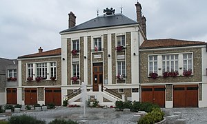
Villiers-sur-Orge (French pronunciation: [vilje syʁ ɔʁʒ] , literally Villiers on Orge) is a commune in the arrondissement of Palaiseau, in the Essonne department, in the Île-de-France region.

Montlhéry
Commune in Île-de-France, France
Distance: Approx. 3048 meters
Latitude and longitude: 48.6392,2.2722
Montlhéry (French pronunciation: [mɔ̃leʁi] ) is a commune in the Essonne department in Île-de-France in northern France. It is located 26 km (16.2 mi) from Paris.

La Ville-du-Bois
Commune in Île-de-France, France
Distance: Approx. 2310 meters
Latitude and longitude: 48.6611,2.2687
La Ville-du-Bois (French pronunciation: [la vil dy bwa] ) is a commune in the southern suburbs of Paris, France. It is located 40 km (25 mi) from the center of Paris.
Ballainvilliers
Commune in Île-de-France, France
Distance: Approx. 1997 meters
Latitude and longitude: 48.6762,2.2901
Ballainvilliers (French: [balɛ̃vilje] ) is a commune in the Essonne department in Île-de-France in northern France.

Longpont-sur-Orge
Commune in Île-de-France, France
Distance: Approx. 1968 meters
Latitude and longitude: 48.6425,2.2927
Longpont-sur-Orge (French pronunciation: [lɔ̃pɔ̃ syʁ ɔʁʒ] , literally Longpont on Orge) is a commune in the Essonne department in Île-de-France in northern France. From 1954 to 1962, the villa in Longpont-sur-Orge owned by William and Noma Copley served as a social hub and a central gathering place in the postwar era for a community of Surrealists to reunite after their dispersal during the war. Among the artists who frequented the villa located at 27, rue du Docteur Darier were Man Ray, Henri Matisse, Marcel Duchamp, Roland Penrose, Lee Miller, and British architect Maxwell Fry.

Villemoisson-sur-Orge
Commune in Île-de-France, France
Distance: Approx. 2205 meters
Latitude and longitude: 48.6618,2.3298
Villemoisson-sur-Orge (French pronunciation: [vilmwasɔ̃ syʁ ɔʁʒ] , literally Villemoisson on Orge) is a commune in the Essonne department in Île-de-France in northern France.
1933 UCI Road World Championships
Cycling championship held in Montlhéry, France
Distance: Approx. 3048 meters
Latitude and longitude: 48.6392,2.2722
The 1933 UCI Road World Championships was the thirteenth edition of the UCI Road World Championships, organized on Monday 14 August 1933. The championship took place on a race circuit, the Autodrome de Linas-Montlhéry in Montlhéry, France. The amateurs rode their 125 km race in the morning, the professional riders (250 km) in the afternoon.
Saint-Michel-sur-Orge station
Distance: Approx. 2740 meters
Latitude and longitude: 48.63527778,2.30666667
Saint-Michel-sur-Orge is a railway station in Saint-Michel-sur-Orge, Essonne, Paris, France. The station was opened in 1843 and is on the Paris–Bordeaux railway.
Sainte-Geneviève-des-Bois station
Distance: Approx. 1214 meters
Latitude and longitude: 48.65305556,2.31333333
Sainte-Geneviève-des-Bois is a railway station in Sainte-Geneviève-des-Bois, Essonne, Paris, France. The station was opened in 1881 and is on the Paris–Bordeaux railway.

Épinay-sur-Orge station
Distance: Approx. 2619 meters
Latitude and longitude: 48.66916667,2.3325
Épinay-sur-Orge is a station on RER C in Épinay-sur-Orge, Essonne, Paris, France. The station was opened in 1843 and is on the Paris–Bordeaux railway.
Weather in this IP's area
broken clouds
13 Celsius
13 Celsius
12 Celsius
14 Celsius
1015 hPa
92 %
1015 hPa
1007 hPa
10000 meters
3.09 m/s
220 degree
75 %
08:17:12
18:53:53


