45.141.216.182 - IP Lookup: Free IP Address Lookup, Postal Code Lookup, IP Location Lookup, IP ASN, Public IP
Country:
 Albania
Region:
City:
Location:
Time Zone:
Postal Code:
ISP:
ASN:
language:
User-Agent:
Proxy IP:
Blacklist:
IP information under different IP Channel
ip-api
Country
Region
City
ASN
Time Zone
ISP
Blacklist
Proxy
Latitude
Longitude
Postal
Route
db-ip
Country
Region
City
ASN
Time Zone
ISP
Blacklist
Proxy
Latitude
Longitude
Postal
Route
IPinfo
Country
Region
City
ASN
Time Zone
ISP
Blacklist
Proxy
Latitude
Longitude
Postal
Route
IP2Location
45.141.216.182Country
alRegion
kukes
City
bajram curri
Time Zone
Europe/Tirane
ISP
Language
User-Agent
Latitude
Longitude
Postal
ipdata
Country
Region
City
ASN
Time Zone
ISP
Blacklist
Proxy
Latitude
Longitude
Postal
Route
Popular places and events near this IP address

Tropojë District
Defunct (2000) Albanian administrative area
Distance: Approx. 3641 meters
Latitude and longitude: 42.38333333,20.05
Tropojë District (Albanian: Rrethi i Tropojës, pronunciation: /tropɔɪə/) was one of the 36 districts of Albania, which were dissolved in July 2000 and replaced by 12 newly created counties. It had a population of 28,154 in 2001, and an area of 1,043 km2 (403 sq mi). It was in the north of the country, and its capital was the town of Bajram Curri.

Bajram Curri (town)
Town in Albania
Distance: Approx. 128 meters
Latitude and longitude: 42.35833333,20.07611111
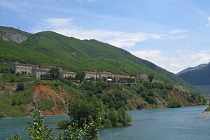
Bajram Curri (Albanian: [bajˈɾam t͡suri]), formerly known as Kolgecaj until 1952, is a town and administrative unit in the municipality of Tropojë, northeastern Albania, within the historical ethnographic region of the Gjakova Highlands. The town is located in a remote and mountainous region of the Albanian Alps, within the Valbonë Valley, and close to the border with Kosovo. It is named after Bajram Curri, a national hero who fought for ethnic Albanians, first against the Ottoman Empire and later against the Albanian government.

Bujan
Municipal unit in Kukës, Albania
Distance: Approx. 3708 meters
Latitude and longitude: 42.32416667,20.07222222
Bujan is a village and a former municipality in the Kukës County, northern Albania. At the 2015 local government reform it became a subdivision of the municipality Tropojë. The population at the 2023 census was 1,738.

Tropojë
Municipality in Albania
Distance: Approx. 8787 meters
Latitude and longitude: 42.4,20.16666667
Tropojë (Albanian: [tɾɔˈpɔjə]; Albanian definite form: Tropoja) is a municipality in Kukës County, northeastern Albania, within the historical ethnographic region of the Gjakova Highlands. The municipality consists of the administrative units of Bajram Curri, Bujan, Bytyç, Fierzë, Lekbibaj, Llugaj, Margegaj and Tropojë, that became municipal units. The seat of the municipality is the town Bajram Curri.
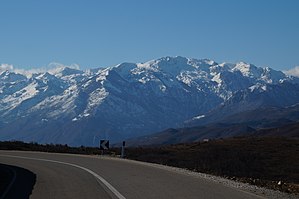
Mali i Hekurave
Mountain in Albania
Distance: Approx. 9398 meters
Latitude and longitude: 42.383976,19.968388
Mali i Hekurave (lit. 'Iron Mountain') is a massif in the Albanian Alps, within the limits of Tropojë municipality. Its main peak, Maja e Hekurave, rises to a height of 2,560 m (8,400 ft).

Margegaj
Municipal unit in Kukës, Albania
Distance: Approx. 3015 meters
Latitude and longitude: 42.38333333,20.06666667
Margegaj is a village and a former municipality in the Kukës County, northern Albania. At the 2015 local government reform it became a subdivision of the municipality Tropojë. The population at the 2023 census was 1,907.
Fierzë, Kukës
Municipal unit in Kukës, Albania
Distance: Approx. 8978 meters
Latitude and longitude: 42.28333333,20.03333333
Fierzë is a town and a former municipality in the Kukës County, northern Albania. At the 2015 local government reform it became a subdivision of the municipality Tropojë. The population at the 2023 census was 1,149.
Llugaj
Municipal unit in Kukës, Albania
Distance: Approx. 4228 meters
Latitude and longitude: 42.33333333,20.11666667
Llugaj is a village and a former municipality in the Kukës County, northern Albania. At the 2015 local government reform it became a subdivision of the municipality Tropojë. The population at the 2023 census was 1,190.
Viçidol
Village in Kukës, Albania
Distance: Approx. 8788 meters
Latitude and longitude: 42.38694444,20.17583333
Viçidol (Albanian definite form: Viçidoli) is a village in the Kukës County, northern Albania. At the 2015 local government reform it became part of the municipality Tropojë. It is located 2.4 kilometres (1.5 mi) away from the town of Tropojë and 4.6 kilometres (2.9 mi) from the border with Kosovo.

Gashi (river)
River in Albanian Alps and a tourist attraction in Albania
Distance: Approx. 2716 meters
Latitude and longitude: 42.37694444,20.09638889
The Gashi (Albanian: Lumi i Gashit) is a 27-kilometre-long (17 mi) river located in Tropojë, northern Albania. It was a nature reserve, spanning an area of 3,000 ha (7,400 acres). The nature reserve forms a part of the European Green Belt and has been declared a UNESCO World Heritage Site within the Primeval Beech Forests of the Carpathians and Other Regions of Europe.

Gashi Valley
Protected area in Albania
Distance: Approx. 7879 meters
Latitude and longitude: 42.42666667,20.09583333
Gashi Valley (Albanian: Lugina e Gashit) is a strict nature reserve located in northern Albania. Along with Rrajcë, it forms the transnational Ancient and Primeval Beech Forests of the Carpathians and Other Regions of Europe, encompassing 94 nature sites, in 18 European countries.
Weather in this IP's area
clear sky
3 Celsius
0 Celsius
3 Celsius
3 Celsius
1032 hPa
54 %
1032 hPa
913 hPa
10000 meters
2.17 m/s
3.09 m/s
61 degree
2 %